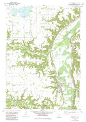
Henderson Topo Map Minnesota
To zoom in, hover over the map of Henderson
USGS Topo Quad 44093e8 - 1:24,000 scale
| Topo Map Name: | Henderson |
| USGS Topo Quad ID: | 44093e8 |
| Print Size: | ca. 21 1/4" wide x 27" high |
| Southeast Coordinates: | 44.5° N latitude / 93.875° W longitude |
| Map Center Coordinates: | 44.5625° N latitude / 93.9375° W longitude |
| U.S. State: | MN |
| Filename: | o44093e8.jpg |
| Download Map JPG Image: | Henderson topo map 1:24,000 scale |
| Map Type: | Topographic |
| Topo Series: | 7.5´ |
| Map Scale: | 1:24,000 |
| Source of Map Images: | United States Geological Survey (USGS) |
| Alternate Map Versions: |
Henderson MN 1981, updated 1982 Download PDF Buy paper map Henderson MN 2010 Download PDF Buy paper map Henderson MN 2013 Download PDF Buy paper map Henderson MN 2016 Download PDF Buy paper map |
1:24,000 Topo Quads surrounding Henderson
> Back to 44093e1 at 1:100,000 scale
> Back to 44092a1 at 1:250,000 scale
> Back to U.S. Topo Maps home
Henderson topo map: Gazetteer
Henderson: Canals
County Ditch Number Fortyfive elevation 299m 980′County Ditch Number Thirty A elevation 301m 987′
Henderson: Dams
High Island Creek Dam elevation 262m 859′Henderson: Lakes
Silver Lake elevation 301m 987′Henderson: Parks
High Island Creek County Park elevation 242m 793′Joseph R Brown State Monument elevation 291m 954′
Rush River State Wayside elevation 261m 856′
Henderson: Populated Places
Allansons Park elevation 229m 751′Henderson elevation 230m 754′
Jessenland elevation 225m 738′
Sibley Estates East elevation 232m 761′
Henderson: Post Offices
Henderson Post Office elevation 228m 748′Jessen Land Post Office (historical) elevation 225m 738′
Henderson: Reservoirs
High Island Creek elevation 262m 859′Henderson: Streams
Buffalo Creek elevation 226m 741′High Island Creek elevation 215m 705′
Rush River elevation 221m 725′
South Branch Rush River elevation 250m 820′
Henderson digital topo map on disk
Buy this Henderson topo map showing relief, roads, GPS coordinates and other geographical features, as a high-resolution digital map file on DVD:


