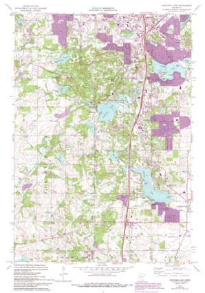
Orchard Lake Topo Map Minnesota
To zoom in, hover over the map of Orchard Lake
USGS Topo Quad 44093f3 - 1:24,000 scale
| Topo Map Name: | Orchard Lake |
| USGS Topo Quad ID: | 44093f3 |
| Print Size: | ca. 21 1/4" wide x 27" high |
| Southeast Coordinates: | 44.625° N latitude / 93.25° W longitude |
| Map Center Coordinates: | 44.6875° N latitude / 93.3125° W longitude |
| U.S. State: | MN |
| Filename: | o44093f3.jpg |
| Download Map JPG Image: | Orchard Lake topo map 1:24,000 scale |
| Map Type: | Topographic |
| Topo Series: | 7.5´ |
| Map Scale: | 1:24,000 |
| Source of Map Images: | United States Geological Survey (USGS) |
| Alternate Map Versions: |
Orchard Lake MN 1974, updated 1976 Download PDF Buy paper map Orchard Lake MN 1974, updated 1993 Download PDF Buy paper map Orchard Lake MN 2010 Download PDF Buy paper map Orchard Lake MN 2013 Download PDF Buy paper map Orchard Lake MN 2016 Download PDF Buy paper map |
1:24,000 Topo Quads surrounding Orchard Lake
> Back to 44093e1 at 1:100,000 scale
> Back to 44092a1 at 1:250,000 scale
> Back to U.S. Topo Maps home
Orchard Lake topo map: Gazetteer
Orchard Lake: Airports
Crystal Lake Seaplane Base elevation 285m 935′Lake Marion Seaplane Base elevation 299m 980′
Orchard Lake: Crossings
Interchange 1 elevation 311m 1020′Interchange 84 elevation 312m 1023′
Interchange 85 elevation 310m 1017′
Interchange 86 elevation 297m 974′
Interchange 87 elevation 305m 1000′
Interchange 88A elevation 297m 974′
Interchange 88B elevation 305m 1000′
Orchard Lake: Dams
Hilgenberg Pond Dam elevation 320m 1049′Wallace Henry Pond Dam elevation 332m 1089′
Orchard Lake: Lakes
Crystal Lake elevation 285m 935′Earley Lake elevation 276m 905′
Featherstone Lake elevation 270m 885′
Hanrahan Lake elevation 270m 885′
Horseshoe Lake elevation 303m 994′
Keller Lake elevation 285m 935′
Kingsley Lake elevation 297m 974′
Krenz Lake elevation 291m 954′
Lee Lake elevation 288m 944′
Marion Lake elevation 297m 974′
Marion Lake elevation 297m 974′
Murphy Lake elevation 279m 915′
Orchard Lake elevation 297m 974′
Orchard Lake: Parks
Antlers Park elevation 301m 987′Burnsville Alimagnet Park elevation 306m 1003′
Cam Ram Park elevation 264m 866′
Casperson Park elevation 312m 1023′
Crystal Lake West Park elevation 289m 948′
Day Park elevation 280m 918′
Hollows Park elevation 290m 951′
Judicial Park elevation 289m 948′
Kensington Park elevation 309m 1013′
King Park elevation 332m 1089′
Lakeside Park elevation 301m 987′
Loop Park elevation 326m 1069′
Meadows Park elevation 305m 1000′
Murphy-Hanrehan Regional Park Reserve elevation 307m 1007′
North Park elevation 322m 1056′
Northview Park elevation 286m 938′
Oak Shores Park elevation 286m 938′
Paha Sapa Park elevation 298m 977′
Ritter Farm Park elevation 311m 1020′
Rollings Oaks Park elevation 308m 1010′
Rose Park elevation 280m 918′
Twin Lakes Park elevation 287m 941′
West Lake Marion Park elevation 310m 1017′
Wood Park elevation 313m 1026′
Orchard Lake: Populated Places
Antlers Park elevation 304m 997′Argonne elevation 315m 1033′
Deer Park elevation 301m 987′
Orchard Garden elevation 309m 1013′
Orchard Lake: Post Offices
Judd Post Office (historical) elevation 285m 935′Orchard Lake: Summits
Buck Hill elevation 361m 1184′Orchard Lake digital topo map on disk
Buy this Orchard Lake topo map showing relief, roads, GPS coordinates and other geographical features, as a high-resolution digital map file on DVD:


