Hamburg Topo Map Minnesota
To zoom in, hover over the map of Hamburg
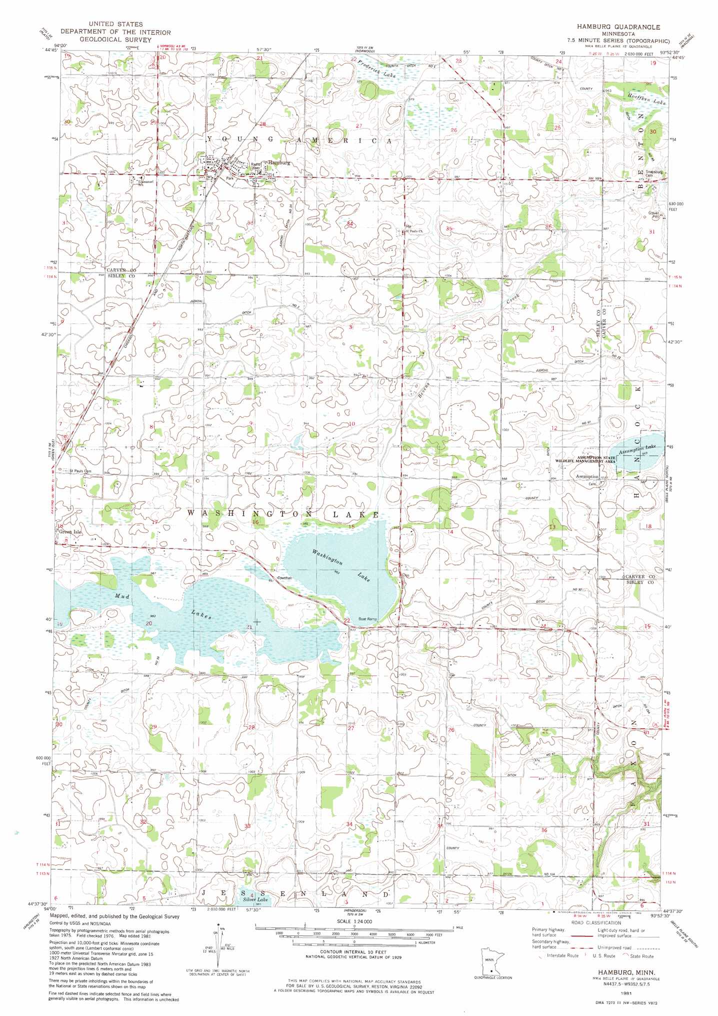
USGS Topo Quad 44093f8 - 1:24,000 scale
| Topo Map Name: | Hamburg |
| USGS Topo Quad ID: | 44093f8 |
| Print Size: | ca. 21 1/4" wide x 27" high |
| Southeast Coordinates: | 44.625° N latitude / 93.875° W longitude |
| Map Center Coordinates: | 44.6875° N latitude / 93.9375° W longitude |
| U.S. State: | MN |
| Filename: | o44093f8.jpg |
| Download Map JPG Image: | Hamburg topo map 1:24,000 scale |
| Map Type: | Topographic |
| Topo Series: | 7.5´ |
| Map Scale: | 1:24,000 |
| Source of Map Images: | United States Geological Survey (USGS) |
| Alternate Map Versions: |
Hamburg MN 1981, updated 1982 Download PDF Buy paper map Hamburg MN 2010 Download PDF Buy paper map Hamburg MN 2013 Download PDF Buy paper map Hamburg MN 2016 Download PDF Buy paper map |
1:24,000 Topo Quads surrounding Hamburg
Silver Lake |
Winsted |
Mayer |
Watertown |
Mound |
Glenco |
Plato |
Norwood |
Waconia |
Victoria |
New Auburn |
Green Isle |
Hamburg |
Belle Plaine North |
Jordan West |
Gaylord |
Arlington |
Henderson |
Belle Plaine South |
Union Hill |
New Sweden |
Norseland |
Le Sueur |
Saint Thomas |
Le Center |
> Back to 44093e1 at 1:100,000 scale
> Back to 44092a1 at 1:250,000 scale
> Back to U.S. Topo Maps home
Hamburg topo map: Gazetteer
Hamburg: Canals
County Ditch Number Fiftyseven elevation 296m 971′County Ditch Number Fortyseven elevation 295m 967′
County Ditch Number Four A elevation 294m 964′
County Ditch Number Thirtynine elevation 302m 990′
County Ditch Number Thirtytwo elevation 293m 961′
County Ditch Number Twelve A elevation 296m 971′
County Ditch Number Twentyfive A elevation 297m 974′
Judicial Ditch Number Three elevation 301m 987′
Judicial Ditch Number Three A elevation 303m 994′
Hamburg: Lakes
Assumption Lake elevation 294m 964′Erin Lake elevation 300m 984′
Washington Lake elevation 300m 984′
Hamburg: Parks
Assumption State Wildlife Management Area elevation 294m 964′Hamburg Bicentennial Park elevation 303m 994′
Hawks Park elevation 305m 1000′
Hamburg: Populated Places
Assumption elevation 308m 1010′Hamburg elevation 308m 1010′
Hamburg: Post Offices
Assumption Post Office (historical) elevation 304m 997′Hamburg Post Office elevation 308m 1010′
Hamburg: Swamps
Frederick Lake elevation 297m 974′Hoeffken Lake elevation 291m 954′
Hamburg digital topo map on disk
Buy this Hamburg topo map showing relief, roads, GPS coordinates and other geographical features, as a high-resolution digital map file on DVD: