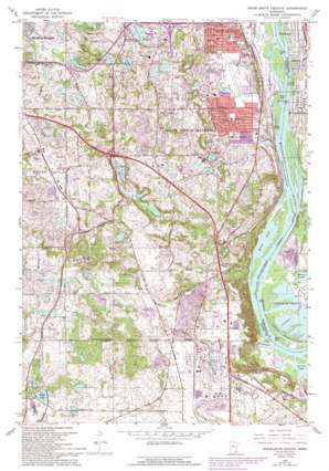
Inver Grove Heights Topo Map Minnesota
To zoom in, hover over the map of Inver Grove Heights
USGS Topo Quad 44093g1 - 1:24,000 scale
| Topo Map Name: | Inver Grove Heights |
| USGS Topo Quad ID: | 44093g1 |
| Print Size: | ca. 21 1/4" wide x 27" high |
| Southeast Coordinates: | 44.75° N latitude / 93° W longitude |
| Map Center Coordinates: | 44.8125° N latitude / 93.0625° W longitude |
| U.S. State: | MN |
| Filename: | o44093g1.jpg |
| Download Map JPG Image: | Inver Grove Heights topo map 1:24,000 scale |
| Map Type: | Topographic |
| Topo Series: | 7.5´ |
| Map Scale: | 1:24,000 |
| Source of Map Images: | United States Geological Survey (USGS) |
| Alternate Map Versions: |
Inver Grove Heights MN 1951, updated 1953 Download PDF Buy paper map Inver Grove MN 1951, updated 1965 Download PDF Buy paper map Inver Grove Heights MN 1967, updated 1969 Download PDF Buy paper map Inver Grove Heights MN 1967, updated 1973 Download PDF Buy paper map Inver Grove Heights MN 1967, updated 1989 Download PDF Buy paper map Inver Grove Heights MN 1967, updated 1993 Download PDF Buy paper map Inver Grove Heights MN 2010 Download PDF Buy paper map Inver Grove Heights MN 2013 Download PDF Buy paper map Inver Grove Heights MN 2016 Download PDF Buy paper map |
1:24,000 Topo Quads surrounding Inver Grove Heights
> Back to 44093e1 at 1:100,000 scale
> Back to 44092a1 at 1:250,000 scale
> Back to U.S. Topo Maps home
Inver Grove Heights topo map: Gazetteer
Inver Grove Heights: Airports
South Saint Paul Municipal Airport-Richard E Fleming Field elevation 248m 813′Wipline Airport elevation 210m 688′
Wipline Seaplane Base elevation 215m 705′
Inver Grove Heights: Crossings
Interchange 65 elevation 248m 813′Interchange 66 elevation 277m 908′
Interchange 67 elevation 307m 1007′
Inver Grove Heights: Islands
Simley Island elevation 272m 892′Inver Grove Heights: Lakes
Baldwin Lake elevation 209m 685′Dickman Lake elevation 276m 905′
Fitz Lake elevation 280m 918′
Hay Lake elevation 276m 905′
Holz Lake elevation 277m 908′
Hornbean Lake elevation 270m 885′
Horseshoe Lake elevation 281m 921′
Kegan Lake elevation 285m 935′
Marcott Lakes elevation 239m 784′
River Lake elevation 209m 685′
Schmidt Lake elevation 286m 938′
Schwanz Lake elevation 266m 872′
Simley Lake elevation 268m 879′
Inver Grove Heights: Parks
Arbor Pointe Park elevation 280m 918′Bridle Ridge Park elevation 272m 892′
Burr Oaks Park elevation 247m 810′
Captain Dodd Park elevation 261m 856′
Concord Park elevation 219m 718′
Dehrer Park elevation 241m 790′
Ernster Park elevation 241m 790′
Friendly Hills Park elevation 259m 849′
Hagstrom King Park elevation 265m 869′
Harmon Park elevation 249m 816′
Harmon Park elevation 292m 958′
Hidden Corner Park elevation 293m 961′
Kensington Park elevation 272m 892′
Lakeside Park elevation 279m 915′
Lions Park elevation 277m 908′
Lions Park elevation 210m 688′
Marianna Ranch Trails Park elevation 270m 885′
McGroarty Park elevation 293m 961′
McMorrow Field elevation 249m 816′
Mississippi National River and Recreation Area elevation 210m 688′
North Valley Park elevation 250m 820′
Oakwood Park elevation 270m 885′
Old City Hall Park elevation 219m 718′
Pioneer Park elevation 221m 725′
Rich Valley Park elevation 269m 882′
River Heights Park elevation 271m 889′
Riverside Park elevation 216m 708′
Salem Park elevation 295m 967′
Simley Island Park elevation 272m 892′
Skyview Park elevation 251m 823′
Sleepy Hollow Park elevation 276m 905′
South Oaks Park elevation 284m 931′
South Valley Park elevation 245m 803′
Southern Lakes Park elevation 292m 958′
Spruce Park elevation 250m 820′
Wandering Walk Park elevation 275m 902′
Wescott Station Park elevation 270m 885′
Wondering Walk Park elevation 275m 902′
Inver Grove Heights: Populated Places
Inver Grove Heights elevation 268m 879′Newport elevation 227m 744′
Pine Bend elevation 286m 938′
Roseport elevation 270m 885′
Sunfish Lake elevation 296m 971′
Wescott elevation 269m 882′
Inver Grove Heights: Post Offices
Pine Bend Post Office (historical) elevation 285m 935′Inver Grove Heights digital topo map on disk
Buy this Inver Grove Heights topo map showing relief, roads, GPS coordinates and other geographical features, as a high-resolution digital map file on DVD:


