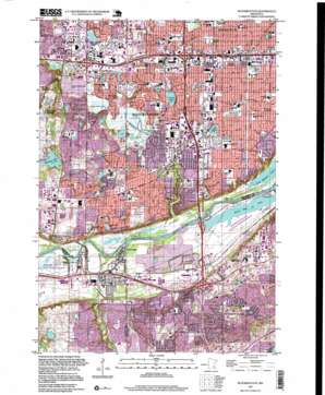
Bloomington Topo Map Minnesota
To zoom in, hover over the map of Bloomington
USGS Topo Quad 44093g3 - 1:24,000 scale
| Topo Map Name: | Bloomington |
| USGS Topo Quad ID: | 44093g3 |
| Print Size: | ca. 21 1/4" wide x 27" high |
| Southeast Coordinates: | 44.75° N latitude / 93.25° W longitude |
| Map Center Coordinates: | 44.8125° N latitude / 93.3125° W longitude |
| U.S. State: | MN |
| Filename: | o44093g3.jpg |
| Download Map JPG Image: | Bloomington topo map 1:24,000 scale |
| Map Type: | Topographic |
| Topo Series: | 7.5´ |
| Map Scale: | 1:24,000 |
| Source of Map Images: | United States Geological Survey (USGS) |
| Alternate Map Versions: |
Bloomington MN 1954, updated 1956 Download PDF Buy paper map Bloomington MN 1954, updated 1964 Download PDF Buy paper map Bloomington MN 1967, updated 1969 Download PDF Buy paper map Bloomington MN 1967, updated 1973 Download PDF Buy paper map Bloomington MN 1967, updated 1981 Download PDF Buy paper map Bloomington MN 1967, updated 1988 Download PDF Buy paper map Bloomington MN 1967, updated 1993 Download PDF Buy paper map Bloomington MN 2010 Download PDF Buy paper map Bloomington MN 2013 Download PDF Buy paper map Bloomington MN 2016 Download PDF Buy paper map |
1:24,000 Topo Quads surrounding Bloomington
> Back to 44093e1 at 1:100,000 scale
> Back to 44092a1 at 1:250,000 scale
> Back to U.S. Topo Maps home
Bloomington topo map: Gazetteer
Bloomington: Airports
Mandarin Yen So Heliport elevation 252m 826′Bloomington: Crossings
Interchange 2 elevation 275m 902′Interchange 3 elevation 250m 820′
Interchange 3A and 3B elevation 251m 823′
Interchange 4A elevation 251m 823′
Interchange 4A elevation 227m 744′
Interchange 4B elevation 258m 846′
Interchange 4B elevation 221m 725′
Interchange 5 elevation 253m 830′
Interchange 5A elevation 257m 843′
Interchange 5B elevation 257m 843′
Interchange 6 elevation 246m 807′
Interchange 6A elevation 252m 826′
Interchange 7A elevation 258m 846′
Interchange 7A elevation 248m 813′
Interchange 7B elevation 258m 846′
Interchange 7B elevation 252m 826′
Interchange 8 elevation 251m 823′
Interchange 8 elevation 252m 826′
Interchange 9A and 9B elevation 257m 843′
Interchange 9C elevation 257m 843′
Bloomington: Dams
Nine Mile Creek Dam elevation 245m 803′Bloomington: Lakes
Barthels Pond elevation 245m 803′Black Dog Lake elevation 212m 695′
Colman Lake elevation 212m 695′
Comma Lake elevation 246m 807′
Hyland Lake elevation 248m 813′
Lake Edina elevation 252m 826′
Lake Girard elevation 248m 813′
Nine Mile Lake elevation 212m 695′
Oxboro Lake elevation 245m 803′
Penn Lake elevation 246m 807′
Bloomington: Parks
Acorn Park elevation 298m 977′Adams Hill Park elevation 251m 823′
Ancel Glen Playfield elevation 265m 869′
Anderson Park elevation 219m 718′
Augsburg Park elevation 257m 843′
Auto Club Park elevation 216m 708′
Black Dog Park elevation 221m 725′
Brooksdale Playground elevation 255m 836′
Brookview Park elevation 278m 912′
Bryant Park elevation 247m 810′
Brye Playground elevation 268m 879′
Burnsville Heights Park elevation 274m 898′
Canterbury Park Recreation Area elevation 266m 872′
Central Park elevation 224m 734′
Cliff Nicollet Park elevation 225m 738′
Colonial Park elevation 298m 977′
Cook Park elevation 250m 820′
Cornelia Park elevation 262m 859′
Crosstown East Park elevation 273m 895′
Crosstown West Park elevation 263m 862′
Donaldson Park elevation 258m 846′
Fenlason Playground elevation 253m 830′
Fremont Park elevation 259m 849′
Gene Kelly Playfield elevation 253m 830′
Haeg Park elevation 249m 816′
Harrison Picnic Grounds elevation 250m 820′
Hidden Valley Park elevation 236m 774′
Hollywood Park elevation 226m 741′
Hopkins Park elevation 213m 698′
Hyland Hills Park elevation 258m 846′
Hyland Lake County Park elevation 271m 889′
Knob Hill Park elevation 283m 928′
Krestwood Park elevation 299m 980′
Lake Edina Park elevation 250m 820′
Lake Girard Park elevation 250m 820′
Lincoln Field elevation 259m 849′
Marsh Lake Park elevation 245m 803′
McAndrews Playground elevation 248m 813′
Moir Park elevation 239m 784′
Mound Springs Park elevation 213m 698′
Mount Normandale Lake Park elevation 245m 803′
Neil Park elevation 276m 905′
Nicollet Park elevation 299m 980′
Nord Myr Park elevation 246m 807′
Norman Ridge Playground elevation 273m 895′
Oak Leaf West Park elevation 284m 931′
Overlook Lake Park elevation 239m 784′
Parkers Picnic Grounds elevation 213m 698′
Paulys Pond Park elevation 249m 816′
Perry Park elevation 245m 803′
Poplar Bridge Playground elevation 249m 816′
Ridgeview Playground elevation 277m 908′
Rolling Meadows Park elevation 256m 839′
Roosevelt Park elevation 260m 853′
Running Park elevation 245m 803′
Skriebakken Park elevation 246m 807′
Skyline Park elevation 282m 925′
Smith Park elevation 247m 810′
South Glen Playground elevation 241m 790′
Southwood Playground elevation 247m 810′
Sunset Pond Park elevation 258m 846′
Valley View Playfield elevation 250m 820′
Vanderbie Park elevation 253m 830′
Vista View Park elevation 261m 856′
Warren Buffet Park elevation 225m 738′
Washington Park elevation 253m 830′
Wellington Crescent Park elevation 298m 977′
Westview Park elevation 277m 908′
Westwood Playground elevation 252m 826′
Wildwood Park elevation 213m 698′
William Wardwell Lewis Park elevation 252m 826′
Wilson Park elevation 246m 807′
Bloomington: Populated Places
Atwood elevation 256m 839′Bloomington elevation 252m 826′
Burnsville elevation 296m 971′
Oxboro elevation 250m 820′
Port Cargill elevation 216m 708′
Savage elevation 220m 721′
Bloomington: Post Offices
Oxboro Post Office (historical) elevation 246m 807′Savage Post Office elevation 269m 882′
Bloomington: Reservoirs
Marsh Lake elevation 245m 803′Bloomington: Streams
Credit River elevation 213m 698′Ninemile Creek elevation 210m 688′
South Fork Ninemile Creek elevation 247m 810′
Bloomington: Summits
Mount Gilboa elevation 311m 1020′Bloomington digital topo map on disk
Buy this Bloomington topo map showing relief, roads, GPS coordinates and other geographical features, as a high-resolution digital map file on DVD:


