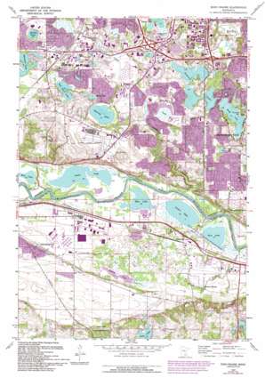
Eden Prairie Topo Map Minnesota
To zoom in, hover over the map of Eden Prairie
USGS Topo Quad 44093g4 - 1:24,000 scale
| Topo Map Name: | Eden Prairie |
| USGS Topo Quad ID: | 44093g4 |
| Print Size: | ca. 21 1/4" wide x 27" high |
| Southeast Coordinates: | 44.75° N latitude / 93.375° W longitude |
| Map Center Coordinates: | 44.8125° N latitude / 93.4375° W longitude |
| U.S. State: | MN |
| Filename: | o44093g4.jpg |
| Download Map JPG Image: | Eden Prairie topo map 1:24,000 scale |
| Map Type: | Topographic |
| Topo Series: | 7.5´ |
| Map Scale: | 1:24,000 |
| Source of Map Images: | United States Geological Survey (USGS) |
| Alternate Map Versions: |
Eden Prairie MN 1954, updated 1956 Download PDF Buy paper map Eden Prairie MN 1954, updated 1963 Download PDF Buy paper map Eden Prairie MN 1967, updated 1969 Download PDF Buy paper map Eden Prairie MN 1967, updated 1973 Download PDF Buy paper map Eden Prairie MN 1967, updated 1981 Download PDF Buy paper map Eden Prairie MN 1967, updated 1987 Download PDF Buy paper map Eden Prairie MN 1967, updated 1994 Download PDF Buy paper map Eden Prairie MN 2010 Download PDF Buy paper map Eden Prairie MN 2013 Download PDF Buy paper map Eden Prairie MN 2016 Download PDF Buy paper map |
1:24,000 Topo Quads surrounding Eden Prairie
> Back to 44093e1 at 1:100,000 scale
> Back to 44092a1 at 1:250,000 scale
> Back to U.S. Topo Maps home
Eden Prairie topo map: Gazetteer
Eden Prairie: Airports
Flying Cloud Airport elevation 275m 902′Koskovich Airport elevation 229m 751′
Eden Prairie: Crossings
Interchange 10 elevation 258m 846′Interchange 11A elevation 271m 889′
Interchange 11B and 11C elevation 266m 872′
Interchange 12 elevation 269m 882′
Eden Prairie: Dams
Riley Creek Dam elevation 268m 879′Eden Prairie: Lakes
Anderson Lakes elevation 255m 836′Blue Lake elevation 212m 695′
Bush Lake elevation 255m 836′
Deans Lake elevation 229m 751′
Fisher Lake elevation 212m 695′
Grass Lake elevation 212m 695′
Lake Idlewild elevation 261m 856′
Lake Smetana elevation 255m 836′
McCoy Lake elevation 252m 826′
Mitchell Lake elevation 264m 866′
Pike Lake elevation 249m 816′
Red Rock Lake elevation 258m 846′
Rice Lake elevation 212m 695′
Rice Lake elevation 212m 695′
Round Lake elevation 267m 875′
Staring Lake elevation 248m 813′
Eden Prairie: Parks
Anderson Lakes Park Reserve elevation 261m 856′Bloomington Ferry Road Park elevation 258m 846′
Braemer Park elevation 285m 935′
Bush Lake Park elevation 284m 931′
Bush Lake Park Reserve elevation 256m 839′
Creekwood Park elevation 248m 813′
Dred Scott Playfield elevation 256m 839′
Eden Lake School Park elevation 251m 823′
Edenvale Park elevation 254m 833′
Flying Cloud Fields elevation 275m 902′
Franlo Park elevation 257m 843′
Homeward Hills Park elevation 248m 813′
James W Wilke Regional Park elevation 212m 695′
Miller Park elevation 267m 875′
Nesbitt Reserve Park elevation 264m 866′
Overlook Lake Park elevation 252m 826′
Pheasant Woods Park elevation 262m 859′
Pioneer Park elevation 267m 875′
Prairie East Park elevation 262m 859′
Purgatory Creek Conservation Area elevation 250m 820′
Red Rock Lake Park elevation 261m 856′
Round Lake Park elevation 274m 898′
Staring Lake Park elevation 255m 836′
Sunrise Park elevation 264m 866′
Willow Park elevation 261m 856′
Eden Prairie: Populated Places
Barden elevation 220m 721′Bloomington Ferry elevation 243m 797′
Eden Prairie elevation 270m 885′
Glendale elevation 299m 980′
Rowland elevation 271m 889′
Eden Prairie: Post Offices
Bloomington Ferry Post Office (historical) elevation 244m 800′Rowland Post Office (historical) elevation 271m 889′
Eden Prairie: Springs
Boiling Springs elevation 222m 728′Eden Prairie: Streams
Bluff Creek elevation 213m 698′Eagle Creek elevation 212m 695′
Purgatory Creek elevation 213m 698′
Riley Creek elevation 213m 698′
Eden Prairie: Swamps
Neill Lake elevation 249m 816′Eden Prairie digital topo map on disk
Buy this Eden Prairie topo map showing relief, roads, GPS coordinates and other geographical features, as a high-resolution digital map file on DVD:


