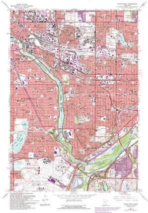
Saint Paul West Topo Map Minnesota
To zoom in, hover over the map of Saint Paul West
USGS Topo Quad 44093h2 - 1:24,000 scale
| Topo Map Name: | Saint Paul West |
| USGS Topo Quad ID: | 44093h2 |
| Print Size: | ca. 21 1/4" wide x 27" high |
| Southeast Coordinates: | 44.875° N latitude / 93.125° W longitude |
| Map Center Coordinates: | 44.9375° N latitude / 93.1875° W longitude |
| U.S. State: | MN |
| Filename: | o44093h2.jpg |
| Download Map JPG Image: | Saint Paul West topo map 1:24,000 scale |
| Map Type: | Topographic |
| Topo Series: | 7.5´ |
| Map Scale: | 1:24,000 |
| Source of Map Images: | United States Geological Survey (USGS) |
| Alternate Map Versions: |
St. Paul West MN 1951, updated 1953 Download PDF Buy paper map St. Paul West MN 1967, updated 1969 Download PDF Buy paper map St. Paul West MN 1967, updated 1973 Download PDF Buy paper map St. Paul West MN 1967, updated 1988 Download PDF Buy paper map St. Paul West MN 1967, updated 1993 Download PDF Buy paper map Saint Paul West MN 2010 Download PDF Buy paper map Saint Paul West MN 2013 Download PDF Buy paper map Saint Paul West MN 2016 Download PDF Buy paper map |
1:24,000 Topo Quads surrounding Saint Paul West
> Back to 44093e1 at 1:100,000 scale
> Back to 44092a1 at 1:250,000 scale
> Back to U.S. Topo Maps home
Saint Paul West topo map: Gazetteer
Saint Paul West: Airports
Minneapolis-Saint Paul International Airport elevation 252m 826′Minneapolis-Saint Paul International/Wold-Chamberlain Airport elevation 251m 823′
University of Minnesota Hospitals and Clinics Heliport elevation 240m 787′
Saint Paul West: Bridges
Mendota Bridge elevation 214m 702′Saint Paul West: Crossings
Interchange 101A and 101B elevation 276m 905′Interchange 102 elevation 241m 790′
Interchange 103A elevation 225m 738′
Interchange 103B elevation 241m 790′
Interchange 104A elevation 256m 839′
Interchange 104C elevation 247m 810′
Interchange 105 elevation 248m 813′
Interchange 17B elevation 253m 830′
Interchange 18 elevation 254m 833′
Interchange 19 elevation 256m 839′
Interchange 234 elevation 262m 859′
Interchange 235 elevation 247m 810′
Interchange 236 elevation 262m 859′
Interchange 237 elevation 272m 892′
Interchange 238 elevation 275m 902′
Interchange 239 elevation 270m 885′
Interchange 240 elevation 279m 915′
Saint Paul West: Dams
Lock and Dam Number One elevation 209m 685′Locks and Dam Number 1 elevation 209m 685′
Saint Anthony Falls Lower Lock and Dam elevation 229m 751′
Snelling Lake Outlet Dam elevation 250m 820′
Saint Paul West: Falls
Minnehaha Falls elevation 247m 810′Shadow Falls elevation 255m 836′
Saint Paul West: Islands
Pike Island elevation 213m 698′Saint Paul West: Lakes
Augusta Lake elevation 251m 823′Crosby Lake elevation 211m 692′
Lake Como elevation 269m 882′
Lake Hiawatha elevation 248m 813′
Lake Nokomis elevation 248m 813′
Mother Lake elevation 250m 820′
Snelling Lake elevation 212m 695′
Upper Lake elevation 211m 692′
Saint Paul West: Parks
Beltrami Park elevation 259m 849′Bossen Field elevation 252m 826′
Brackett Field elevation 253m 830′
Carty Park elevation 279m 915′
Cedar Avenue Field elevation 259m 849′
College Park elevation 285m 935′
Como Park elevation 277m 908′
Corcoran Park elevation 262m 859′
Crosby Lake Regional Park elevation 214m 702′
Dale Playground elevation 280m 918′
Desnoyer Park elevation 270m 885′
Dickerman Park elevation 277m 908′
Dunning Field elevation 282m 925′
East Phillips Park elevation 256m 839′
East River Flats elevation 231m 757′
Edgecombe Recreational Area elevation 275m 902′
Flatman Field elevation 276m 905′
Fort Snelling State Park elevation 213m 698′
Griggs Playground elevation 275m 902′
Groveland Park elevation 283m 928′
Hamline Playground elevation 283m 928′
Hampden Park elevation 276m 905′
Hancock Recreational Area elevation 284m 931′
Hiawatha Lake Park elevation 251m 823′
Hiawatha Park elevation 250m 820′
Hidden Falls-Crosby Farm Regional Park elevation 213m 698′
Highland Park elevation 283m 928′
Highland Park elevation 273m 895′
Hillcrest Park elevation 274m 898′
Homecroft Park elevation 251m 823′
Horton Park elevation 286m 938′
Keewaydin Field elevation 249m 816′
Lake Nokomis Park elevation 251m 823′
Langford Park elevation 273m 895′
Lauderdale Community Park elevation 286m 938′
Linwood Park elevation 276m 905′
Longfellow Field elevation 253m 830′
Longfellow Gardens elevation 256m 839′
Luxton Park elevation 258m 846′
Marcy Park elevation 256m 839′
Marie Park elevation 268m 879′
Mattocks Park elevation 285m 935′
McDonough Park elevation 257m 843′
Mendakota Park elevation 275m 902′
Merriam Terrace Park elevation 281m 921′
Midway Stadium elevation 276m 905′
Minnehaha Park elevation 247m 810′
Mississippi Park elevation 231m 757′
Morris Park elevation 254m 833′
Murphy Square elevation 257m 843′
Nature Park elevation 287m 941′
Newell Park elevation 280m 918′
Orchard Park elevation 278m 912′
Oxford/Jimmy Lee Playground elevation 269m 882′
Palace Park elevation 243m 797′
Pine Island Park elevation 213m 698′
Riverside Park elevation 235m 770′
Seven Oaks Park elevation 251m 823′
Seward Park elevation 255m 836′
Sibley Field elevation 253m 830′
Tilden Park elevation 283m 928′
Tower Hill Park elevation 295m 967′
Valley Park elevation 246m 807′
Van Cleve Park elevation 256m 839′
Victoria Highland Park elevation 261m 856′
Saint Paul West: Populated Places
Falcon Heights elevation 291m 954′Lauderdale elevation 292m 958′
Lilydale elevation 214m 702′
Mendota elevation 234m 767′
Mendota Heights elevation 278m 912′
Saint Paul West: Post Offices
Hamline Post Office (historical) elevation 286m 938′Macalester Post Office (historical) elevation 290m 951′
Minnehaha Park Post Office (historical) elevation 250m 820′
Saint Anthony Park Post Office (historical) elevation 282m 925′
Saint Paul West: Reservoirs
Intermediate Pool elevation 229m 751′Pool 1 elevation 209m 685′
Snelling Lake elevation 250m 820′
Saint Paul West: Streams
Minnehaha Creek elevation 209m 685′Minnesota River elevation 209m 685′
Saint Paul West: Summits
Pilot Knob elevation 288m 944′Saint Paul West digital topo map on disk
Buy this Saint Paul West topo map showing relief, roads, GPS coordinates and other geographical features, as a high-resolution digital map file on DVD:


