Lake Crystal Topo Map Minnesota
To zoom in, hover over the map of Lake Crystal
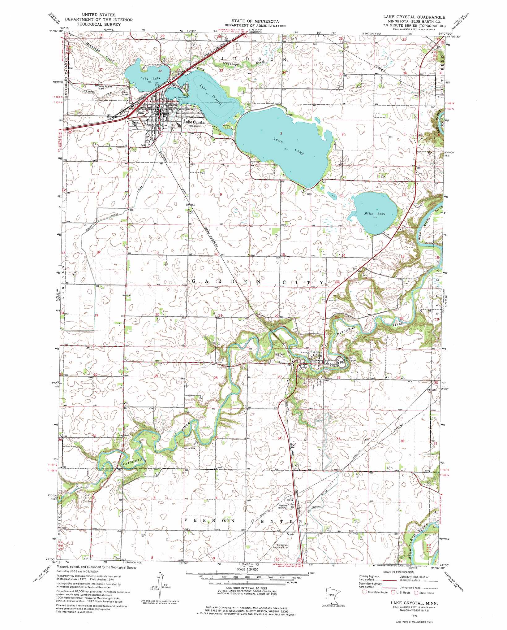
USGS Topo Quad 44094a2 - 1:24,000 scale
| Topo Map Name: | Lake Crystal |
| USGS Topo Quad ID: | 44094a2 |
| Print Size: | ca. 21 1/4" wide x 27" high |
| Southeast Coordinates: | 44° N latitude / 94.125° W longitude |
| Map Center Coordinates: | 44.0625° N latitude / 94.1875° W longitude |
| U.S. State: | MN |
| Filename: | o44094a2.jpg |
| Download Map JPG Image: | Lake Crystal topo map 1:24,000 scale |
| Map Type: | Topographic |
| Topo Series: | 7.5´ |
| Map Scale: | 1:24,000 |
| Source of Map Images: | United States Geological Survey (USGS) |
| Alternate Map Versions: |
Lake Crystal MN 1974, updated 1976 Download PDF Buy paper map Lake Crystal MN 2010 Download PDF Buy paper map Lake Crystal MN 2013 Download PDF Buy paper map Lake Crystal MN 2016 Download PDF Buy paper map |
1:24,000 Topo Quads surrounding Lake Crystal
New Ulm |
Courtland |
Nicollet |
North Star |
Saint Peter |
Hanska |
Cambria |
Judson |
Mankato West |
Mankato East |
Madelia |
Perth |
Lake Crystal |
Good Thunder |
Beauford |
Lewisville |
Willow Creek |
Amboy |
Sterling Center |
Mapleton |
Truman |
Truman Se |
Winnebago |
Delavan |
Easton |
> Back to 44094a1 at 1:100,000 scale
> Back to 44094a1 at 1:250,000 scale
> Back to U.S. Topo Maps home
Lake Crystal topo map: Gazetteer
Lake Crystal: Airports
Bergemann Airport elevation 305m 1000′Lake Crystal: Canals
County Ditch Number Fiftysix elevation 299m 980′County Ditch Number Seventyeight elevation 299m 980′
County Ditch Number Twentyseven elevation 299m 980′
Lake Crystal: Lakes
Lake Crystal elevation 296m 971′Lily Lake elevation 294m 964′
Loon Lake elevation 296m 971′
Mills Lake elevation 297m 974′
Lake Crystal: Parks
Robinson Park elevation 300m 984′Lake Crystal: Populated Places
Garden City elevation 280m 918′Lake Crystal elevation 303m 994′
Rambush Estates II elevation 306m 1003′
Lake Crystal: Post Offices
Garden City Post Office elevation 282m 925′Lake Crystal Post Office elevation 303m 994′
Lake Crystal: Streams
Watonwan River elevation 265m 869′Wells Creek elevation 266m 872′
Lake Crystal digital topo map on disk
Buy this Lake Crystal topo map showing relief, roads, GPS coordinates and other geographical features, as a high-resolution digital map file on DVD: