Darfur Topo Map Minnesota
To zoom in, hover over the map of Darfur
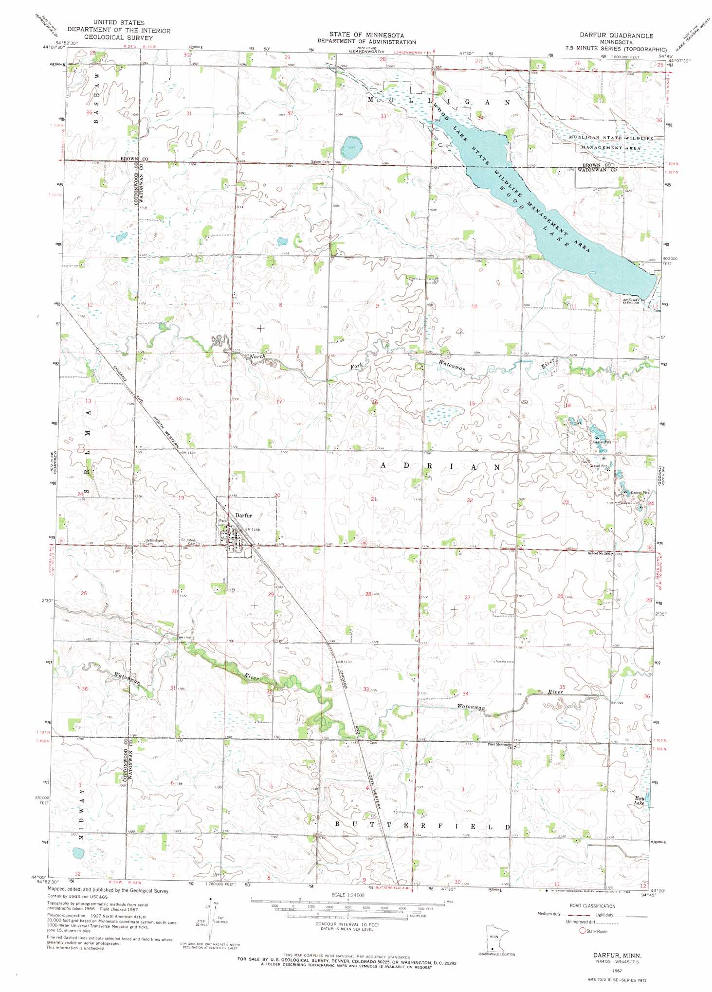
USGS Topo Quad 44094a7 - 1:24,000 scale
| Topo Map Name: | Darfur |
| USGS Topo Quad ID: | 44094a7 |
| Print Size: | ca. 21 1/4" wide x 27" high |
| Southeast Coordinates: | 44° N latitude / 94.75° W longitude |
| Map Center Coordinates: | 44.0625° N latitude / 94.8125° W longitude |
| U.S. State: | MN |
| Filename: | o44094a7.jpg |
| Download Map JPG Image: | Darfur topo map 1:24,000 scale |
| Map Type: | Topographic |
| Topo Series: | 7.5´ |
| Map Scale: | 1:24,000 |
| Source of Map Images: | United States Geological Survey (USGS) |
| Alternate Map Versions: |
Darfur MN 1967, updated 1968 Download PDF Buy paper map Darfur MN 2010 Download PDF Buy paper map Darfur MN 2013 Download PDF Buy paper map Darfur MN 2016 Download PDF Buy paper map |
1:24,000 Topo Quads surrounding Darfur
Clements Se |
Boise Lake |
Evan |
Sleepy Eye |
Essig |
Sanborn Ne |
Springfield |
Leavenworth |
Lake Hanska West |
Lake Hanska East |
Sanborn Se |
Comfrey |
Darfur |
Godahl |
La Salle |
Bingham Lake |
Mountain Lake |
Butterfield |
Saint James West |
Saint James East |
Windom |
Bergen |
Mountain Lake Se |
Trimont |
Saint James Se |
> Back to 44094a1 at 1:100,000 scale
> Back to 44094a1 at 1:250,000 scale
> Back to U.S. Topo Maps home
Darfur topo map: Gazetteer
Darfur: Parks
Wood Lake State Wildlife Management Area elevation 320m 1049′Darfur: Populated Places
Darfur elevation 354m 1161′Darfur: Post Offices
Darfur Post Office elevation 354m 1161′Darfur: Reservoirs
Wood Lake elevation 323m 1059′Darfur digital topo map on disk
Buy this Darfur topo map showing relief, roads, GPS coordinates and other geographical features, as a high-resolution digital map file on DVD: