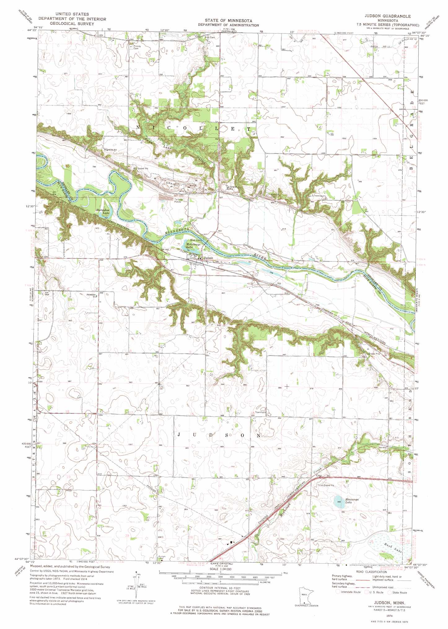
Judson Topo Map Minnesota
To zoom in, hover over the map of Judson
USGS Topo Quad 44094b2 - 1:24,000 scale
| Topo Map Name: | Judson |
| USGS Topo Quad ID: | 44094b2 |
| Print Size: | ca. 21 1/4" wide x 27" high |
| Southeast Coordinates: | 44.125° N latitude / 94.125° W longitude |
| Map Center Coordinates: | 44.1875° N latitude / 94.1875° W longitude |
| U.S. State: | MN |
| Filename: | o44094b2.jpg |
| Download Map JPG Image: | Judson topo map 1:24,000 scale |
| Map Type: | Topographic |
| Topo Series: | 7.5´ |
| Map Scale: | 1:24,000 |
| Source of Map Images: | United States Geological Survey (USGS) |
| Alternate Map Versions: |
Judson MN 1974, updated 1976 Download PDF Buy paper map Judson MN 2010 Download PDF Buy paper map Judson MN 2013 Download PDF Buy paper map Judson MN 2016 Download PDF Buy paper map |
1:24,000 Topo Quads surrounding Judson
Lafayette |
Bernadotte |
New Sweden |
Norseland |
Le Sueur |
New Ulm |
Courtland |
Nicollet |
North Star |
Saint Peter |
Hanska |
Cambria |
Judson |
Mankato West |
Mankato East |
Madelia |
Perth |
Lake Crystal |
Good Thunder |
Beauford |
Lewisville |
Willow Creek |
Amboy |
Sterling Center |
Mapleton |
> Back to 44094a1 at 1:100,000 scale
> Back to 44094a1 at 1:250,000 scale
> Back to U.S. Topo Maps home
Judson topo map: Gazetteer
Judson: Lakes
Horseshoe Lake elevation 234m 767′McGibneys Lake elevation 238m 780′
Mennenga Lake elevation 294m 964′
Judson: Populated Places
Judson elevation 243m 797′Judson: Post Offices
Judson Post Office (historical) elevation 243m 797′Judson: Streams
Swan Lake Outlet elevation 233m 764′Judson: Swamps
Rush Lake elevation 295m 967′Judson digital topo map on disk
Buy this Judson topo map showing relief, roads, GPS coordinates and other geographical features, as a high-resolution digital map file on DVD: