Bernadotte Topo Map Minnesota
To zoom in, hover over the map of Bernadotte
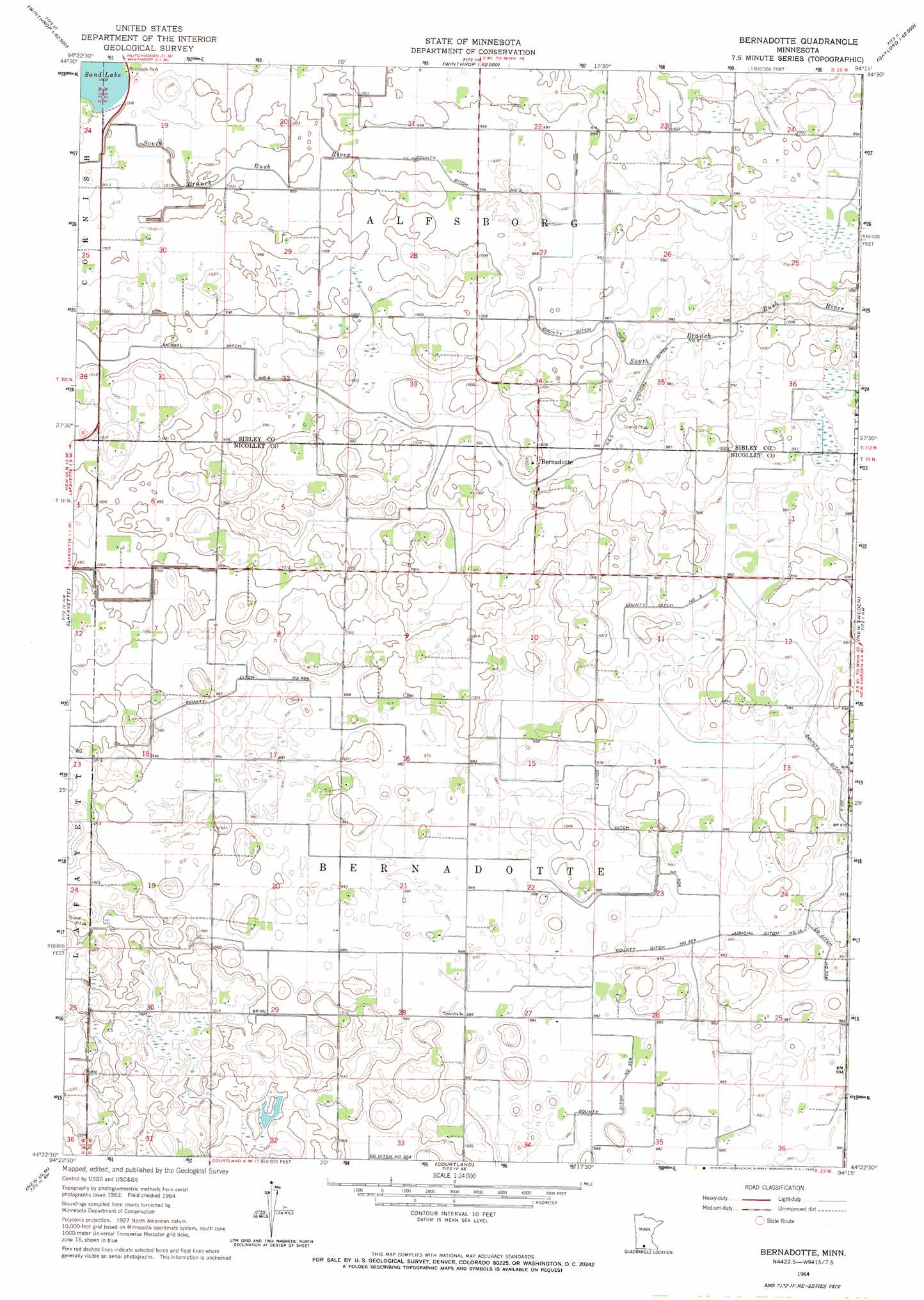
USGS Topo Quad 44094d3 - 1:24,000 scale
| Topo Map Name: | Bernadotte |
| USGS Topo Quad ID: | 44094d3 |
| Print Size: | ca. 21 1/4" wide x 27" high |
| Southeast Coordinates: | 44.375° N latitude / 94.25° W longitude |
| Map Center Coordinates: | 44.4375° N latitude / 94.3125° W longitude |
| U.S. State: | MN |
| Filename: | o44094d3.jpg |
| Download Map JPG Image: | Bernadotte topo map 1:24,000 scale |
| Map Type: | Topographic |
| Topo Series: | 7.5´ |
| Map Scale: | 1:24,000 |
| Source of Map Images: | United States Geological Survey (USGS) |
| Alternate Map Versions: |
Bernadotte MN 1964, updated 1965 Download PDF Buy paper map Bernadotte MN 2010 Download PDF Buy paper map Bernadotte MN 2013 Download PDF Buy paper map Bernadotte MN 2016 Download PDF Buy paper map |
1:24,000 Topo Quads surrounding Bernadotte
Buffalo Lake |
Stewart |
Brownton |
New Auburn |
Green Isle |
Gibbon |
Winthrop Sw |
Winthrop |
Gaylord |
Arlington |
Saint George |
Lafayette |
Bernadotte |
New Sweden |
Norseland |
Essig |
New Ulm |
Courtland |
Nicollet |
North Star |
Lake Hanska East |
Hanska |
Cambria |
Judson |
Mankato West |
> Back to 44094a1 at 1:100,000 scale
> Back to 44094a1 at 1:250,000 scale
> Back to U.S. Topo Maps home
Bernadotte topo map: Gazetteer
Bernadotte: Canals
County Ditch Number Five elevation 302m 990′County Ditch Number Forty A elevation 299m 980′
County Ditch Number Nine elevation 298m 977′
County Ditch Number Thirtytwo A elevation 296m 971′
Judicial Ditch Number Six elevation 300m 984′
Bernadotte: Lakes
Sand Lake elevation 306m 1003′Bernadotte: Parks
Sand Lake Wayside Park elevation 308m 1010′Bernadotte: Populated Places
Bernadotte elevation 305m 1000′Bernadotte: Post Offices
Bernadotte Post Office (historical) elevation 305m 1000′Bernadotte digital topo map on disk
Buy this Bernadotte topo map showing relief, roads, GPS coordinates and other geographical features, as a high-resolution digital map file on DVD: