Lafayette Topo Map Minnesota
To zoom in, hover over the map of Lafayette
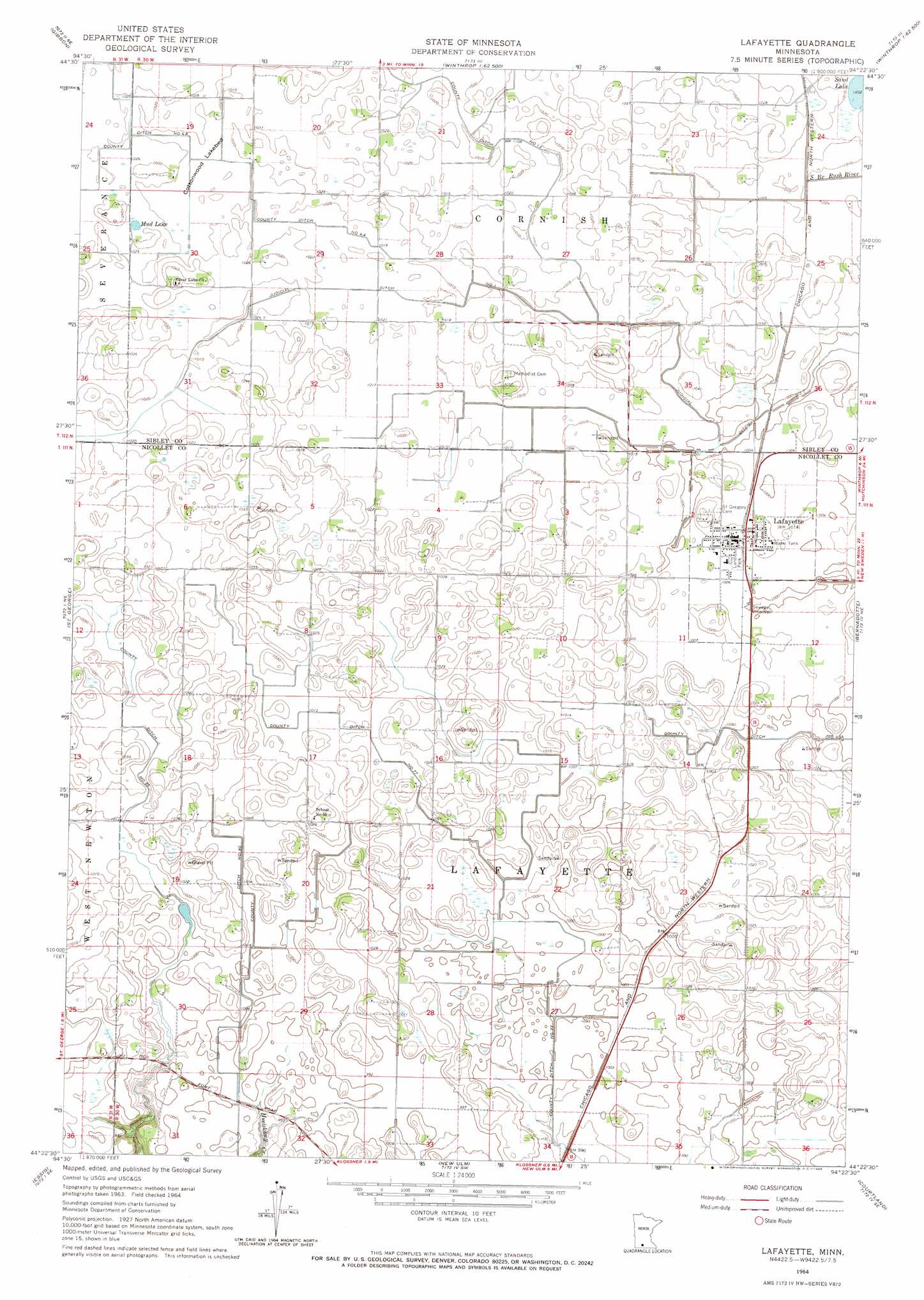
USGS Topo Quad 44094d4 - 1:24,000 scale
| Topo Map Name: | Lafayette |
| USGS Topo Quad ID: | 44094d4 |
| Print Size: | ca. 21 1/4" wide x 27" high |
| Southeast Coordinates: | 44.375° N latitude / 94.375° W longitude |
| Map Center Coordinates: | 44.4375° N latitude / 94.4375° W longitude |
| U.S. State: | MN |
| Filename: | o44094d4.jpg |
| Download Map JPG Image: | Lafayette topo map 1:24,000 scale |
| Map Type: | Topographic |
| Topo Series: | 7.5´ |
| Map Scale: | 1:24,000 |
| Source of Map Images: | United States Geological Survey (USGS) |
| Alternate Map Versions: |
Lafayette MN 1964, updated 1965 Download PDF Buy paper map Lafayette MN 2010 Download PDF Buy paper map Lafayette MN 2013 Download PDF Buy paper map Lafayette MN 2016 Download PDF Buy paper map |
1:24,000 Topo Quads surrounding Lafayette
Hector |
Buffalo Lake |
Stewart |
Brownton |
New Auburn |
Fairfax |
Gibbon |
Winthrop Sw |
Winthrop |
Gaylord |
Sleepy Eye Nw |
Saint George |
Lafayette |
Bernadotte |
New Sweden |
Sleepy Eye |
Essig |
New Ulm |
Courtland |
Nicollet |
Lake Hanska West |
Lake Hanska East |
Hanska |
Cambria |
Judson |
> Back to 44094a1 at 1:100,000 scale
> Back to 44094a1 at 1:250,000 scale
> Back to U.S. Topo Maps home
Lafayette topo map: Gazetteer
Lafayette: Canals
County Ditch Number Eightyfive elevation 309m 1013′County Ditch Number Four A elevation 308m 1010′
County Ditch Number Seventyseven elevation 302m 990′
County Ditch Number Thirteen elevation 308m 1010′
Judicial Ditch Number One elevation 306m 1003′
Lafayette: Flats
Cottonwood Lakebed elevation 309m 1013′Lafayette: Lakes
Mud Lake elevation 313m 1026′Lafayette: Parks
Lund Park elevation 307m 1007′Lafayette: Populated Places
Lafayette elevation 308m 1010′Lafayette: Post Offices
Lafayette Post Office elevation 310m 1017′Lafayette digital topo map on disk
Buy this Lafayette topo map showing relief, roads, GPS coordinates and other geographical features, as a high-resolution digital map file on DVD: