Arlington Topo Map Minnesota
To zoom in, hover over the map of Arlington
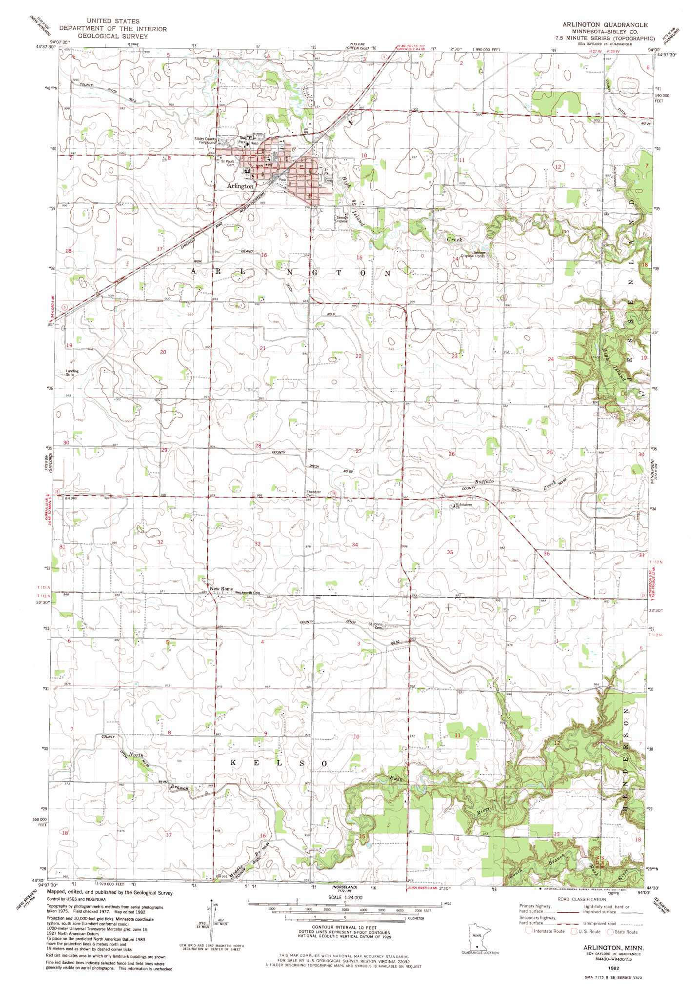
USGS Topo Quad 44094e1 - 1:24,000 scale
| Topo Map Name: | Arlington |
| USGS Topo Quad ID: | 44094e1 |
| Print Size: | ca. 21 1/4" wide x 27" high |
| Southeast Coordinates: | 44.5° N latitude / 94° W longitude |
| Map Center Coordinates: | 44.5625° N latitude / 94.0625° W longitude |
| U.S. State: | MN |
| Filename: | o44094e1.jpg |
| Download Map JPG Image: | Arlington topo map 1:24,000 scale |
| Map Type: | Topographic |
| Topo Series: | 7.5´ |
| Map Scale: | 1:24,000 |
| Source of Map Images: | United States Geological Survey (USGS) |
| Alternate Map Versions: |
Arlington MN 1982, updated 1983 Download PDF Buy paper map Arlington MN 2010 Download PDF Buy paper map Arlington MN 2013 Download PDF Buy paper map Arlington MN 2016 Download PDF Buy paper map |
1:24,000 Topo Quads surrounding Arlington
Biscay |
Glenco |
Plato |
Norwood |
Waconia |
Brownton |
New Auburn |
Green Isle |
Hamburg |
Belle Plaine North |
Winthrop |
Gaylord |
Arlington |
Henderson |
Belle Plaine South |
Bernadotte |
New Sweden |
Norseland |
Le Sueur |
Saint Thomas |
Courtland |
Nicollet |
North Star |
Saint Peter |
Cleveland |
> Back to 44094e1 at 1:100,000 scale
> Back to 44094a1 at 1:250,000 scale
> Back to U.S. Topo Maps home
Arlington topo map: Gazetteer
Arlington: Canals
County Ditch Number Fifty elevation 293m 961′County Ditch Number Fiftynine elevation 296m 971′
High Island Ditch Number Five elevation 299m 980′
Arlington: Populated Places
Arlington elevation 306m 1003′Arlington Mobile Home Park elevation 299m 980′
New Rome elevation 303m 994′
Arlington: Post Offices
Arlington Post Office elevation 305m 1000′New Rome Post Office (historical) elevation 303m 994′
Arlington: Streams
Middle Branch Rush River elevation 287m 941′North Branch Rush River elevation 287m 941′
Arlington digital topo map on disk
Buy this Arlington topo map showing relief, roads, GPS coordinates and other geographical features, as a high-resolution digital map file on DVD: