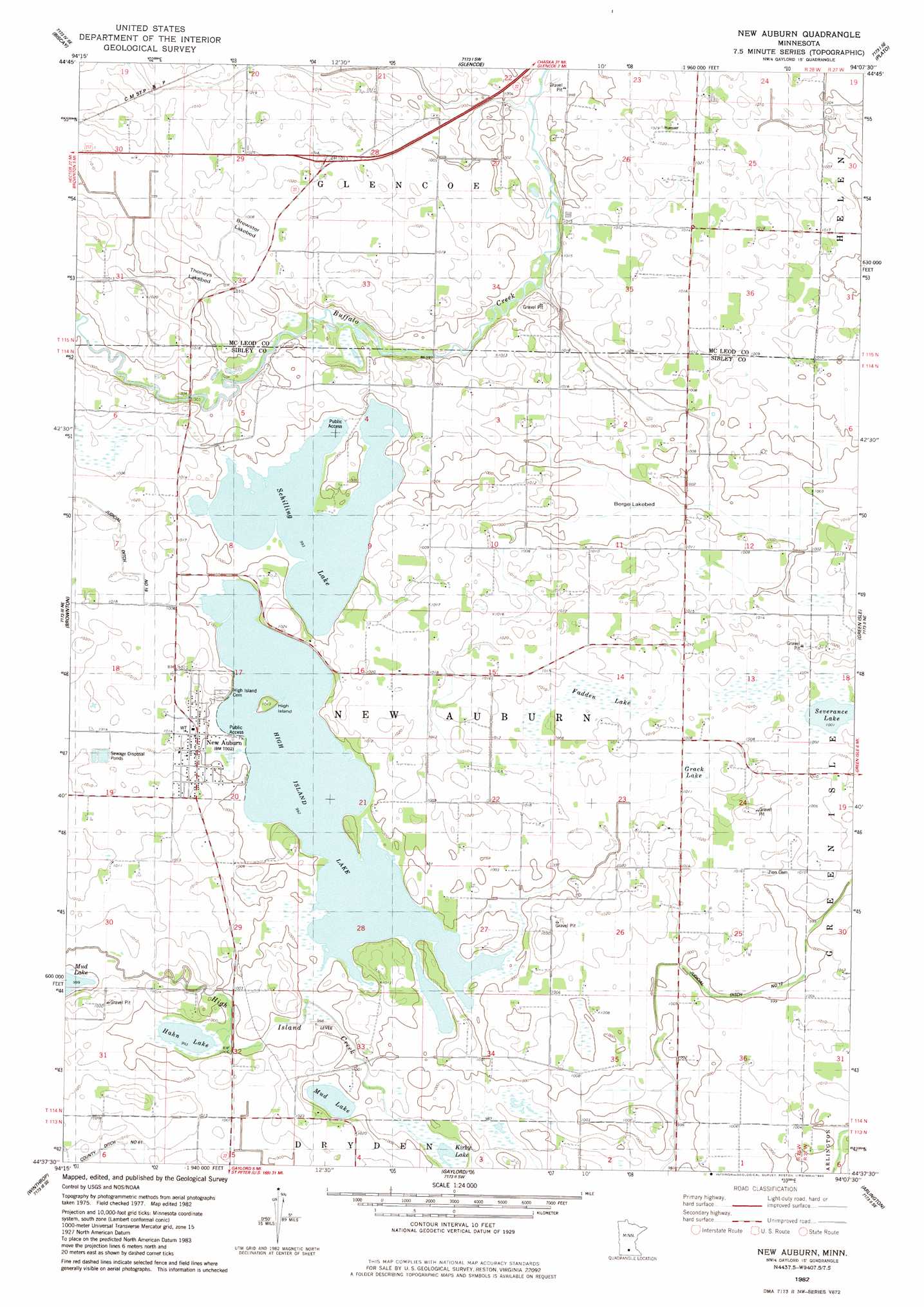
New Auburn Topo Map Minnesota
To zoom in, hover over the map of New Auburn
USGS Topo Quad 44094f2 - 1:24,000 scale
| Topo Map Name: | New Auburn |
| USGS Topo Quad ID: | 44094f2 |
| Print Size: | ca. 21 1/4" wide x 27" high |
| Southeast Coordinates: | 44.625° N latitude / 94.125° W longitude |
| Map Center Coordinates: | 44.6875° N latitude / 94.1875° W longitude |
| U.S. State: | MN |
| Filename: | o44094f2.jpg |
| Download Map JPG Image: | New Auburn topo map 1:24,000 scale |
| Map Type: | Topographic |
| Topo Series: | 7.5´ |
| Map Scale: | 1:24,000 |
| Source of Map Images: | United States Geological Survey (USGS) |
| Alternate Map Versions: |
New Auburn MN 1982, updated 1983 Download PDF Buy paper map New Auburn MN 2010 Download PDF Buy paper map New Auburn MN 2013 Download PDF Buy paper map New Auburn MN 2016 Download PDF Buy paper map |
1:24,000 Topo Quads surrounding New Auburn
Hutchinson West |
Hutchinson East |
Silver Lake |
Winsted |
Mayer |
Heatwole |
Biscay |
Glenco |
Plato |
Norwood |
Stewart |
Brownton |
New Auburn |
Green Isle |
Hamburg |
Winthrop Sw |
Winthrop |
Gaylord |
Arlington |
Henderson |
Lafayette |
Bernadotte |
New Sweden |
Norseland |
Le Sueur |
> Back to 44094e1 at 1:100,000 scale
> Back to 44094a1 at 1:250,000 scale
> Back to U.S. Topo Maps home
New Auburn topo map: Gazetteer
New Auburn: Canals
Judicial Ditch Number Nineteen elevation 308m 1010′Judicial Ditch Number Twelve elevation 305m 1000′
New Auburn: Flats
Berge Lakebed elevation 303m 994′Brewster Lakebed elevation 308m 1010′
Thoneys Lakebed elevation 305m 1000′
New Auburn: Lakes
Hahn Lake elevation 302m 990′High Island Lake elevation 302m 990′
Kirby Lake elevation 300m 984′
Mud Lake elevation 302m 990′
Schilling Lake elevation 302m 990′
New Auburn: Populated Places
New Auburn elevation 307m 1007′Ringo Mobile Home Park elevation 306m 1003′
New Auburn: Post Offices
New Auburn Post Office elevation 306m 1003′New Auburn: Swamps
Fadden Lake elevation 308m 1010′Grack Lake elevation 308m 1010′
New Auburn digital topo map on disk
Buy this New Auburn topo map showing relief, roads, GPS coordinates and other geographical features, as a high-resolution digital map file on DVD: