Heatwole Topo Map Minnesota
To zoom in, hover over the map of Heatwole
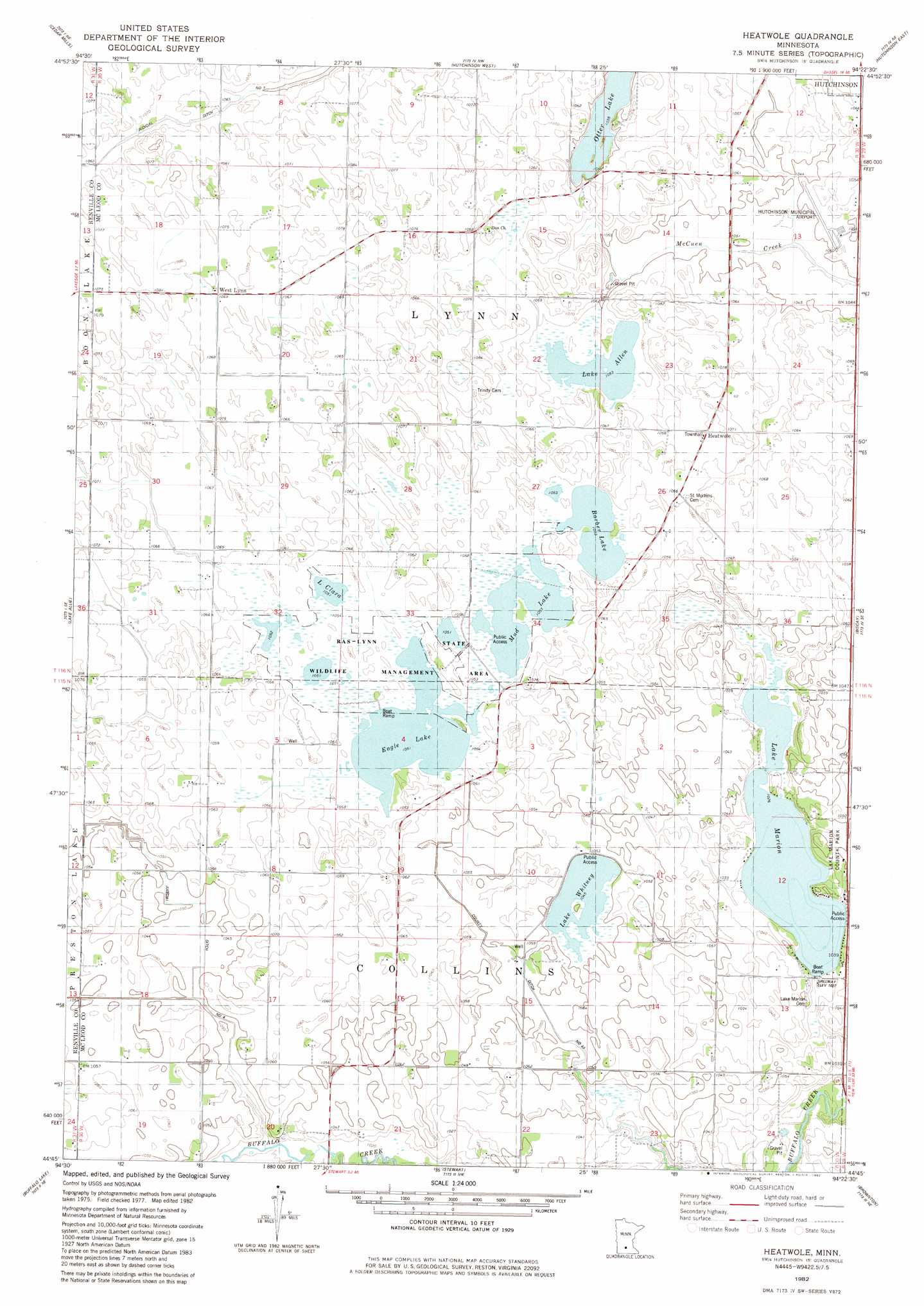
USGS Topo Quad 44094g4 - 1:24,000 scale
| Topo Map Name: | Heatwole |
| USGS Topo Quad ID: | 44094g4 |
| Print Size: | ca. 21 1/4" wide x 27" high |
| Southeast Coordinates: | 44.75° N latitude / 94.375° W longitude |
| Map Center Coordinates: | 44.8125° N latitude / 94.4375° W longitude |
| U.S. State: | MN |
| Filename: | o44094g4.jpg |
| Download Map JPG Image: | Heatwole topo map 1:24,000 scale |
| Map Type: | Topographic |
| Topo Series: | 7.5´ |
| Map Scale: | 1:24,000 |
| Source of Map Images: | United States Geological Survey (USGS) |
| Alternate Map Versions: |
Heatwole MN 1982, updated 1982 Download PDF Buy paper map Heatwole MN 2010 Download PDF Buy paper map Heatwole MN 2013 Download PDF Buy paper map Heatwole MN 2016 Download PDF Buy paper map |
1:24,000 Topo Quads surrounding Heatwole
Rosendale |
Litchfield South |
Darwin |
Dassel |
Cokato |
Cosmos |
Cedar Mills |
Hutchinson West |
Hutchinson East |
Silver Lake |
Churchill |
Lake Allie |
Heatwole |
Biscay |
Glenco |
Hector |
Buffalo Lake |
Stewart |
Brownton |
New Auburn |
Fairfax |
Gibbon |
Winthrop Sw |
Winthrop |
Gaylord |
> Back to 44094e1 at 1:100,000 scale
> Back to 44094a1 at 1:250,000 scale
> Back to U.S. Topo Maps home
Heatwole topo map: Gazetteer
Heatwole: Airports
Hutchinson Municipal Airport elevation 321m 1053′Heatwole: Canals
County Ditch Number Thirtythree elevation 317m 1040′Judicial Ditch Number Four elevation 317m 1040′
Heatwole: Dams
Marion Lake Dam elevation 314m 1030′Heatwole: Lakes
Barber Lake elevation 321m 1053′Eagle Lake elevation 320m 1049′
Lake Allen elevation 321m 1053′
Lake Clara elevation 320m 1049′
Lake Marion elevation 312m 1023′
Lake Whitney elevation 318m 1043′
Mud Lake elevation 321m 1053′
Heatwole: Parks
Lake Marion County Park elevation 319m 1046′Ras-Lynn State Wildlife Management Area elevation 323m 1059′
Heatwole: Populated Places
Heatwole elevation 323m 1059′West Lynn elevation 326m 1069′
Heatwole: Post Offices
Heatwole Post Office (historical) elevation 323m 1059′Heatwole: Reservoirs
Marion Lake elevation 314m 1030′Heatwole digital topo map on disk
Buy this Heatwole topo map showing relief, roads, GPS coordinates and other geographical features, as a high-resolution digital map file on DVD: