Storden Topo Map Minnesota
To zoom in, hover over the map of Storden
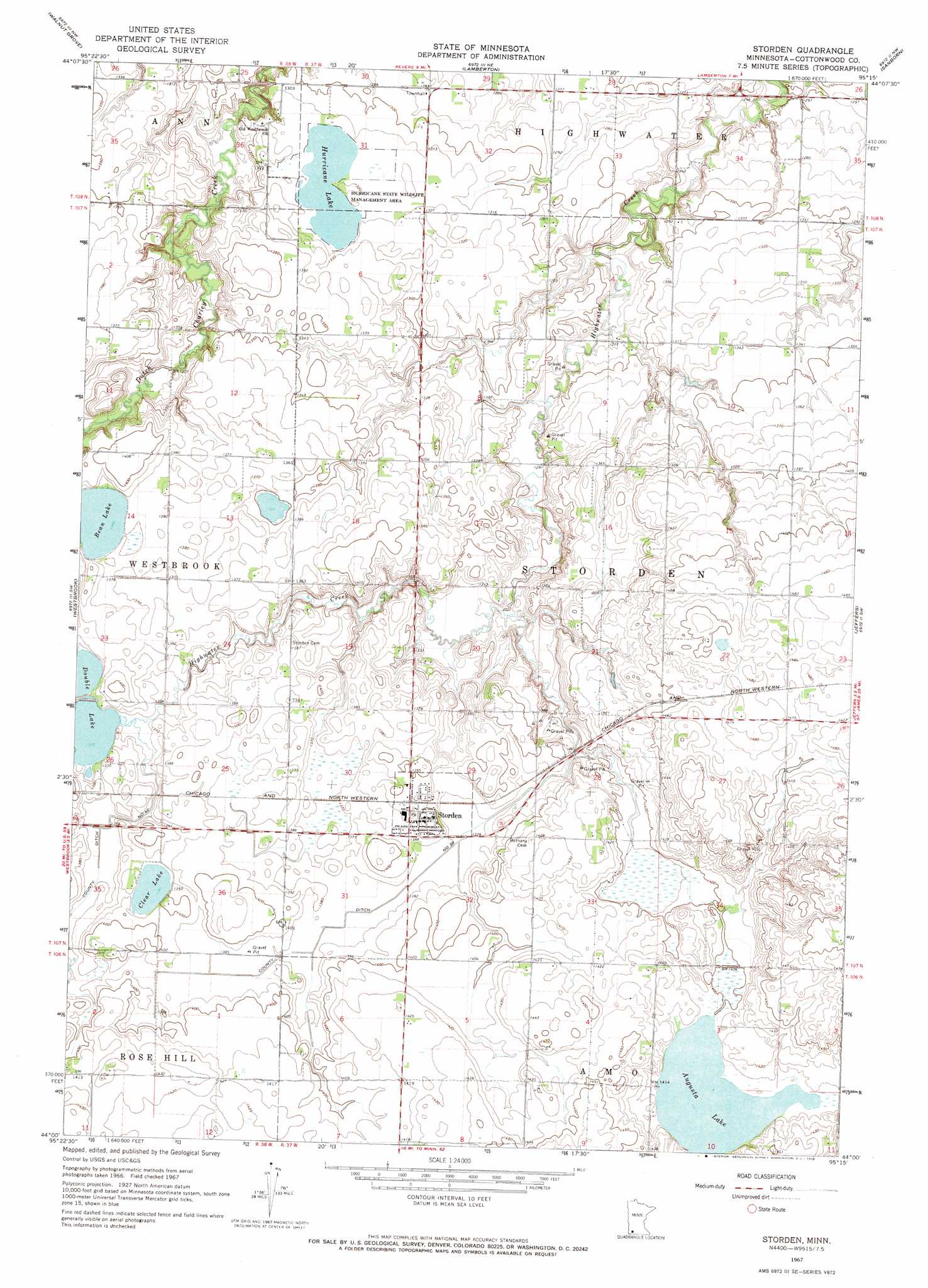
USGS Topo Quad 44095a3 - 1:24,000 scale
| Topo Map Name: | Storden |
| USGS Topo Quad ID: | 44095a3 |
| Print Size: | ca. 21 1/4" wide x 27" high |
| Southeast Coordinates: | 44° N latitude / 95.25° W longitude |
| Map Center Coordinates: | 44.0625° N latitude / 95.3125° W longitude |
| U.S. State: | MN |
| Filename: | o44095a3.jpg |
| Download Map JPG Image: | Storden topo map 1:24,000 scale |
| Map Type: | Topographic |
| Topo Series: | 7.5´ |
| Map Scale: | 1:24,000 |
| Source of Map Images: | United States Geological Survey (USGS) |
| Alternate Map Versions: |
Storden MN 1967, updated 1968 Download PDF Buy paper map Storden MN 2010 Download PDF Buy paper map Storden MN 2013 Download PDF Buy paper map Storden MN 2016 Download PDF Buy paper map |
1:24,000 Topo Quads surrounding Storden
Milroy Se |
Wabasso Sw |
Wabasso Se |
Wanda |
Clements Se |
Tracy East |
Walnut Grove |
Lamberton |
Sanborn |
Sanborn Ne |
Dovray |
Westbrook |
Storden |
Jeffers |
Sanborn Se |
Lime Creek |
Heron Lake Nw |
Heron Lake Ne |
Harder Lake |
Bingham Lake |
Fulda |
Dundee |
Heron Lake |
Wilder |
Windom |
> Back to 44095a1 at 1:100,000 scale
> Back to 44094a1 at 1:250,000 scale
> Back to U.S. Topo Maps home
Storden topo map: Gazetteer
Storden: Canals
County Ditch Number Fortytwo elevation 417m 1368′County Ditch Number Thirtyseven elevation 418m 1371′
Storden: Lakes
Augusta Lake elevation 427m 1400′Bean Lake elevation 418m 1371′
Clear Lake elevation 421m 1381′
Double Lake elevation 413m 1354′
Hurricane Lake elevation 399m 1309′
Storden: Parks
Highwater Park elevation 380m 1246′Hurricane State Wildlife Management Area elevation 399m 1309′
Sara Park elevation 429m 1407′
Storden: Populated Places
Storden elevation 430m 1410′Storden: Post Offices
Storden Post Office elevation 426m 1397′Storden digital topo map on disk
Buy this Storden topo map showing relief, roads, GPS coordinates and other geographical features, as a high-resolution digital map file on DVD: