Lamberton Topo Map Minnesota
To zoom in, hover over the map of Lamberton
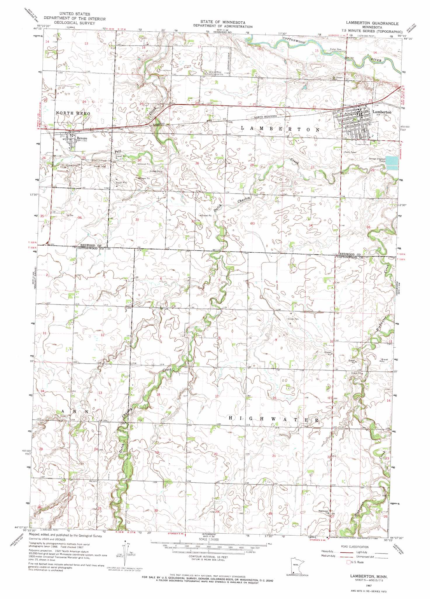
USGS Topo Quad 44095b3 - 1:24,000 scale
| Topo Map Name: | Lamberton |
| USGS Topo Quad ID: | 44095b3 |
| Print Size: | ca. 21 1/4" wide x 27" high |
| Southeast Coordinates: | 44.125° N latitude / 95.25° W longitude |
| Map Center Coordinates: | 44.1875° N latitude / 95.3125° W longitude |
| U.S. State: | MN |
| Filename: | o44095b3.jpg |
| Download Map JPG Image: | Lamberton topo map 1:24,000 scale |
| Map Type: | Topographic |
| Topo Series: | 7.5´ |
| Map Scale: | 1:24,000 |
| Source of Map Images: | United States Geological Survey (USGS) |
| Alternate Map Versions: |
Lamberton MN 1967, updated 1969 Download PDF Buy paper map Lamberton MN 2010 Download PDF Buy paper map Lamberton MN 2013 Download PDF Buy paper map Lamberton MN 2016 Download PDF Buy paper map |
1:24,000 Topo Quads surrounding Lamberton
Milroy |
Lucan |
Wabasso |
Rowena |
Clements |
Milroy Se |
Wabasso Sw |
Wabasso Se |
Wanda |
Clements Se |
Tracy East |
Walnut Grove |
Lamberton |
Sanborn |
Sanborn Ne |
Dovray |
Westbrook |
Storden |
Jeffers |
Sanborn Se |
Lime Creek |
Heron Lake Nw |
Heron Lake Ne |
Harder Lake |
Bingham Lake |
> Back to 44095a1 at 1:100,000 scale
> Back to 44094a1 at 1:250,000 scale
> Back to U.S. Topo Maps home
Lamberton topo map: Gazetteer
Lamberton: Parks
Kuhar Park elevation 323m 1059′Lamberton: Populated Places
Lamberton elevation 348m 1141′Revere elevation 350m 1148′
Lamberton: Post Offices
Lamberton Post Office elevation 348m 1141′Revere Post Office elevation 350m 1148′
Lamberton digital topo map on disk
Buy this Lamberton topo map showing relief, roads, GPS coordinates and other geographical features, as a high-resolution digital map file on DVD: