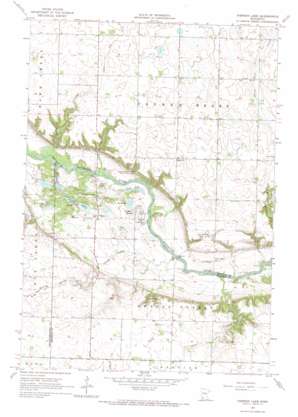
Iverson Lake Topo Map Minnesota
To zoom in, hover over the map of Iverson Lake
USGS Topo Quad 44095f3 - 1:24,000 scale
| Topo Map Name: | Iverson Lake |
| USGS Topo Quad ID: | 44095f3 |
| Print Size: | ca. 21 1/4" wide x 27" high |
| Southeast Coordinates: | 44.625° N latitude / 95.25° W longitude |
| Map Center Coordinates: | 44.6875° N latitude / 95.3125° W longitude |
| U.S. State: | MN |
| Filename: | o44095f3.jpg |
| Download Map JPG Image: | Iverson Lake topo map 1:24,000 scale |
| Map Type: | Topographic |
| Topo Series: | 7.5´ |
| Map Scale: | 1:24,000 |
| Source of Map Images: | United States Geological Survey (USGS) |
| Alternate Map Versions: |
Iverson Lake MN 1965, updated 1966 Download PDF Buy paper map Iverson Lake MN 2010 Download PDF Buy paper map Iverson Lake MN 2013 Download PDF Buy paper map Iverson Lake MN 2016 Download PDF Buy paper map |
1:24,000 Topo Quads surrounding Iverson Lake
> Back to 44095e1 at 1:100,000 scale
> Back to 44094a1 at 1:250,000 scale
> Back to U.S. Topo Maps home
Iverson Lake topo map: Gazetteer
Iverson Lake: Lakes
Iverson Lake elevation 272m 892′Joe Slough elevation 267m 875′
Long Lake elevation 261m 856′
Nordeen Slough elevation 260m 853′
Iverson Lake: Parks
Farther and Gay Castle Historical Marker elevation 296m 971′Joseph R Brown Wayside Park elevation 291m 954′
Iverson Lake: Streams
Boiling Spring Creek elevation 259m 849′Echo Creek elevation 259m 849′
Iverson Lake: Summits
Middag Knutea elevation 289m 948′Iverson Lake digital topo map on disk
Buy this Iverson Lake topo map showing relief, roads, GPS coordinates and other geographical features, as a high-resolution digital map file on DVD:


