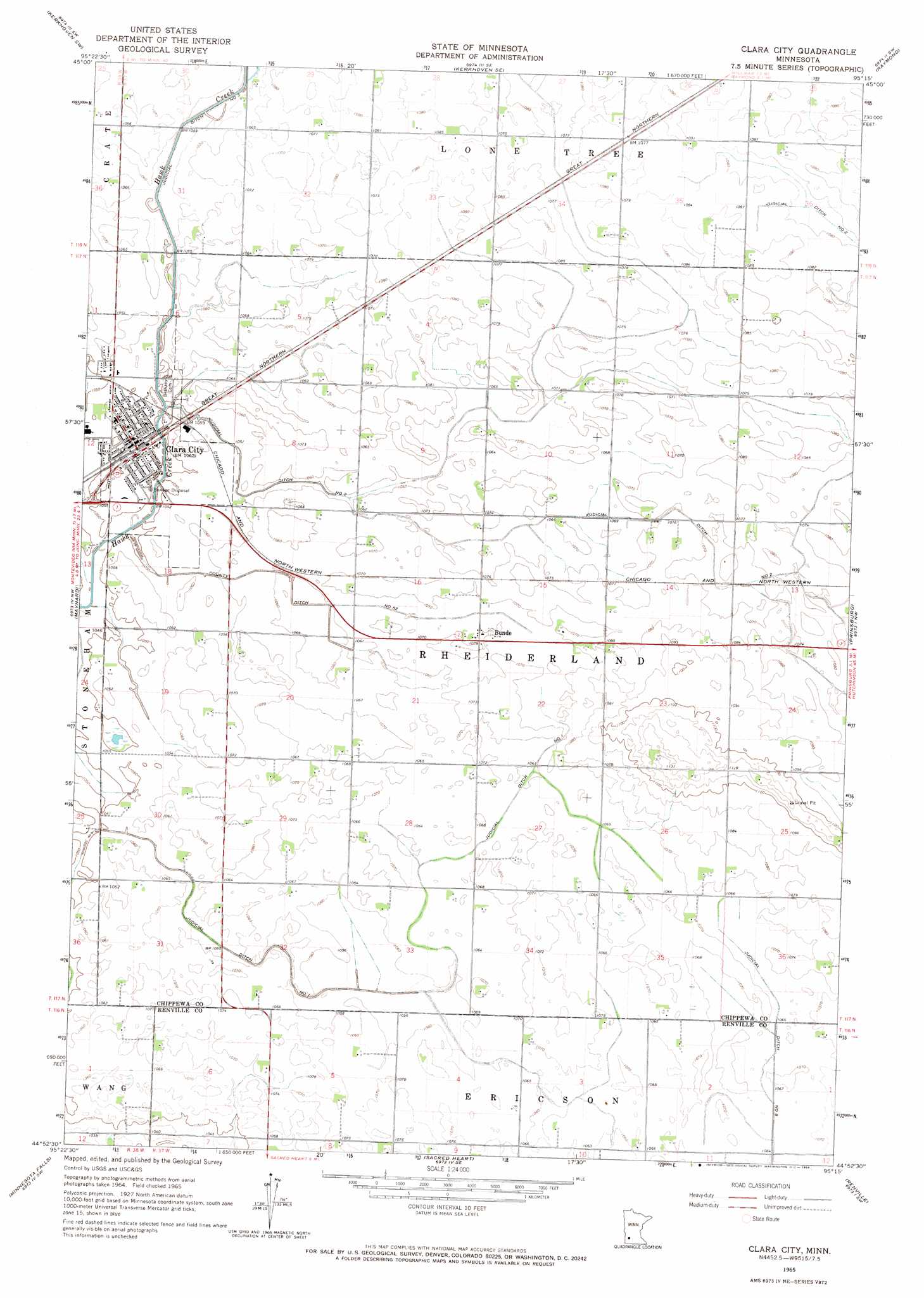
Clara City Topo Map Minnesota
To zoom in, hover over the map of Clara City
USGS Topo Quad 44095h3 - 1:24,000 scale
| Topo Map Name: | Clara City |
| USGS Topo Quad ID: | 44095h3 |
| Print Size: | ca. 21 1/4" wide x 27" high |
| Southeast Coordinates: | 44.875° N latitude / 95.25° W longitude |
| Map Center Coordinates: | 44.9375° N latitude / 95.3125° W longitude |
| U.S. State: | MN |
| Filename: | o44095h3.jpg |
| Download Map JPG Image: | Clara City topo map 1:24,000 scale |
| Map Type: | Topographic |
| Topo Series: | 7.5´ |
| Map Scale: | 1:24,000 |
| Source of Map Images: | United States Geological Survey (USGS) |
| Alternate Map Versions: |
Clara City MN 1965, updated 1966 Download PDF Buy paper map Clara City MN 2010 Download PDF Buy paper map Clara City MN 2013 Download PDF Buy paper map Clara City MN 2016 Download PDF Buy paper map |
1:24,000 Topo Quads surrounding Clara City
Gracelock Ne |
Murdock |
Kerkhoven |
Pennock |
Solomon Lake |
Gracelock |
Kerkhoven Sw |
Kerkhoven Se |
Raymond |
Willmar |
Asbury |
Maynard |
Clara City |
Prinsburg |
Blomkest |
Granite Falls |
Minnesota Falls |
Sacred Heart |
Renville |
Danube |
Wood Lake |
Lone Tree Lake |
Iverson Lake |
Vicksburg |
Bechyn |
> Back to 44095e1 at 1:100,000 scale
> Back to 44094a1 at 1:250,000 scale
> Back to U.S. Topo Maps home
Clara City topo map: Gazetteer
Clara City: Canals
County Ditch Number Fiftytwo elevation 320m 1049′Judicial Ditch Number Two elevation 326m 1069′
Clara City: Populated Places
Bunde elevation 328m 1076′Clara City elevation 322m 1056′
Clara City: Post Offices
Clara City Post Office elevation 322m 1056′Clara City Post Office elevation 322m 1056′
Clara City digital topo map on disk
Buy this Clara City topo map showing relief, roads, GPS coordinates and other geographical features, as a high-resolution digital map file on DVD: