Ruthton Topo Map Minnesota
To zoom in, hover over the map of Ruthton
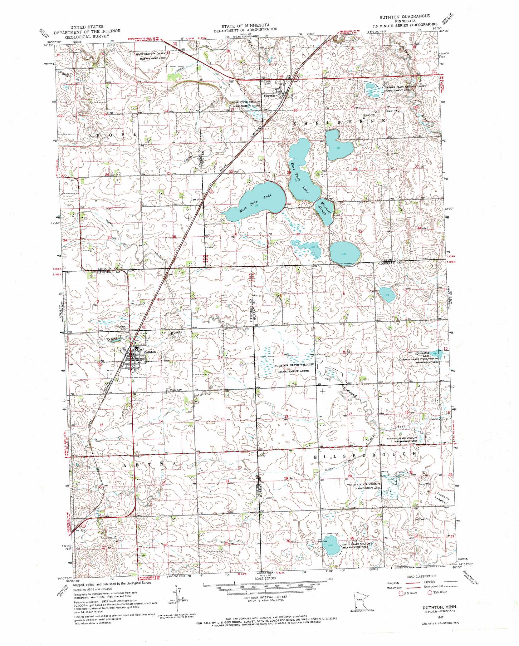
USGS Topo Quad 44096b1 - 1:24,000 scale
| Topo Map Name: | Ruthton |
| USGS Topo Quad ID: | 44096b1 |
| Print Size: | ca. 21 1/4" wide x 27" high |
| Southeast Coordinates: | 44.125° N latitude / 96° W longitude |
| Map Center Coordinates: | 44.1875° N latitude / 96.0625° W longitude |
| U.S. State: | MN |
| Filename: | o44096b1.jpg |
| Download Map JPG Image: | Ruthton topo map 1:24,000 scale |
| Map Type: | Topographic |
| Topo Series: | 7.5´ |
| Map Scale: | 1:24,000 |
| Source of Map Images: | United States Geological Survey (USGS) |
| Alternate Map Versions: |
Ruthton MN 1967, updated 1968 Download PDF Buy paper map Ruthton MN 2010 Download PDF Buy paper map Ruthton MN 2013 Download PDF Buy paper map Ruthton MN 2016 Download PDF Buy paper map |
1:24,000 Topo Quads surrounding Ruthton
Lake Benton Ne |
Arco |
Gislason Lake |
Lynd |
Marshall |
Lake Benton |
Tyler |
Dead Coon Lake |
Russell |
Marshall Se |
Verdi |
Ruthton Nw |
Ruthton |
Current Lake |
Balaton |
Pipestone North |
Holland |
Woodstock |
Balaton Sw |
Hadley |
Pipestone South |
Edgerton North |
Edgerton Ne |
Chandler |
Slayton |
> Back to 44096a1 at 1:100,000 scale
> Back to 44096a1 at 1:250,000 scale
> Back to U.S. Topo Maps home
Ruthton topo map: Gazetteer
Ruthton: Canals
County Ditch Number Sixteen elevation 521m 1709′County Ditch Number Twentyone elevation 513m 1683′
Judicial Ditch Number Thirteen elevation 521m 1709′
Judicial Ditch Number Twelve elevation 512m 1679′
Ruthton: Flats
Ivadelle Lakebed elevation 511m 1676′Ruthton: Lakes
East Twin Lake elevation 510m 1673′Hjermstad Lake elevation 513m 1683′
Mitchell Slough elevation 510m 1673′
West Twin Lake elevation 516m 1692′
Ruthton: Parks
Hjermstad Lake State Wildlife Management Are elevation 514m 1686′Hope State Wildlife Management Area elevation 514m 1686′
Lange State Wildlife Management Area elevation 515m 1689′
Nyroca Flats State Wildlife Management Area elevation 504m 1653′
Ruthton State Wildlife Management Area elevation 515m 1689′
Van Eck State Wildlife Management Area elevation 510m 1673′
Ruthton: Populated Places
Florence elevation 528m 1732′Ruthton elevation 527m 1729′
Ruthton: Post Offices
Florence Post Office elevation 528m 1732′Ruthton Post Office elevation 525m 1722′
Ruthton digital topo map on disk
Buy this Ruthton topo map showing relief, roads, GPS coordinates and other geographical features, as a high-resolution digital map file on DVD:
Eastern North Dakota & Eastern South Dakota
Buy digital topo maps: Eastern North Dakota & Eastern South Dakota