Rutland Nw Topo Map South Dakota
To zoom in, hover over the map of Rutland Nw
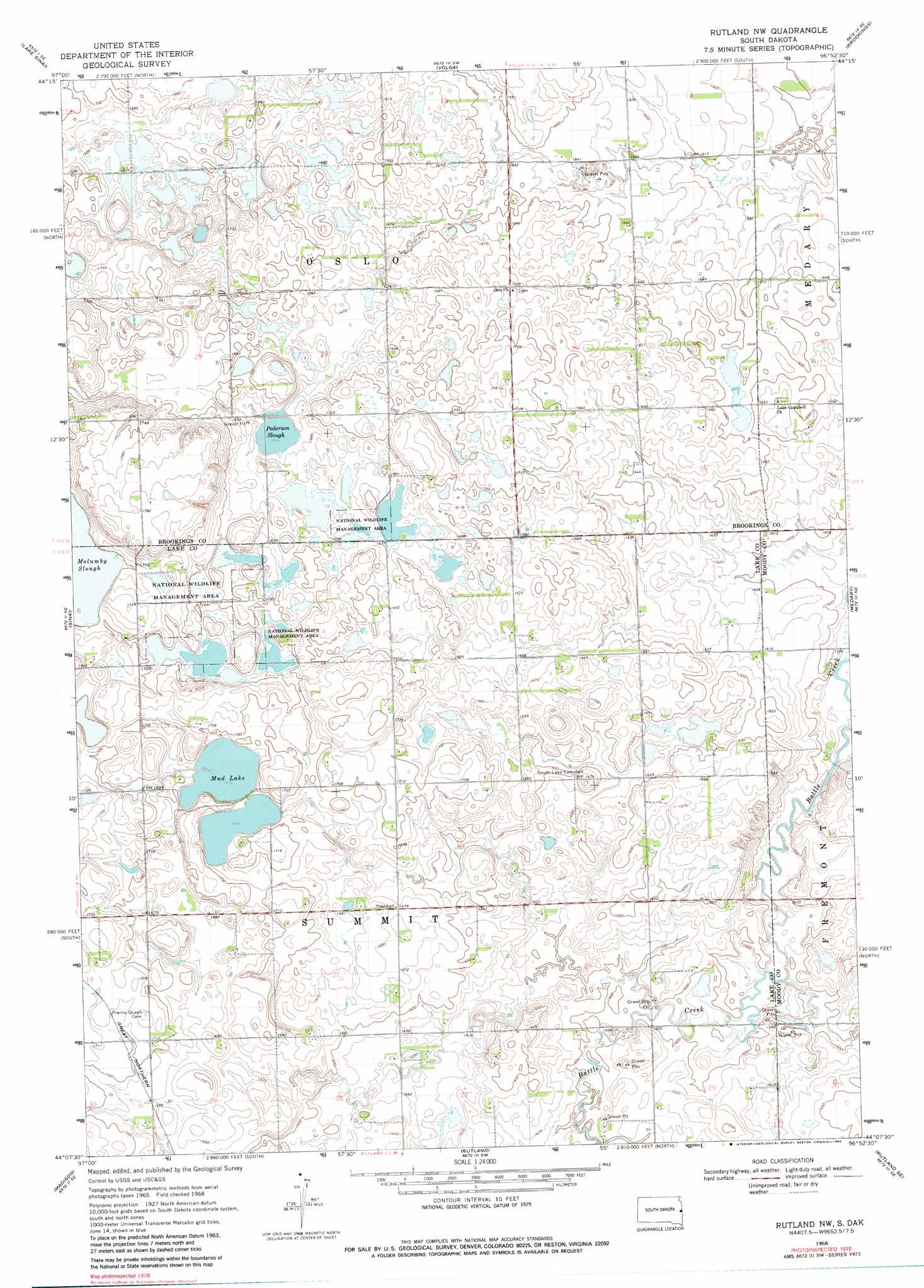
USGS Topo Quad 44096b8 - 1:24,000 scale
| Topo Map Name: | Rutland Nw |
| USGS Topo Quad ID: | 44096b8 |
| Print Size: | ca. 21 1/4" wide x 27" high |
| Southeast Coordinates: | 44.125° N latitude / 96.875° W longitude |
| Map Center Coordinates: | 44.1875° N latitude / 96.9375° W longitude |
| U.S. State: | SD |
| Filename: | o44096b8.jpg |
| Download Map JPG Image: | Rutland Nw topo map 1:24,000 scale |
| Map Type: | Topographic |
| Topo Series: | 7.5´ |
| Map Scale: | 1:24,000 |
| Source of Map Images: | United States Geological Survey (USGS) |
| Alternate Map Versions: |
Rutland NW SD 1968, updated 1971 Download PDF Buy paper map Rutland NW SD 1968, updated 1984 Download PDF Buy paper map Rutland NW SD 2012 Download PDF Buy paper map Rutland NW SD 2015 Download PDF Buy paper map |
1:24,000 Topo Quads surrounding Rutland Nw
Badger |
Arlington Ne |
Bruce |
Brookings Ne |
White |
Arlington |
Lake Sinai |
Volga |
Brookings |
Aurora |
Madison Nw |
Sinai |
Rutland Nw |
Medary |
Flandreau Nw |
Ramona |
Madison |
Rutland |
Rutland Se |
Flandreau Sw |
Lake Herman |
Lake Madison |
Wentworth |
Colman |
Trent |
> Back to 44096a1 at 1:100,000 scale
> Back to 44096a1 at 1:250,000 scale
> Back to U.S. Topo Maps home
Rutland Nw topo map: Gazetteer
Rutland Nw: Lakes
Molumby Slough elevation 518m 1699′Mud Lake elevation 510m 1673′
Pederson Slough elevation 507m 1663′
Rutland Nw digital topo map on disk
Buy this Rutland Nw topo map showing relief, roads, GPS coordinates and other geographical features, as a high-resolution digital map file on DVD:
Eastern North Dakota & Eastern South Dakota
Buy digital topo maps: Eastern North Dakota & Eastern South Dakota