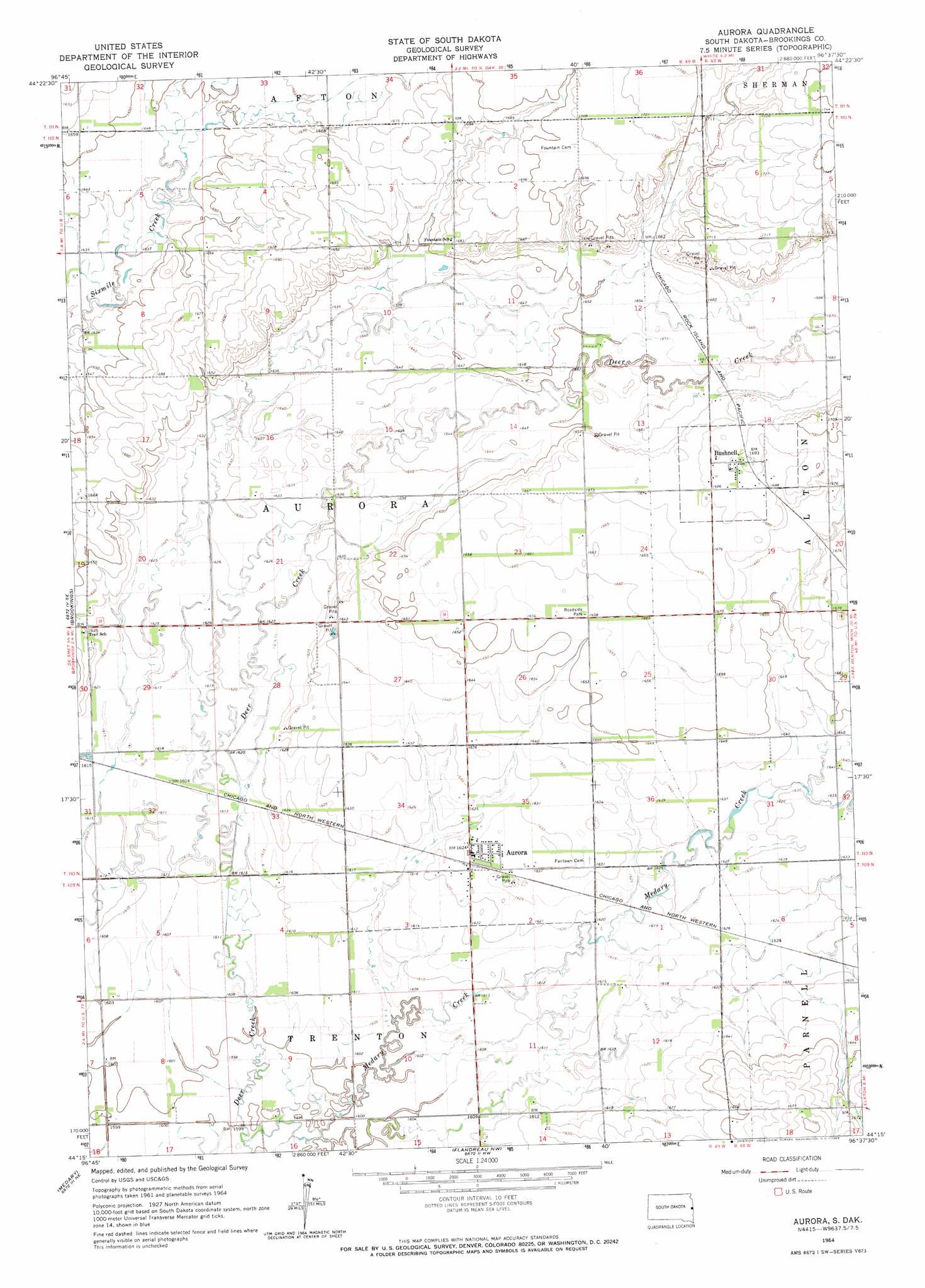
Aurora Topo Map South Dakota
To zoom in, hover over the map of Aurora
USGS Topo Quad 44096c6 - 1:24,000 scale
| Topo Map Name: | Aurora |
| USGS Topo Quad ID: | 44096c6 |
| Print Size: | ca. 21 1/4" wide x 27" high |
| Southeast Coordinates: | 44.25° N latitude / 96.625° W longitude |
| Map Center Coordinates: | 44.3125° N latitude / 96.6875° W longitude |
| U.S. State: | SD |
| Filename: | o44096c6.jpg |
| Download Map JPG Image: | Aurora topo map 1:24,000 scale |
| Map Type: | Topographic |
| Topo Series: | 7.5´ |
| Map Scale: | 1:24,000 |
| Source of Map Images: | United States Geological Survey (USGS) |
| Alternate Map Versions: |
Aurora SD 1964, updated 1965 Download PDF Buy paper map Aurora SD 2012 Download PDF Buy paper map Aurora SD 2015 Download PDF Buy paper map |
1:24,000 Topo Quads surrounding Aurora
Estelline |
Estelline Se |
Toronto |
Astoria |
Hendricks |
Bruce |
Brookings Ne |
White |
White Ne |
Lake Benton Nw |
Volga |
Brookings |
Aurora |
White Se |
Lake Benton Sw |
Rutland Nw |
Medary |
Flandreau Nw |
Flandreau Ne |
Elkton |
Rutland |
Rutland Se |
Flandreau Sw |
Flandreau |
Elkton Sw |
> Back to 44096a1 at 1:100,000 scale
> Back to 44096a1 at 1:250,000 scale
> Back to U.S. Topo Maps home
Aurora topo map: Gazetteer
Aurora: Areas
Aurora Prairie elevation 489m 1604′Aurora: Populated Places
Aurora elevation 495m 1624′Bushnell elevation 515m 1689′
Aurora: Streams
Deer Creek elevation 488m 1601′Aurora digital topo map on disk
Buy this Aurora topo map showing relief, roads, GPS coordinates and other geographical features, as a high-resolution digital map file on DVD:
Eastern North Dakota & Eastern South Dakota
Buy digital topo maps: Eastern North Dakota & Eastern South Dakota