Astoria Topo Map South Dakota
To zoom in, hover over the map of Astoria
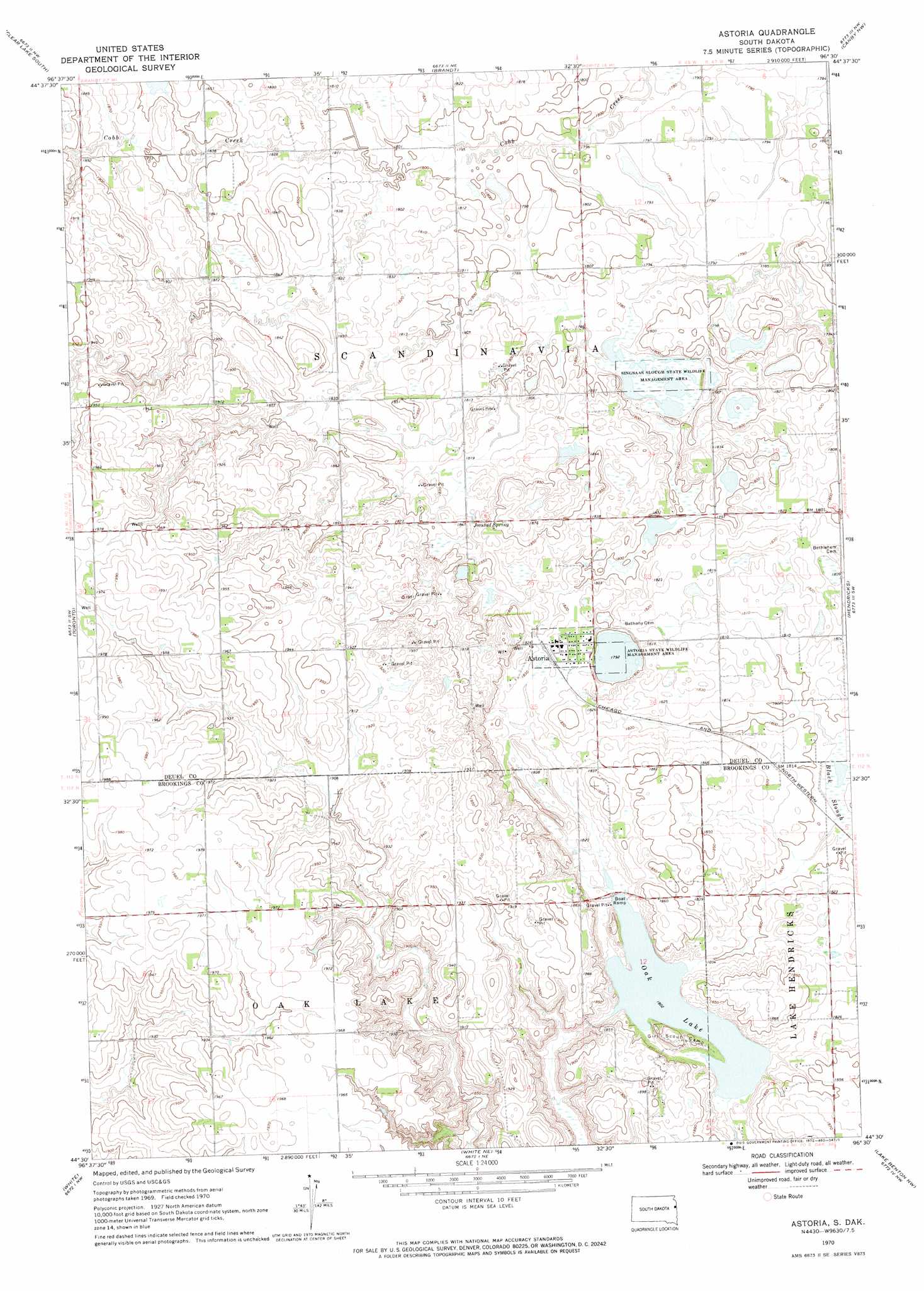
USGS Topo Quad 44096e5 - 1:24,000 scale
| Topo Map Name: | Astoria |
| USGS Topo Quad ID: | 44096e5 |
| Print Size: | ca. 21 1/4" wide x 27" high |
| Southeast Coordinates: | 44.5° N latitude / 96.5° W longitude |
| Map Center Coordinates: | 44.5625° N latitude / 96.5625° W longitude |
| U.S. State: | SD |
| Filename: | o44096e5.jpg |
| Download Map JPG Image: | Astoria topo map 1:24,000 scale |
| Map Type: | Topographic |
| Topo Series: | 7.5´ |
| Map Scale: | 1:24,000 |
| Source of Map Images: | United States Geological Survey (USGS) |
| Alternate Map Versions: |
Astoria SD 1970, updated 1972 Download PDF Buy paper map Astoria SD 2012 Download PDF Buy paper map Astoria SD 2015 Download PDF Buy paper map |
1:24,000 Topo Quads surrounding Astoria
Bemis |
Clear Lake North |
Lake Francis |
Gary |
Gary Se |
Estelline Ne |
Clear Lake South |
Brandt |
Canby Nw |
Canby |
Estelline Se |
Toronto |
Astoria |
Hendricks |
Canby Se |
Brookings Ne |
White |
White Ne |
Lake Benton Nw |
Lake Benton Ne |
Brookings |
Aurora |
White Se |
Lake Benton Sw |
Lake Benton |
> Back to 44096e1 at 1:100,000 scale
> Back to 44096a1 at 1:250,000 scale
> Back to U.S. Topo Maps home
Astoria topo map: Gazetteer
Astoria: Lakes
Oak Lake elevation 549m 1801′Astoria: Parks
Astoria State Wildlife Management Area elevation 546m 1791′Oak Lake Girl Scout Camp elevation 549m 1801′
Singsaas Slough State Wildlife Management Area elevation 541m 1774′
Astoria: Populated Places
Astoria elevation 556m 1824′Astoria: Post Offices
Scandinavia Post Office (historical) elevation 552m 1811′Astoria: Springs
Jorstad Spring elevation 561m 1840′Astoria digital topo map on disk
Buy this Astoria topo map showing relief, roads, GPS coordinates and other geographical features, as a high-resolution digital map file on DVD:
Eastern North Dakota & Eastern South Dakota
Buy digital topo maps: Eastern North Dakota & Eastern South Dakota