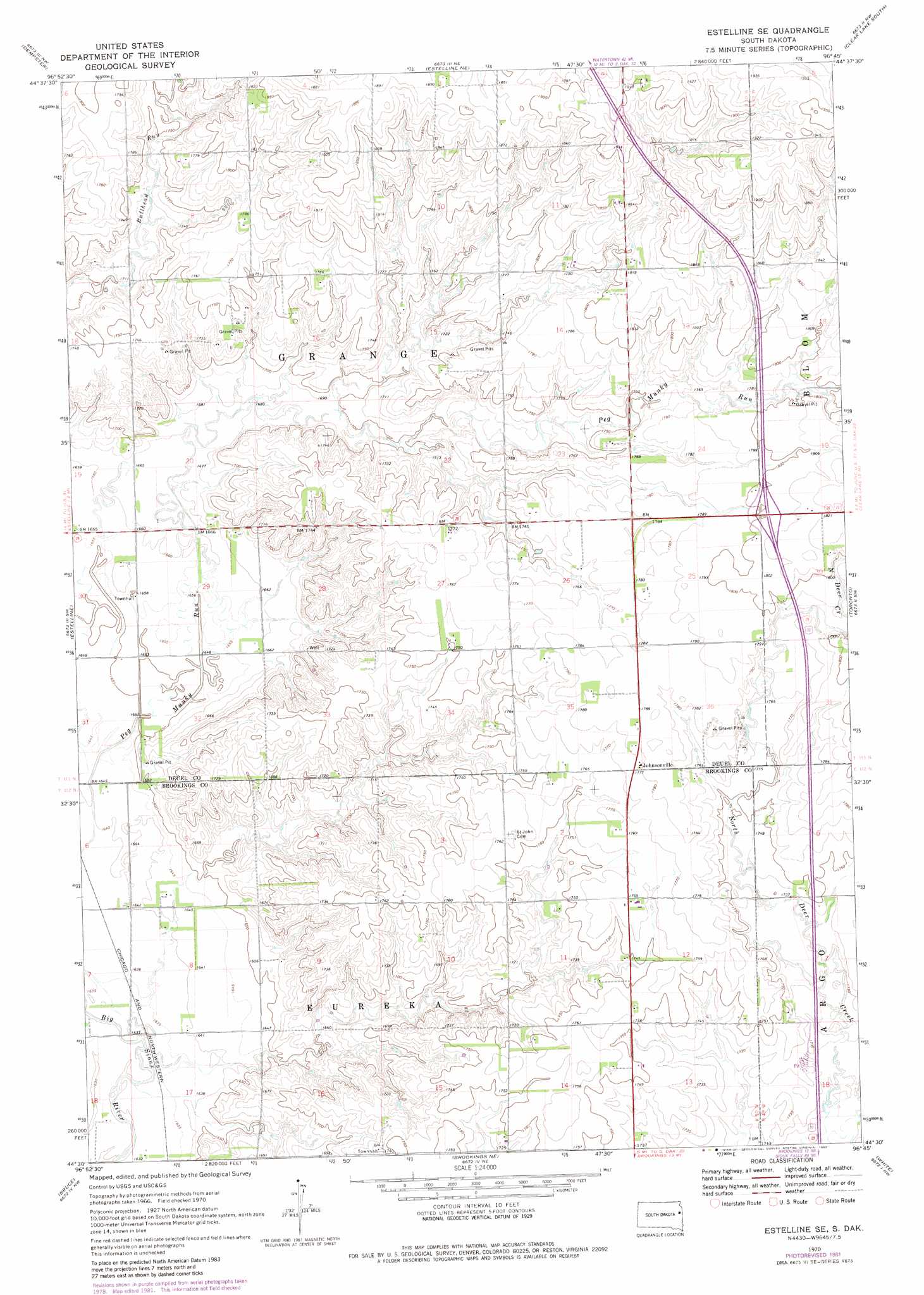
Estelline Se Topo Map South Dakota
To zoom in, hover over the map of Estelline Se
USGS Topo Quad 44096e7 - 1:24,000 scale
| Topo Map Name: | Estelline Se |
| USGS Topo Quad ID: | 44096e7 |
| Print Size: | ca. 21 1/4" wide x 27" high |
| Southeast Coordinates: | 44.5° N latitude / 96.75° W longitude |
| Map Center Coordinates: | 44.5625° N latitude / 96.8125° W longitude |
| U.S. State: | SD |
| Filename: | o44096e7.jpg |
| Download Map JPG Image: | Estelline Se topo map 1:24,000 scale |
| Map Type: | Topographic |
| Topo Series: | 7.5´ |
| Map Scale: | 1:24,000 |
| Source of Map Images: | United States Geological Survey (USGS) |
| Alternate Map Versions: |
Estelline SE SD 1970, updated 1972 Download PDF Buy paper map Estelline SE SD 1970, updated 1982 Download PDF Buy paper map Estelline SE SD 2012 Download PDF Buy paper map Estelline SE SD 2015 Download PDF Buy paper map |
1:24,000 Topo Quads surrounding Estelline Se
Watertown Se |
Kranzburg Sw |
Bemis |
Clear Lake North |
Lake Francis |
Castlewood |
Dempster |
Estelline Ne |
Clear Lake South |
Brandt |
Lake Poinsett |
Estelline |
Estelline Se |
Toronto |
Astoria |
Arlington Ne |
Bruce |
Brookings Ne |
White |
White Ne |
Lake Sinai |
Volga |
Brookings |
Aurora |
White Se |
> Back to 44096e1 at 1:100,000 scale
> Back to 44096a1 at 1:250,000 scale
> Back to U.S. Topo Maps home
Estelline Se digital topo map on disk
Buy this Estelline Se topo map showing relief, roads, GPS coordinates and other geographical features, as a high-resolution digital map file on DVD:
Eastern North Dakota & Eastern South Dakota
Buy digital topo maps: Eastern North Dakota & Eastern South Dakota