Porter Topo Map Minnesota
To zoom in, hover over the map of Porter
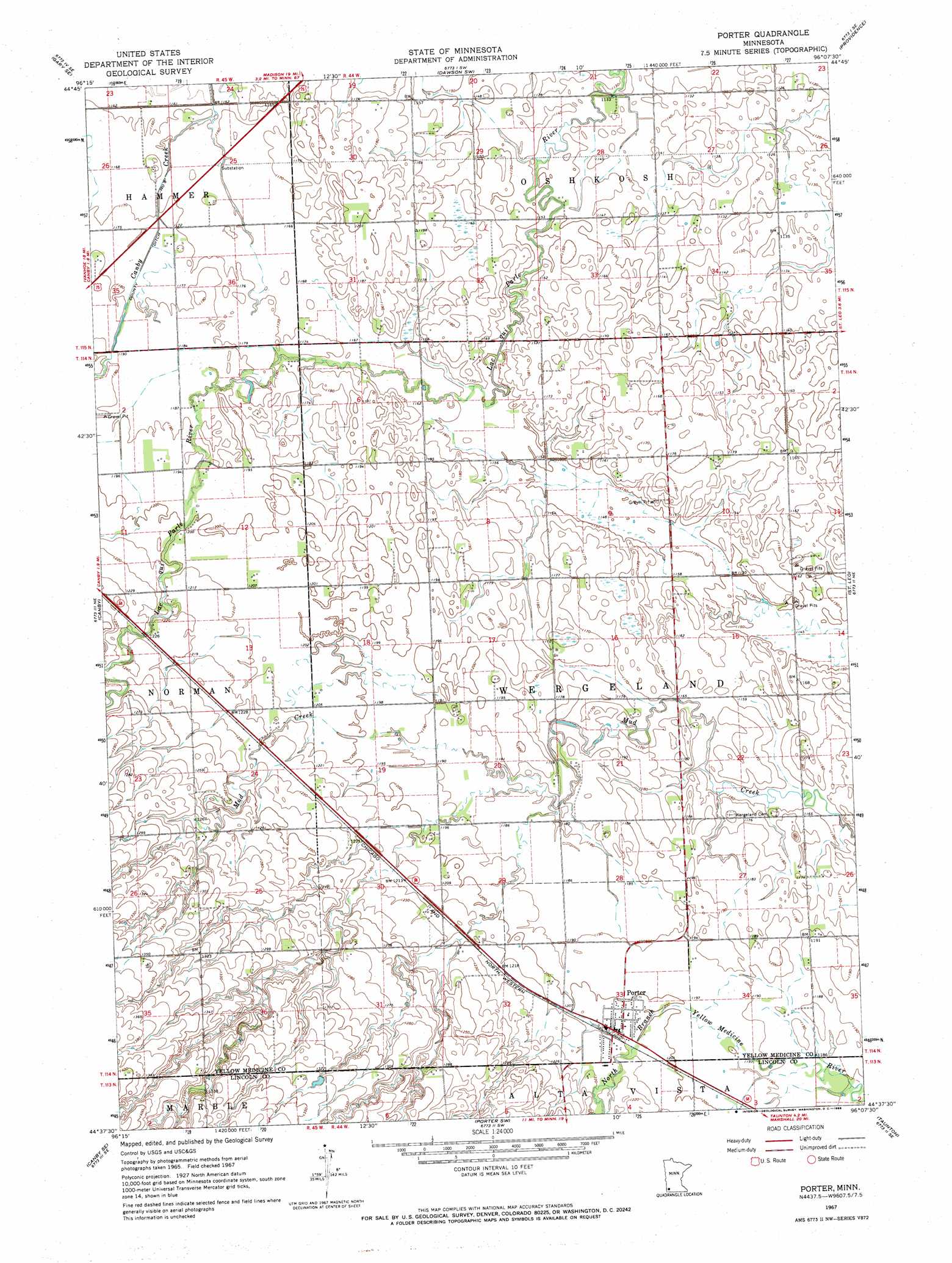
USGS Topo Quad 44096f2 - 1:24,000 scale
| Topo Map Name: | Porter |
| USGS Topo Quad ID: | 44096f2 |
| Print Size: | ca. 21 1/4" wide x 27" high |
| Southeast Coordinates: | 44.625° N latitude / 96.125° W longitude |
| Map Center Coordinates: | 44.6875° N latitude / 96.1875° W longitude |
| U.S. State: | MN |
| Filename: | o44096f2.jpg |
| Download Map JPG Image: | Porter topo map 1:24,000 scale |
| Map Type: | Topographic |
| Topo Series: | 7.5´ |
| Map Scale: | 1:24,000 |
| Source of Map Images: | United States Geological Survey (USGS) |
| Alternate Map Versions: |
Porter MN 1967, updated 1968 Download PDF Buy paper map Porter MN 2010 Download PDF Buy paper map Porter MN 2013 Download PDF Buy paper map Porter MN 2016 Download PDF Buy paper map |
1:24,000 Topo Quads surrounding Porter
Gary Nw |
Mount Wickham |
Dawson Nw |
Dawson |
Tenmile Lake |
Gary |
Gary Se |
Dawson Sw |
Providence |
Boyd |
Canby Nw |
Canby |
Porter |
Saint Leo |
Minneota Nw |
Hendricks |
Canby Se |
Porter Sw |
Taunton |
Minneota |
Lake Benton Nw |
Lake Benton Ne |
Arco |
Gislason Lake |
Lynd |
> Back to 44096e1 at 1:100,000 scale
> Back to 44096a1 at 1:250,000 scale
> Back to U.S. Topo Maps home
Porter topo map: Gazetteer
Porter: Canals
County Ditch Number Eight elevation 357m 1171′Porter: Populated Places
Porter elevation 367m 1204′Porter: Post Offices
Porter Post Office elevation 367m 1204′Porter Post Office elevation 367m 1204′
Porter digital topo map on disk
Buy this Porter topo map showing relief, roads, GPS coordinates and other geographical features, as a high-resolution digital map file on DVD:
Eastern North Dakota & Eastern South Dakota
Buy digital topo maps: Eastern North Dakota & Eastern South Dakota