Madison Topo Map South Dakota
To zoom in, hover over the map of Madison
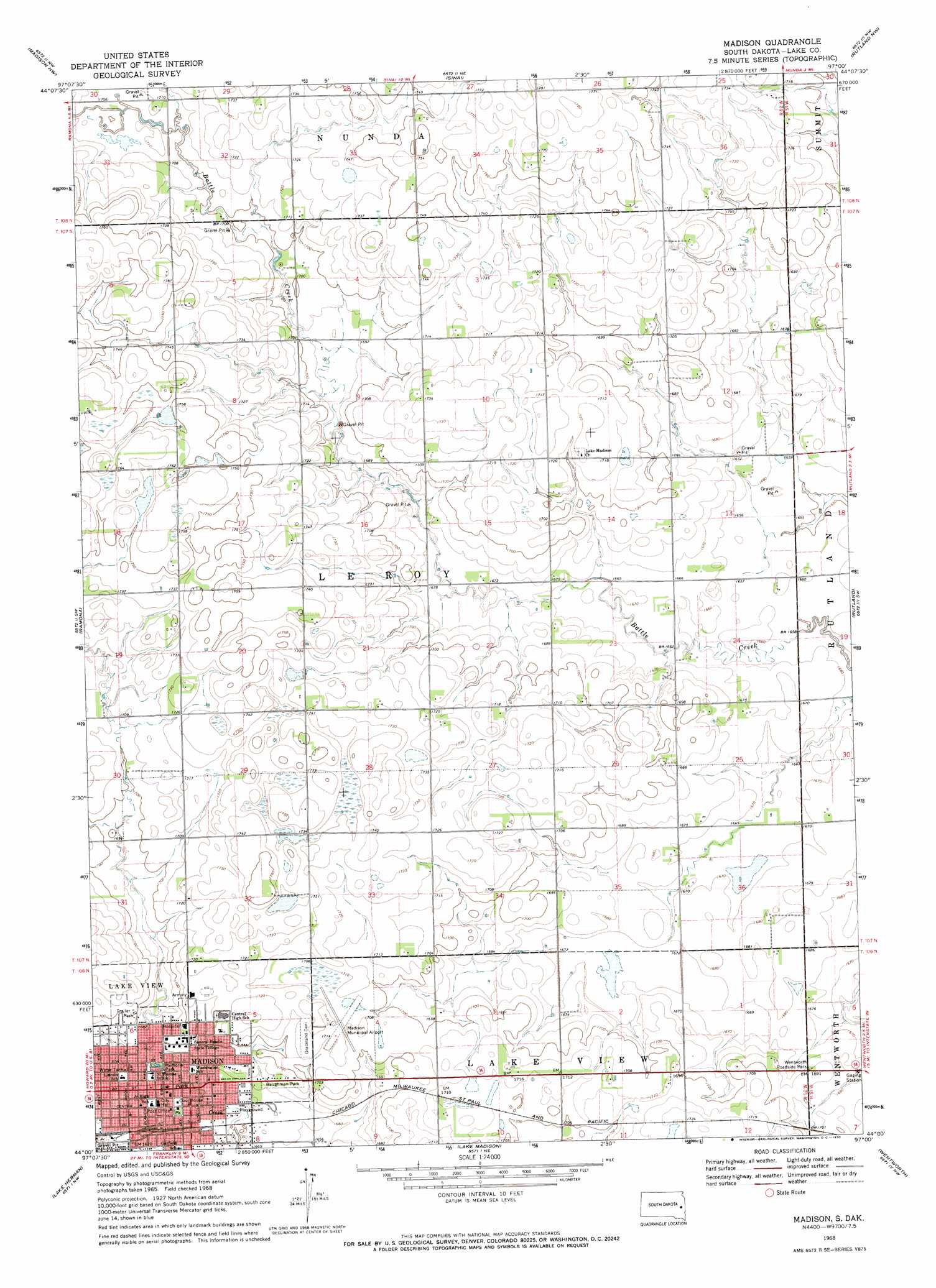
USGS Topo Quad 44097a1 - 1:24,000 scale
| Topo Map Name: | Madison |
| USGS Topo Quad ID: | 44097a1 |
| Print Size: | ca. 21 1/4" wide x 27" high |
| Southeast Coordinates: | 44° N latitude / 97° W longitude |
| Map Center Coordinates: | 44.0625° N latitude / 97.0625° W longitude |
| U.S. State: | SD |
| Filename: | o44097a1.jpg |
| Download Map JPG Image: | Madison topo map 1:24,000 scale |
| Map Type: | Topographic |
| Topo Series: | 7.5´ |
| Map Scale: | 1:24,000 |
| Source of Map Images: | United States Geological Survey (USGS) |
| Alternate Map Versions: |
Madison SD 1968, updated 1970 Download PDF Buy paper map Madison SD 2012 Download PDF Buy paper map Madison SD 2015 Download PDF Buy paper map |
1:24,000 Topo Quads surrounding Madison
Lake Preston East |
Arlington |
Lake Sinai |
Volga |
Brookings |
Oldham |
Madison Nw |
Sinai |
Rutland Nw |
Medary |
Oldham Se |
Ramona |
Madison |
Rutland |
Rutland Se |
Winfred |
Lake Herman |
Lake Madison |
Wentworth |
Colman |
Winfred Se |
Lake Madison Sw |
Buffalo Trading Post |
Colton |
Colton Se |
> Back to 44097a1 at 1:100,000 scale
> Back to 44096a1 at 1:250,000 scale
> Back to U.S. Topo Maps home
Madison topo map: Gazetteer
Madison: Airports
Madison Municipal Airport elevation 521m 1709′Madison: Parks
Baughman Park elevation 516m 1692′Wentworth Roadside Park elevation 516m 1692′
Madison: Populated Places
Madison elevation 511m 1676′Madison digital topo map on disk
Buy this Madison topo map showing relief, roads, GPS coordinates and other geographical features, as a high-resolution digital map file on DVD:
Eastern North Dakota & Eastern South Dakota
Buy digital topo maps: Eastern North Dakota & Eastern South Dakota