Roswell Topo Map South Dakota
To zoom in, hover over the map of Roswell
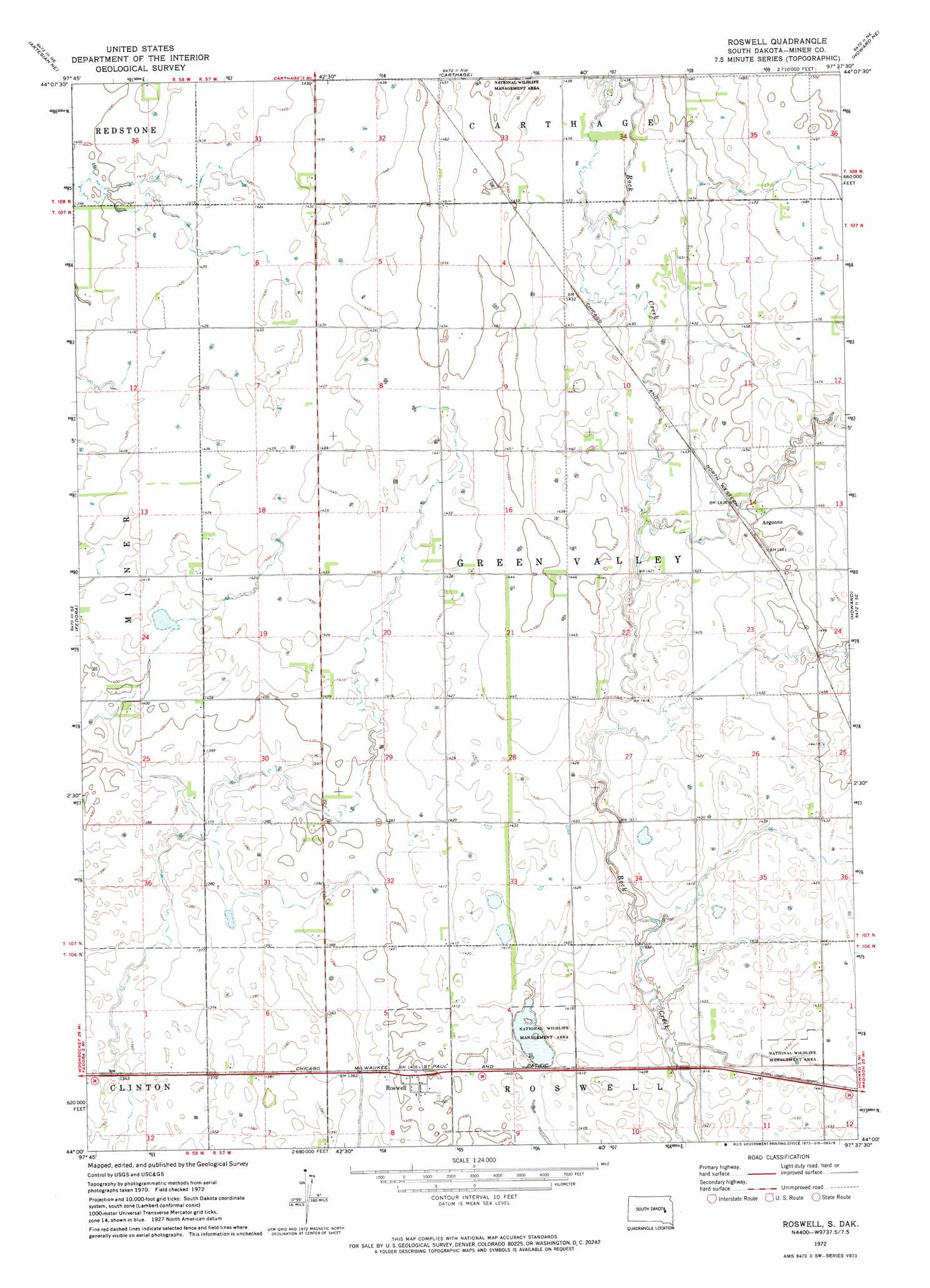
USGS Topo Quad 44097a6 - 1:24,000 scale
| Topo Map Name: | Roswell |
| USGS Topo Quad ID: | 44097a6 |
| Print Size: | ca. 21 1/4" wide x 27" high |
| Southeast Coordinates: | 44° N latitude / 97.625° W longitude |
| Map Center Coordinates: | 44.0625° N latitude / 97.6875° W longitude |
| U.S. State: | SD |
| Filename: | o44097a6.jpg |
| Download Map JPG Image: | Roswell topo map 1:24,000 scale |
| Map Type: | Topographic |
| Topo Series: | 7.5´ |
| Map Scale: | 1:24,000 |
| Source of Map Images: | United States Geological Survey (USGS) |
| Alternate Map Versions: |
Roswell SD 1972, updated 1973 Download PDF Buy paper map Roswell SD 1978, updated 1978 Download PDF Buy paper map Roswell SD 2012 Download PDF Buy paper map Roswell SD 2015 Download PDF Buy paper map |
1:24,000 Topo Quads surrounding Roswell
Pearl Creek Colony |
Iroquois |
Manchester |
De Smet Se |
Lake Preston West |
Artesian Nw |
Artesian Ne |
Carthage |
Howard Ne |
Oldham Nw |
Artesian |
Fedora |
Roswell |
Howard |
Oldham Sw |
Farwell Nw |
Morris Lake |
Bitter Lake |
Canova West |
Canova East |
Farwell |
Ness Chain Lakes |
Epiphany |
Canova Se |
Unityville |
> Back to 44097a1 at 1:100,000 scale
> Back to 44096a1 at 1:250,000 scale
> Back to U.S. Topo Maps home
Roswell topo map: Gazetteer
Roswell: Populated Places
Argonne elevation 443m 1453′Roswell elevation 427m 1400′
Roswell: Post Offices
Woodworth Post Office elevation 427m 1400′Roswell digital topo map on disk
Buy this Roswell topo map showing relief, roads, GPS coordinates and other geographical features, as a high-resolution digital map file on DVD:
Eastern North Dakota & Eastern South Dakota
Buy digital topo maps: Eastern North Dakota & Eastern South Dakota