Sinai Topo Map South Dakota
To zoom in, hover over the map of Sinai
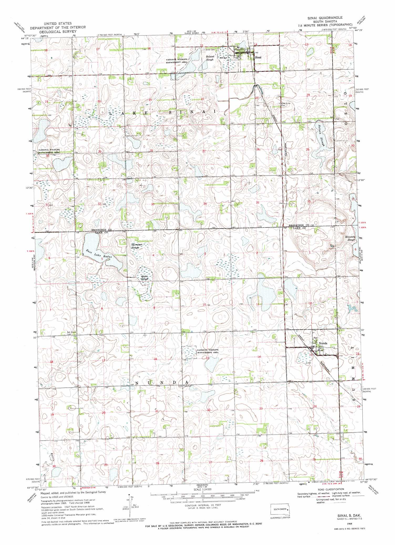
USGS Topo Quad 44097b1 - 1:24,000 scale
| Topo Map Name: | Sinai |
| USGS Topo Quad ID: | 44097b1 |
| Print Size: | ca. 21 1/4" wide x 27" high |
| Southeast Coordinates: | 44.125° N latitude / 97° W longitude |
| Map Center Coordinates: | 44.1875° N latitude / 97.0625° W longitude |
| U.S. State: | SD |
| Filename: | o44097b1.jpg |
| Download Map JPG Image: | Sinai topo map 1:24,000 scale |
| Map Type: | Topographic |
| Topo Series: | 7.5´ |
| Map Scale: | 1:24,000 |
| Source of Map Images: | United States Geological Survey (USGS) |
| Alternate Map Versions: |
Sinai SD 1968, updated 1970 Download PDF Buy paper map Sinai SD 2012 Download PDF Buy paper map Sinai SD 2015 Download PDF Buy paper map |
1:24,000 Topo Quads surrounding Sinai
Lake Preston Ne |
Badger |
Arlington Ne |
Bruce |
Brookings Ne |
Lake Preston East |
Arlington |
Lake Sinai |
Volga |
Brookings |
Oldham |
Madison Nw |
Sinai |
Rutland Nw |
Medary |
Oldham Se |
Ramona |
Madison |
Rutland |
Rutland Se |
Winfred |
Lake Herman |
Lake Madison |
Wentworth |
Colman |
> Back to 44097a1 at 1:100,000 scale
> Back to 44096a1 at 1:250,000 scale
> Back to U.S. Topo Maps home
Sinai topo map: Gazetteer
Sinai: Guts
Bolstad Slough elevation 539m 1768′Nelson Slough elevation 520m 1706′
Quam Slough elevation 533m 1748′
Thompson Slough elevation 540m 1771′
Sinai: Lakes
East Lake Badus elevation 533m 1748′Sinai: Populated Places
Nunda elevation 537m 1761′Prairie Queen (historical) elevation 523m 1715′
Sinai elevation 543m 1781′
Sinai digital topo map on disk
Buy this Sinai topo map showing relief, roads, GPS coordinates and other geographical features, as a high-resolution digital map file on DVD:
Eastern North Dakota & Eastern South Dakota
Buy digital topo maps: Eastern North Dakota & Eastern South Dakota