Madison Nw Topo Map South Dakota
To zoom in, hover over the map of Madison Nw
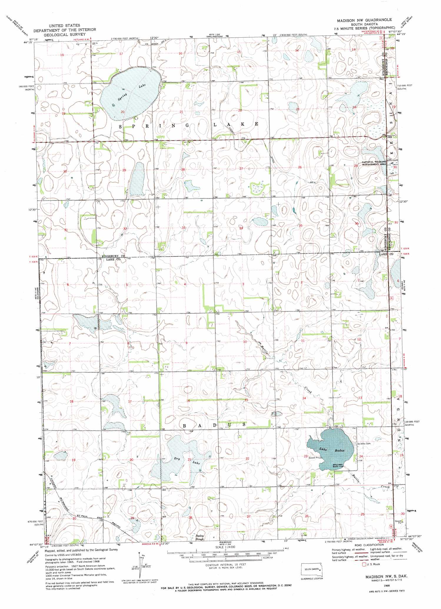
USGS Topo Quad 44097b2 - 1:24,000 scale
| Topo Map Name: | Madison Nw |
| USGS Topo Quad ID: | 44097b2 |
| Print Size: | ca. 21 1/4" wide x 27" high |
| Southeast Coordinates: | 44.125° N latitude / 97.125° W longitude |
| Map Center Coordinates: | 44.1875° N latitude / 97.1875° W longitude |
| U.S. State: | SD |
| Filename: | o44097b2.jpg |
| Download Map JPG Image: | Madison Nw topo map 1:24,000 scale |
| Map Type: | Topographic |
| Topo Series: | 7.5´ |
| Map Scale: | 1:24,000 |
| Source of Map Images: | United States Geological Survey (USGS) |
| Alternate Map Versions: |
Madison NW SD 1968, updated 1971 Download PDF Buy paper map Madison NW SD 2012 Download PDF Buy paper map Madison NW SD 2015 Download PDF Buy paper map |
1:24,000 Topo Quads surrounding Madison Nw
Erwin |
Lake Preston Ne |
Badger |
Arlington Ne |
Bruce |
Lake Preston West |
Lake Preston East |
Arlington |
Lake Sinai |
Volga |
Oldham Nw |
Oldham |
Madison Nw |
Sinai |
Rutland Nw |
Oldham Sw |
Oldham Se |
Ramona |
Madison |
Rutland |
Canova East |
Winfred |
Lake Herman |
Lake Madison |
Wentworth |
> Back to 44097a1 at 1:100,000 scale
> Back to 44096a1 at 1:250,000 scale
> Back to U.S. Topo Maps home
Madison Nw topo map: Gazetteer
Madison Nw: Lakes
Dry Lake elevation 543m 1781′Spring Lake elevation 529m 1735′
Madison Nw: Post Offices
Badus Post Office (historical) elevation 532m 1745′Madison Nw: Reservoirs
Lake Badus elevation 525m 1722′Madison Nw digital topo map on disk
Buy this Madison Nw topo map showing relief, roads, GPS coordinates and other geographical features, as a high-resolution digital map file on DVD:
Eastern North Dakota & Eastern South Dakota
Buy digital topo maps: Eastern North Dakota & Eastern South Dakota