Arlington Ne Topo Map South Dakota
To zoom in, hover over the map of Arlington Ne
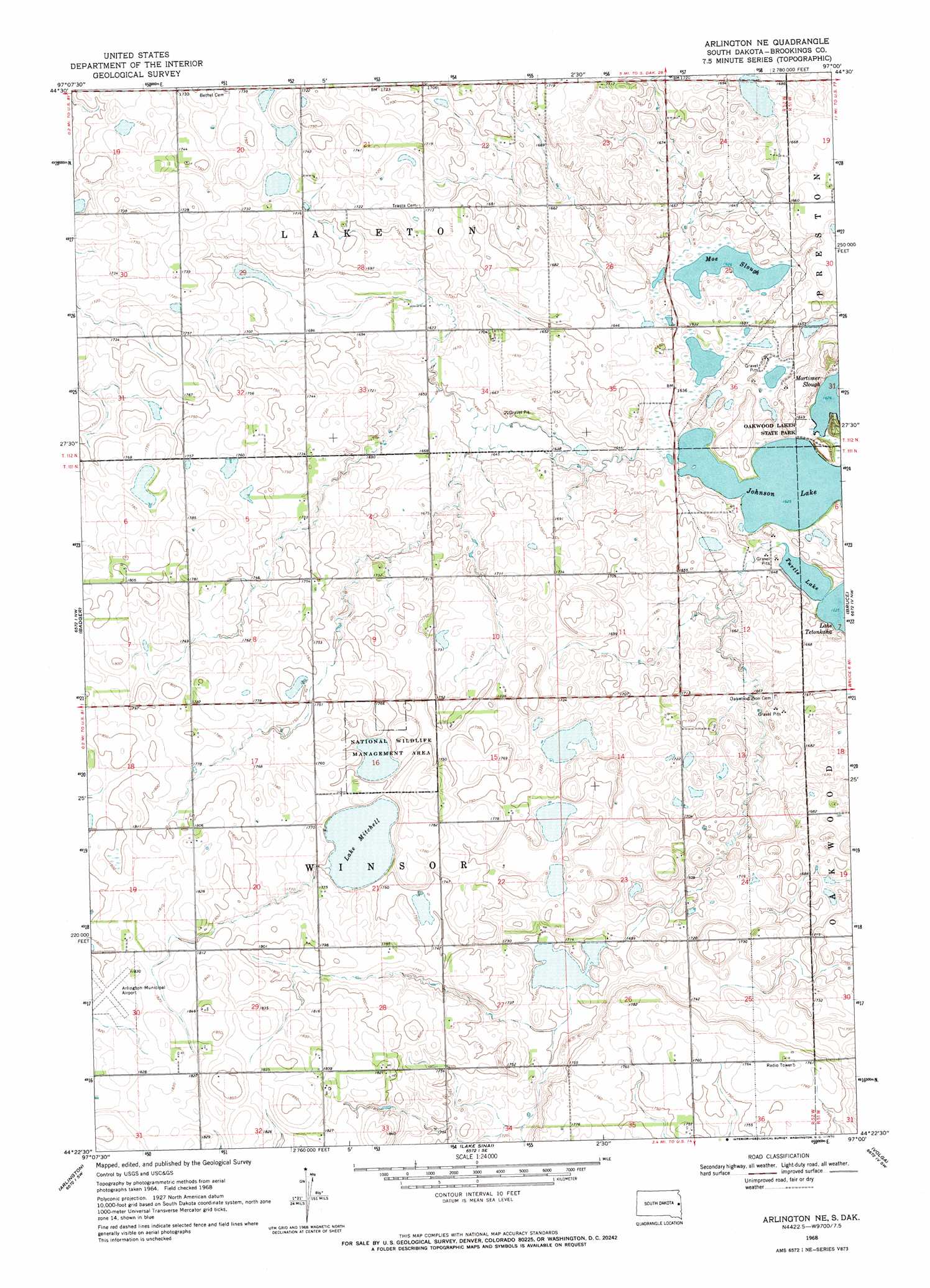
USGS Topo Quad 44097d1 - 1:24,000 scale
| Topo Map Name: | Arlington Ne |
| USGS Topo Quad ID: | 44097d1 |
| Print Size: | ca. 21 1/4" wide x 27" high |
| Southeast Coordinates: | 44.375° N latitude / 97° W longitude |
| Map Center Coordinates: | 44.4375° N latitude / 97.0625° W longitude |
| U.S. State: | SD |
| Filename: | o44097d1.jpg |
| Download Map JPG Image: | Arlington Ne topo map 1:24,000 scale |
| Map Type: | Topographic |
| Topo Series: | 7.5´ |
| Map Scale: | 1:24,000 |
| Source of Map Images: | United States Geological Survey (USGS) |
| Alternate Map Versions: |
Arlington NE SD 1968, updated 1970 Download PDF Buy paper map Arlington NE SD 2012 Download PDF Buy paper map Arlington NE SD 2015 Download PDF Buy paper map |
1:24,000 Topo Quads surrounding Arlington Ne
Bryant Ne |
Hayti |
Castlewood |
Dempster |
Estelline Ne |
Gertson Slough |
Lake Norden |
Lake Poinsett |
Estelline |
Estelline Se |
Lake Preston Ne |
Badger |
Arlington Ne |
Bruce |
Brookings Ne |
Lake Preston East |
Arlington |
Lake Sinai |
Volga |
Brookings |
Oldham |
Madison Nw |
Sinai |
Rutland Nw |
Medary |
> Back to 44097a1 at 1:100,000 scale
> Back to 44096a1 at 1:250,000 scale
> Back to U.S. Topo Maps home
Arlington Ne topo map: Gazetteer
Arlington Ne: Airports
Arlington Municipal Airport elevation 552m 1811′Arlington Ne: Lakes
Johnson Lake elevation 494m 1620′Lake Mitchell elevation 533m 1748′
Moe Slough elevation 494m 1620′
Oakwood Lakes elevation 512m 1679′
Turtle Lake elevation 494m 1620′
Arlington Ne digital topo map on disk
Buy this Arlington Ne topo map showing relief, roads, GPS coordinates and other geographical features, as a high-resolution digital map file on DVD:
Eastern North Dakota & Eastern South Dakota
Buy digital topo maps: Eastern North Dakota & Eastern South Dakota