Watertown Se Topo Map South Dakota
To zoom in, hover over the map of Watertown Se
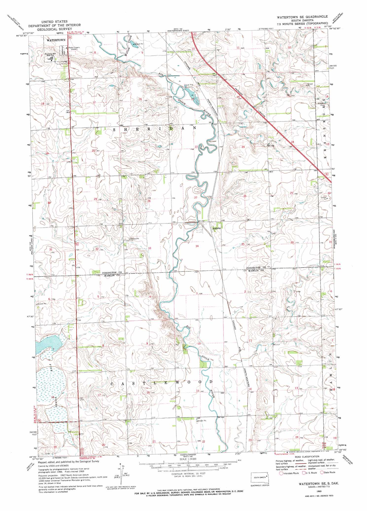
USGS Topo Quad 44097g1 - 1:24,000 scale
| Topo Map Name: | Watertown Se |
| USGS Topo Quad ID: | 44097g1 |
| Print Size: | ca. 21 1/4" wide x 27" high |
| Southeast Coordinates: | 44.75° N latitude / 97° W longitude |
| Map Center Coordinates: | 44.8125° N latitude / 97.0625° W longitude |
| U.S. State: | SD |
| Filename: | o44097g1.jpg |
| Download Map JPG Image: | Watertown Se topo map 1:24,000 scale |
| Map Type: | Topographic |
| Topo Series: | 7.5´ |
| Map Scale: | 1:24,000 |
| Source of Map Images: | United States Geological Survey (USGS) |
| Alternate Map Versions: |
Watertown SE SD 1969, updated 1972 Download PDF Buy paper map Watertown SE SD 2012 Download PDF Buy paper map Watertown SE SD 2015 Download PDF Buy paper map |
1:24,000 Topo Quads surrounding Watertown Se
Florence |
Still Lake |
Still Lake Se |
South Shore |
Stockholm |
Kampeska |
Watertown West |
Watertown East |
Kranzburg |
Goodwin |
Grover |
Pelican Lake |
Watertown Se |
Kranzburg Sw |
Bemis |
Bryant Ne |
Hayti |
Castlewood |
Dempster |
Estelline Ne |
Gertson Slough |
Lake Norden |
Lake Poinsett |
Estelline |
Estelline Se |
> Back to 44097e1 at 1:100,000 scale
> Back to 44096a1 at 1:250,000 scale
> Back to U.S. Topo Maps home
Watertown Se topo map: Gazetteer
Watertown Se: Populated Places
Appleby elevation 521m 1709′Watertown Se: Streams
Willow Creek elevation 521m 1709′Watertown Se: Swamps
Five Ponds elevation 517m 1696′Watertown Se digital topo map on disk
Buy this Watertown Se topo map showing relief, roads, GPS coordinates and other geographical features, as a high-resolution digital map file on DVD:
Eastern North Dakota & Eastern South Dakota
Buy digital topo maps: Eastern North Dakota & Eastern South Dakota