Pelican Lake Topo Map South Dakota
To zoom in, hover over the map of Pelican Lake
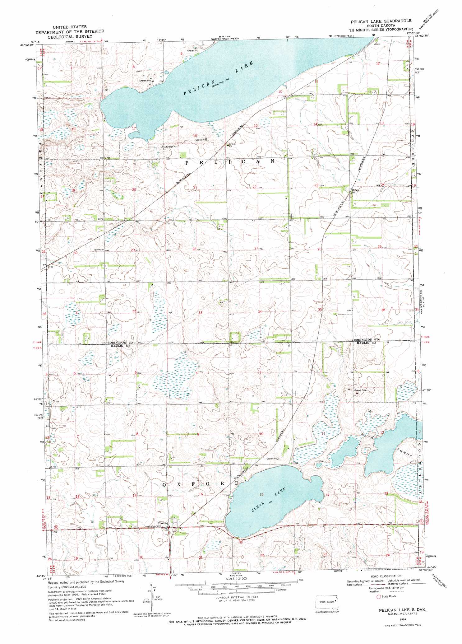
USGS Topo Quad 44097g2 - 1:24,000 scale
| Topo Map Name: | Pelican Lake |
| USGS Topo Quad ID: | 44097g2 |
| Print Size: | ca. 21 1/4" wide x 27" high |
| Southeast Coordinates: | 44.75° N latitude / 97.125° W longitude |
| Map Center Coordinates: | 44.8125° N latitude / 97.1875° W longitude |
| U.S. State: | SD |
| Filename: | o44097g2.jpg |
| Download Map JPG Image: | Pelican Lake topo map 1:24,000 scale |
| Map Type: | Topographic |
| Topo Series: | 7.5´ |
| Map Scale: | 1:24,000 |
| Source of Map Images: | United States Geological Survey (USGS) |
| Alternate Map Versions: |
Pelican Lake SD 1969, updated 1971 Download PDF Buy paper map Pelican Lake SD 2012 Download PDF Buy paper map Pelican Lake SD 2015 Download PDF Buy paper map |
1:24,000 Topo Quads surrounding Pelican Lake
Wallace |
Florence |
Still Lake |
Still Lake Se |
South Shore |
Henry |
Kampeska |
Watertown West |
Watertown East |
Kranzburg |
Hazel |
Grover |
Pelican Lake |
Watertown Se |
Kranzburg Sw |
Vienna East |
Bryant Ne |
Hayti |
Castlewood |
Dempster |
Bryant |
Gertson Slough |
Lake Norden |
Lake Poinsett |
Estelline |
> Back to 44097e1 at 1:100,000 scale
> Back to 44096a1 at 1:250,000 scale
> Back to U.S. Topo Maps home
Pelican Lake topo map: Gazetteer
Pelican Lake: Lakes
Clear Lake elevation 516m 1692′Pelican Lake elevation 519m 1702′
Pelican Lake: Populated Places
Foley elevation 546m 1791′Thomas elevation 537m 1761′
Pelican Lake digital topo map on disk
Buy this Pelican Lake topo map showing relief, roads, GPS coordinates and other geographical features, as a high-resolution digital map file on DVD:
Eastern North Dakota & Eastern South Dakota
Buy digital topo maps: Eastern North Dakota & Eastern South Dakota