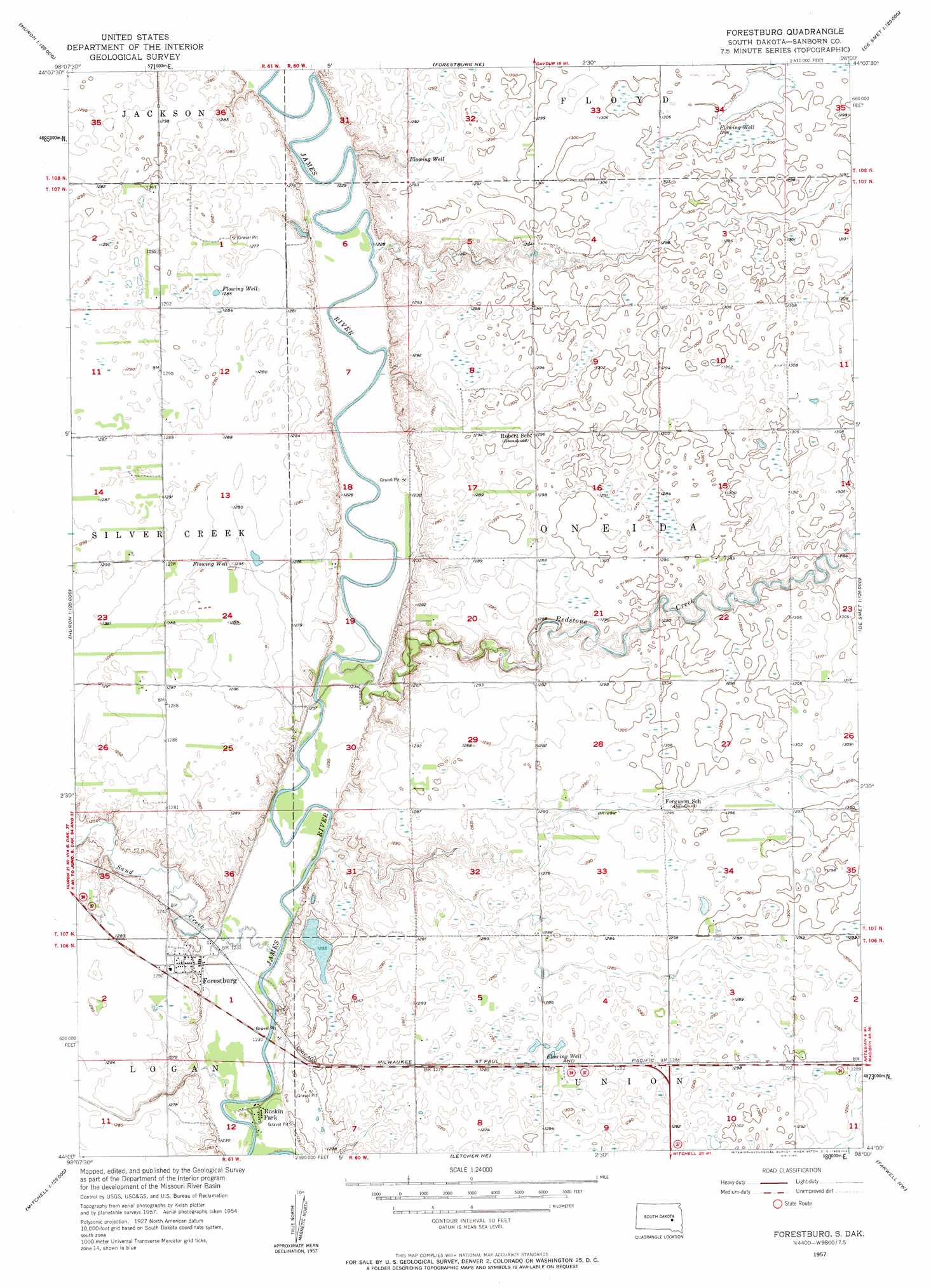
Forestburg Topo Map South Dakota
To zoom in, hover over the map of Forestburg
USGS Topo Quad 44098a1 - 1:24,000 scale
| Topo Map Name: | Forestburg |
| USGS Topo Quad ID: | 44098a1 |
| Print Size: | ca. 21 1/4" wide x 27" high |
| Southeast Coordinates: | 44° N latitude / 98° W longitude |
| Map Center Coordinates: | 44.0625° N latitude / 98.0625° W longitude |
| U.S. State: | SD |
| Filename: | o44098a1.jpg |
| Download Map JPG Image: | Forestburg topo map 1:24,000 scale |
| Map Type: | Topographic |
| Topo Series: | 7.5´ |
| Map Scale: | 1:24,000 |
| Source of Map Images: | United States Geological Survey (USGS) |
| Alternate Map Versions: |
Forestburg SD 1957, updated 1958 Download PDF Buy paper map Forestburg SD 2012 Download PDF Buy paper map Forestburg SD 2015 Download PDF Buy paper map |
1:24,000 Topo Quads surrounding Forestburg
Wolsey Se |
Huron |
Cavour |
Pearl Creek Colony |
Iroquois |
Alpena |
Forestburg Nw |
Forestburg Ne |
Artesian Nw |
Artesian Ne |
Woonsocket |
Forestburg Sw |
Forestburg |
Artesian |
Fedora |
Twin Lakes |
Letcher |
Letcher Ne |
Farwell Nw |
Morris Lake |
Storla |
Letcher Sw |
Loomis |
Farwell |
Ness Chain Lakes |
> Back to 44098a1 at 1:100,000 scale
> Back to 44098a1 at 1:250,000 scale
> Back to U.S. Topo Maps home
Forestburg topo map: Gazetteer
Forestburg: Parks
Ruskin Park (historical) elevation 372m 1220′Forestburg: Populated Places
Forestburg elevation 386m 1266′Ruskin Park elevation 375m 1230′
Forestburg: Streams
Redstone Creek elevation 370m 1213′Sand Creek elevation 371m 1217′
Forestburg: Summits
Big Mound elevation 399m 1309′Forestburg digital topo map on disk
Buy this Forestburg topo map showing relief, roads, GPS coordinates and other geographical features, as a high-resolution digital map file on DVD:
Eastern North Dakota & Eastern South Dakota
Buy digital topo maps: Eastern North Dakota & Eastern South Dakota