Wessington Springs Sw Topo Map South Dakota
To zoom in, hover over the map of Wessington Springs Sw
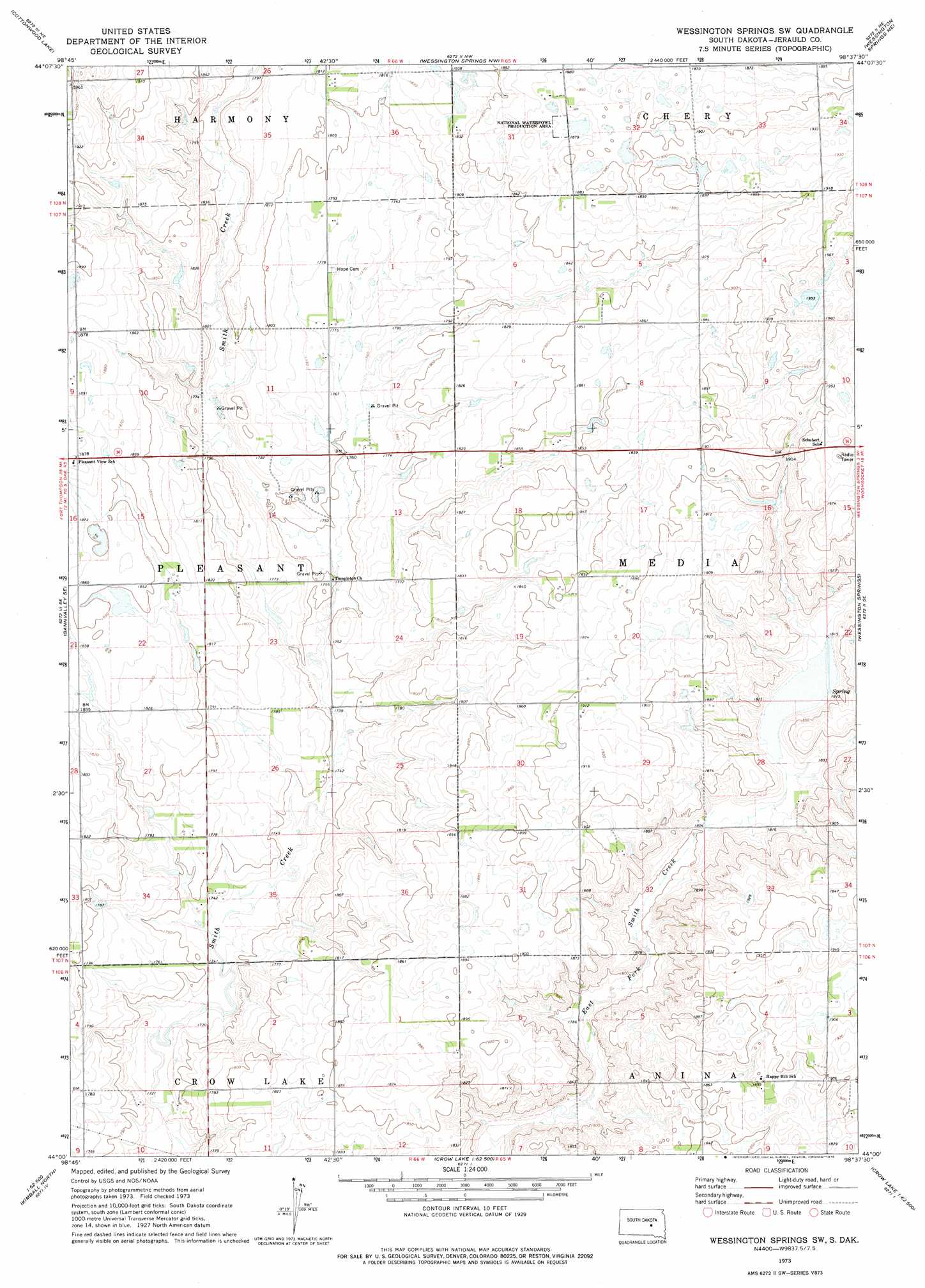
USGS Topo Quad 44098a6 - 1:24,000 scale
| Topo Map Name: | Wessington Springs Sw |
| USGS Topo Quad ID: | 44098a6 |
| Print Size: | ca. 21 1/4" wide x 27" high |
| Southeast Coordinates: | 44° N latitude / 98.625° W longitude |
| Map Center Coordinates: | 44.0625° N latitude / 98.6875° W longitude |
| U.S. State: | SD |
| Filename: | o44098a6.jpg |
| Download Map JPG Image: | Wessington Springs Sw topo map 1:24,000 scale |
| Map Type: | Topographic |
| Topo Series: | 7.5´ |
| Map Scale: | 1:24,000 |
| Source of Map Images: | United States Geological Survey (USGS) |
| Alternate Map Versions: |
Wessington Springs SW SD 1973, updated 1976 Download PDF Buy paper map Wessington Springs SW SD 2012 Download PDF Buy paper map Wessington Springs SW SD 2015 Download PDF Buy paper map |
1:24,000 Topo Quads surrounding Wessington Springs Sw
Vayland Sw |
Vayland Se |
Wessington Sw |
Wessington Se |
Virgil |
Mittelstedt Slough |
Cottonwood Lake |
Wessington Springs Nw |
Wessington Springs Ne |
Woonsocket Nw |
Gannvalley |
Gannvalley Se |
Wessington Springs Sw |
Wessington Springs |
Lane |
Isham Lake |
Hoagland Lake |
Fraser Dam |
||
Wilson Dam |
Wilmarth Lake |
Storla Sw |
> Back to 44098a1 at 1:100,000 scale
> Back to 44098a1 at 1:250,000 scale
> Back to U.S. Topo Maps home
Wessington Springs Sw topo map: Gazetteer
Wessington Springs Sw: Post Offices
Fauston Post Office (historical) elevation 531m 1742′Wessington Springs Sw digital topo map on disk
Buy this Wessington Springs Sw topo map showing relief, roads, GPS coordinates and other geographical features, as a high-resolution digital map file on DVD:
Eastern North Dakota & Eastern South Dakota
Buy digital topo maps: Eastern North Dakota & Eastern South Dakota