Bloomfield Topo Map South Dakota
To zoom in, hover over the map of Bloomfield
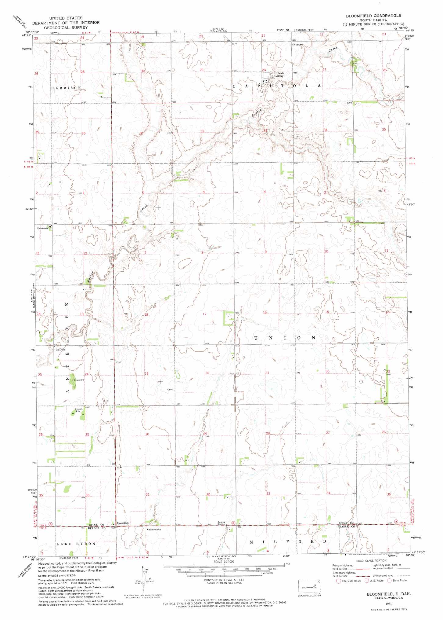
USGS Topo Quad 44098f1 - 1:24,000 scale
| Topo Map Name: | Bloomfield |
| USGS Topo Quad ID: | 44098f1 |
| Print Size: | ca. 21 1/4" wide x 27" high |
| Southeast Coordinates: | 44.625° N latitude / 98° W longitude |
| Map Center Coordinates: | 44.6875° N latitude / 98.0625° W longitude |
| U.S. State: | SD |
| Filename: | o44098f1.jpg |
| Download Map JPG Image: | Bloomfield topo map 1:24,000 scale |
| Map Type: | Topographic |
| Topo Series: | 7.5´ |
| Map Scale: | 1:24,000 |
| Source of Map Images: | United States Geological Survey (USGS) |
| Alternate Map Versions: |
Bloomfield SD 2012 Download PDF Buy paper map Bloomfield SD 2015 Download PDF Buy paper map |
1:24,000 Topo Quads surrounding Bloomfield
Frankfort |
Doland Nw |
Doland |
Raymond |
Baileys Lake |
Glendale Colony |
Doland Sw |
Doland Se |
Fordham Dam |
Raymond Se |
Spink Colony |
Lake Byron Nw |
Bloomfield |
Carpenter |
Carpenter Ne |
Hitchcock Se |
Lake Byron |
Lake Byron Se |
Staum Dam |
Carpenter Se |
Broadland |
Huron Nw |
Huron Ne |
Yale |
Bancroft West |
> Back to 44098e1 at 1:100,000 scale
> Back to 44098a1 at 1:250,000 scale
> Back to U.S. Topo Maps home
Bloomfield topo map: Gazetteer
Bloomfield: Populated Places
Bloomfield elevation 404m 1325′Hillside Colony elevation 419m 1374′
LaDelle elevation 403m 1322′
Bloomfield digital topo map on disk
Buy this Bloomfield topo map showing relief, roads, GPS coordinates and other geographical features, as a high-resolution digital map file on DVD:
Eastern North Dakota & Eastern South Dakota
Buy digital topo maps: Eastern North Dakota & Eastern South Dakota