Glendale Colony Topo Map South Dakota
To zoom in, hover over the map of Glendale Colony
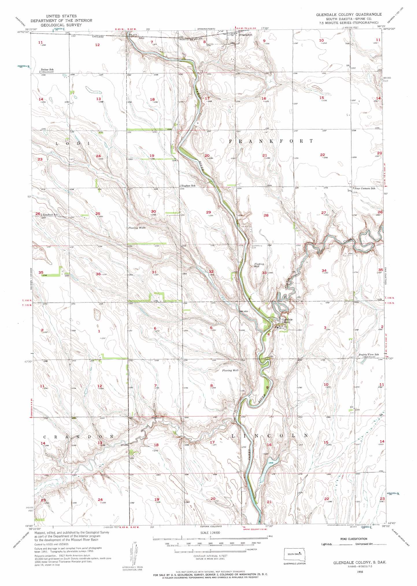
USGS Topo Quad 44098g3 - 1:24,000 scale
| Topo Map Name: | Glendale Colony |
| USGS Topo Quad ID: | 44098g3 |
| Print Size: | ca. 21 1/4" wide x 27" high |
| Southeast Coordinates: | 44.75° N latitude / 98.25° W longitude |
| Map Center Coordinates: | 44.8125° N latitude / 98.3125° W longitude |
| U.S. State: | SD |
| Filename: | o44098g3.jpg |
| Download Map JPG Image: | Glendale Colony topo map 1:24,000 scale |
| Map Type: | Topographic |
| Topo Series: | 7.5´ |
| Map Scale: | 1:24,000 |
| Source of Map Images: | United States Geological Survey (USGS) |
| Alternate Map Versions: |
Glendale Colony SD 1956, updated 1957 Download PDF Buy paper map Glendale Colony SD 2012 Download PDF Buy paper map Glendale Colony SD 2015 Download PDF Buy paper map |
1:24,000 Topo Quads surrounding Glendale Colony
Athol |
Gallup |
Brentford Se |
Conde Sw |
Turton |
Redfield North |
Ashton |
Frankfort |
Doland Nw |
Doland |
Redfield South |
Frankfort Sw |
Glendale Colony |
Doland Sw |
Doland Se |
Tulare |
Hitchcock |
Spink Colony |
Lake Byron Nw |
Bloomfield |
Tulare Se |
Hitchcock Sw |
Hitchcock Se |
Lake Byron |
Lake Byron Se |
> Back to 44098e1 at 1:100,000 scale
> Back to 44098a1 at 1:250,000 scale
> Back to U.S. Topo Maps home
Glendale Colony topo map: Gazetteer
Glendale Colony: Dams
Dudley Dam elevation 395m 1295′Glendale Colony: Populated Places
Glendale Colony elevation 393m 1289′Glendale Colony: Streams
Timber Creek elevation 377m 1236′Glendale Colony digital topo map on disk
Buy this Glendale Colony topo map showing relief, roads, GPS coordinates and other geographical features, as a high-resolution digital map file on DVD:
Eastern North Dakota & Eastern South Dakota
Buy digital topo maps: Eastern North Dakota & Eastern South Dakota