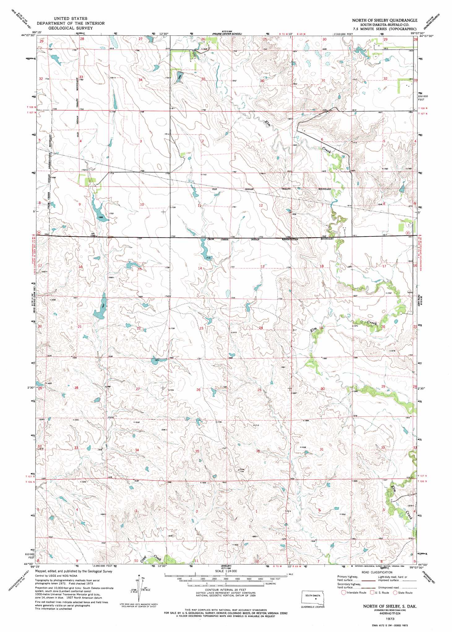
Big Bend Dam 4 Sw Topo Map South Dakota
To zoom in, hover over the map of Big Bend Dam 4 Sw
USGS Topo Quad 44099a2 - 1:24,000 scale
| Topo Map Name: | Big Bend Dam 4 Sw |
| USGS Topo Quad ID: | 44099a2 |
| Print Size: | ca. 21 1/4" wide x 27" high |
| Southeast Coordinates: | 44° N latitude / 99.125° W longitude |
| Map Center Coordinates: | 44.0625° N latitude / 99.1875° W longitude |
| U.S. State: | SD |
| Filename: | o44099a2.jpg |
| Download Map JPG Image: | Big Bend Dam 4 Sw topo map 1:24,000 scale |
| Map Type: | Topographic |
| Topo Series: | 7.5´ |
| Map Scale: | 1:24,000 |
| Source of Map Images: | United States Geological Survey (USGS) |
| Alternate Map Versions: |
Big Bend Dam 4 SW SD 1973, updated 1976 Download PDF Buy paper map North Of Shelby SD 1973, updated 1994 Download PDF Buy paper map North of Shelby SD 2012 Download PDF Buy paper map North of Shelby SD 2015 Download PDF Buy paper map |
1:24,000 Topo Quads surrounding Big Bend Dam 4 Sw
Macs Corner |
Macs Corner Se |
Miller Dale Colony Sw |
Ames |
Vayland Sw |
Stephan |
Big Bend Dam Ne |
Big Bend Dam 4 Nw |
Big Bend Dam 4 Ne |
Mittelstedt Slough |
Big Bend Dam |
Big Bend Dam Se |
Big Bend Dam 4 Sw |
Big Bend Dam 4 Se |
Gannvalley |
Short Creek |
Bedashosha Lake |
Shelby |
Pukwana Ne |
|
Oacoma |
Chamberlain |
Pukwana |
Pukwana Se |
> Back to 44099a1 at 1:100,000 scale
> Back to 44098a1 at 1:250,000 scale
> Back to U.S. Topo Maps home
Big Bend Dam 4 Sw topo map: Gazetteer
Big Bend Dam 4 Sw: Dams
Cable Dam 4 elevation 515m 1689′Cable Dams elevation 491m 1610′
Etbauer Dam elevation 525m 1722′
Knippling Stockwater Dam Number 2 elevation 517m 1696′
Knippling Stockwater Dam Number 3 elevation 520m 1706′
Weisner Dam elevation 501m 1643′
Weisner Dam 1 elevation 475m 1558′
Big Bend Dam 4 Sw digital topo map on disk
Buy this Big Bend Dam 4 Sw topo map showing relief, roads, GPS coordinates and other geographical features, as a high-resolution digital map file on DVD:
Eastern North Dakota & Eastern South Dakota
Buy digital topo maps: Eastern North Dakota & Eastern South Dakota