Lower Brule Sw Topo Map South Dakota
To zoom in, hover over the map of Lower Brule Sw
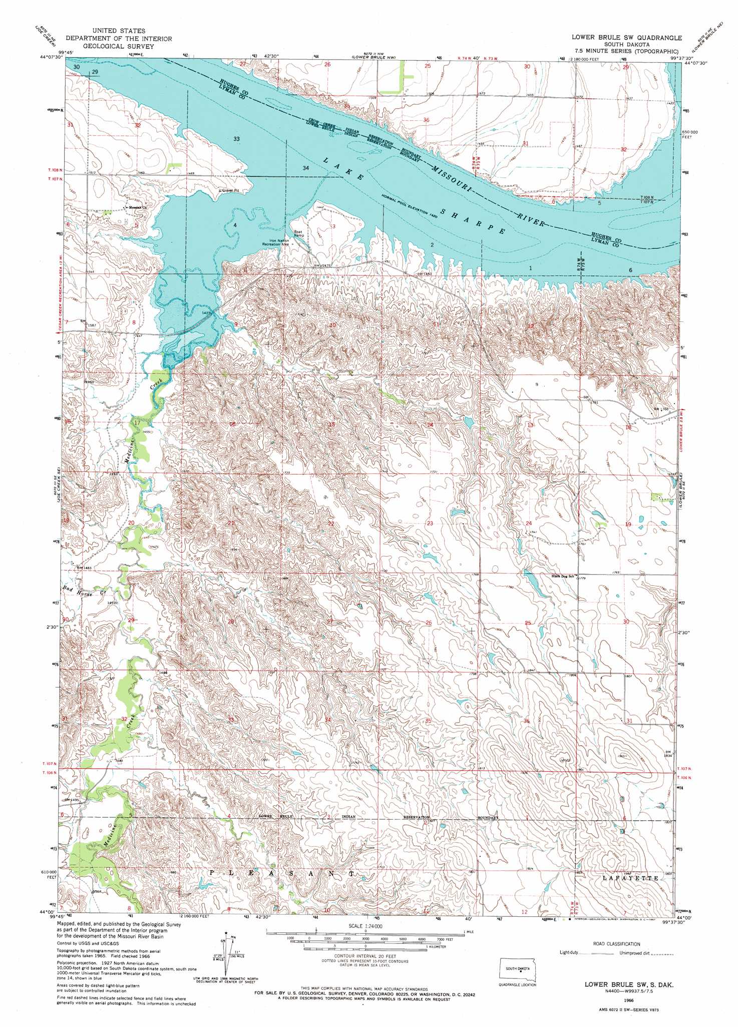
USGS Topo Quad 44099a6 - 1:24,000 scale
| Topo Map Name: | Lower Brule Sw |
| USGS Topo Quad ID: | 44099a6 |
| Print Size: | ca. 21 1/4" wide x 27" high |
| Southeast Coordinates: | 44° N latitude / 99.625° W longitude |
| Map Center Coordinates: | 44.0625° N latitude / 99.6875° W longitude |
| U.S. State: | SD |
| Filename: | o44099a6.jpg |
| Download Map JPG Image: | Lower Brule Sw topo map 1:24,000 scale |
| Map Type: | Topographic |
| Topo Series: | 7.5´ |
| Map Scale: | 1:24,000 |
| Source of Map Images: | United States Geological Survey (USGS) |
| Alternate Map Versions: |
Lower Brule SW SD 1966, updated 1967 Download PDF Buy paper map Lower Brule SW SD 2012 Download PDF Buy paper map Lower Brule SW SD 2015 Download PDF Buy paper map |
1:24,000 Topo Quads surrounding Lower Brule Sw
De Grey |
De Grey Se |
Chapelle Lake Sw |
Chapelle Lake Se |
Macs Corner |
Joe Creek Nw |
Joe Creek |
Lower Brule Nw |
Lower Brule Ne |
Stephan |
Joe Creek Sw |
Joe Creek Se |
Lower Brule Sw |
Lower Brule |
Big Bend Dam |
Brakke Dam |
Kennebec |
Lyman |
Reliance |
Short Creek |
Kennebec Sw |
Kennebec Se |
Reliance Sw |
Reliance Se |
Oacoma |
> Back to 44099a1 at 1:100,000 scale
> Back to 44098a1 at 1:250,000 scale
> Back to U.S. Topo Maps home
Lower Brule Sw topo map: Gazetteer
Lower Brule Sw: Islands
Medicine Island (historical) elevation 433m 1420′Lower Brule Sw: Parks
Iron Nation Recreation Area elevation 437m 1433′Lower Brule Sw: Post Offices
Iron Nation Post Office (historical) elevation 433m 1420′Lower Brule Sw: Streams
Bad Horse Creek elevation 440m 1443′Medicine Creek elevation 433m 1420′
Lower Brule Sw digital topo map on disk
Buy this Lower Brule Sw topo map showing relief, roads, GPS coordinates and other geographical features, as a high-resolution digital map file on DVD:
Eastern North Dakota & Eastern South Dakota
Buy digital topo maps: Eastern North Dakota & Eastern South Dakota