Big Bend Dam Ne Topo Map South Dakota
To zoom in, hover over the map of Big Bend Dam Ne
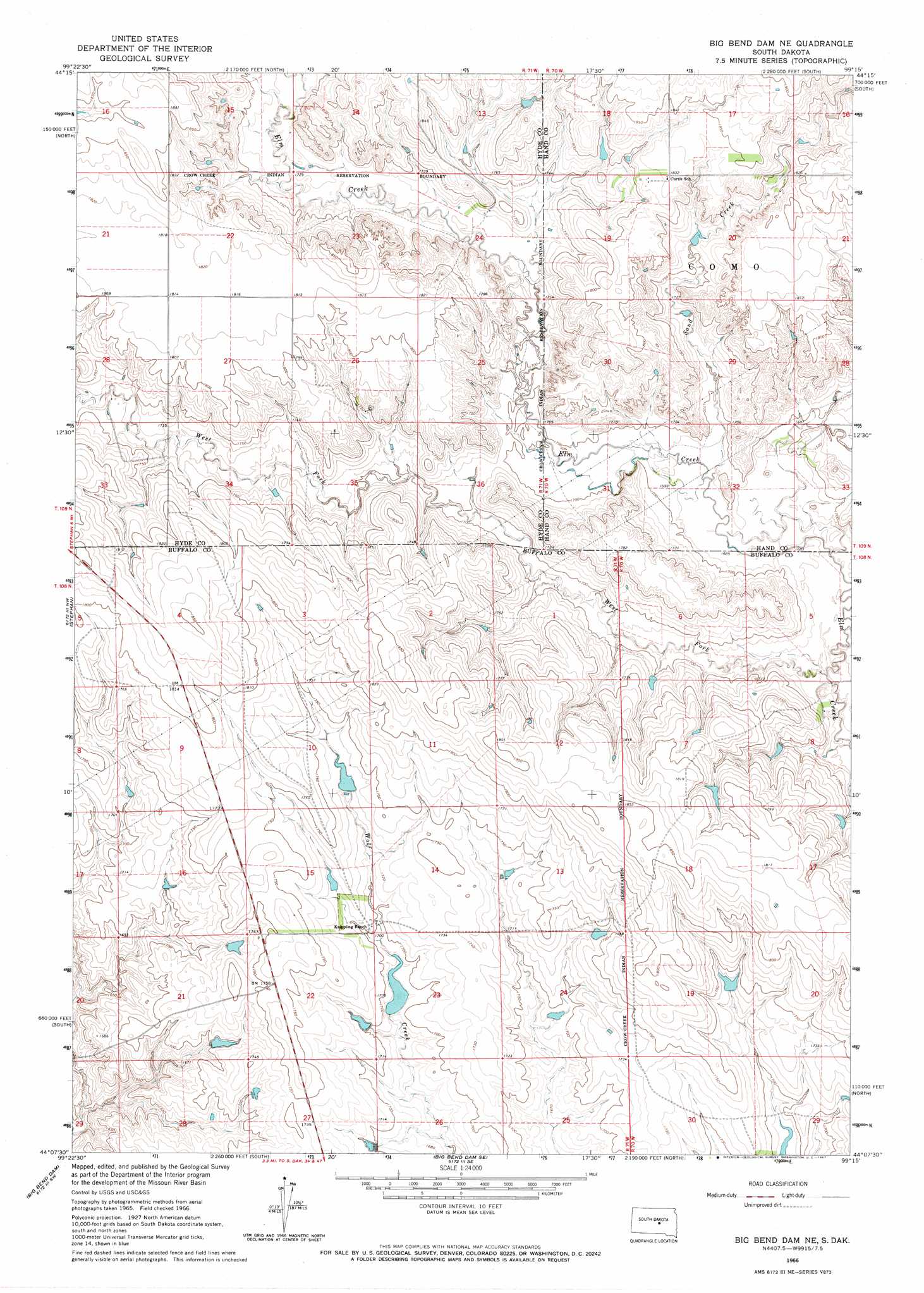
USGS Topo Quad 44099b3 - 1:24,000 scale
| Topo Map Name: | Big Bend Dam Ne |
| USGS Topo Quad ID: | 44099b3 |
| Print Size: | ca. 21 1/4" wide x 27" high |
| Southeast Coordinates: | 44.125° N latitude / 99.25° W longitude |
| Map Center Coordinates: | 44.1875° N latitude / 99.3125° W longitude |
| U.S. State: | SD |
| Filename: | o44099b3.jpg |
| Download Map JPG Image: | Big Bend Dam Ne topo map 1:24,000 scale |
| Map Type: | Topographic |
| Topo Series: | 7.5´ |
| Map Scale: | 1:24,000 |
| Source of Map Images: | United States Geological Survey (USGS) |
| Alternate Map Versions: |
Big Bend Dam NE SD 1966, updated 1967 Download PDF Buy paper map Big Bend Dam NE SD 2012 Download PDF Buy paper map Big Bend Dam NE SD 2015 Download PDF Buy paper map |
1:24,000 Topo Quads surrounding Big Bend Dam Ne
Chapelle Lake |
Macs Corner Nw |
Macs Corner Ne |
Miller Dale Colony Nw |
Miller Dale Colony |
Chapelle Lake Se |
Macs Corner |
Macs Corner Se |
Miller Dale Colony Sw |
Ames |
Lower Brule Ne |
Stephan |
Big Bend Dam Ne |
Big Bend Dam 4 Nw |
Big Bend Dam 4 Ne |
Lower Brule |
Big Bend Dam |
Big Bend Dam Se |
Big Bend Dam 4 Sw |
Big Bend Dam 4 Se |
Reliance |
Short Creek |
Bedashosha Lake |
Shelby |
Pukwana Ne |
> Back to 44099a1 at 1:100,000 scale
> Back to 44098a1 at 1:250,000 scale
> Back to U.S. Topo Maps home
Big Bend Dam Ne topo map: Gazetteer
Big Bend Dam Ne: Dams
M Smith Dam elevation 551m 1807′Big Bend Dam Ne: Streams
Sand Creek elevation 512m 1679′West Fork Elm Creek elevation 506m 1660′
Big Bend Dam Ne digital topo map on disk
Buy this Big Bend Dam Ne topo map showing relief, roads, GPS coordinates and other geographical features, as a high-resolution digital map file on DVD:
Eastern North Dakota & Eastern South Dakota
Buy digital topo maps: Eastern North Dakota & Eastern South Dakota