Polo Topo Map South Dakota
To zoom in, hover over the map of Polo
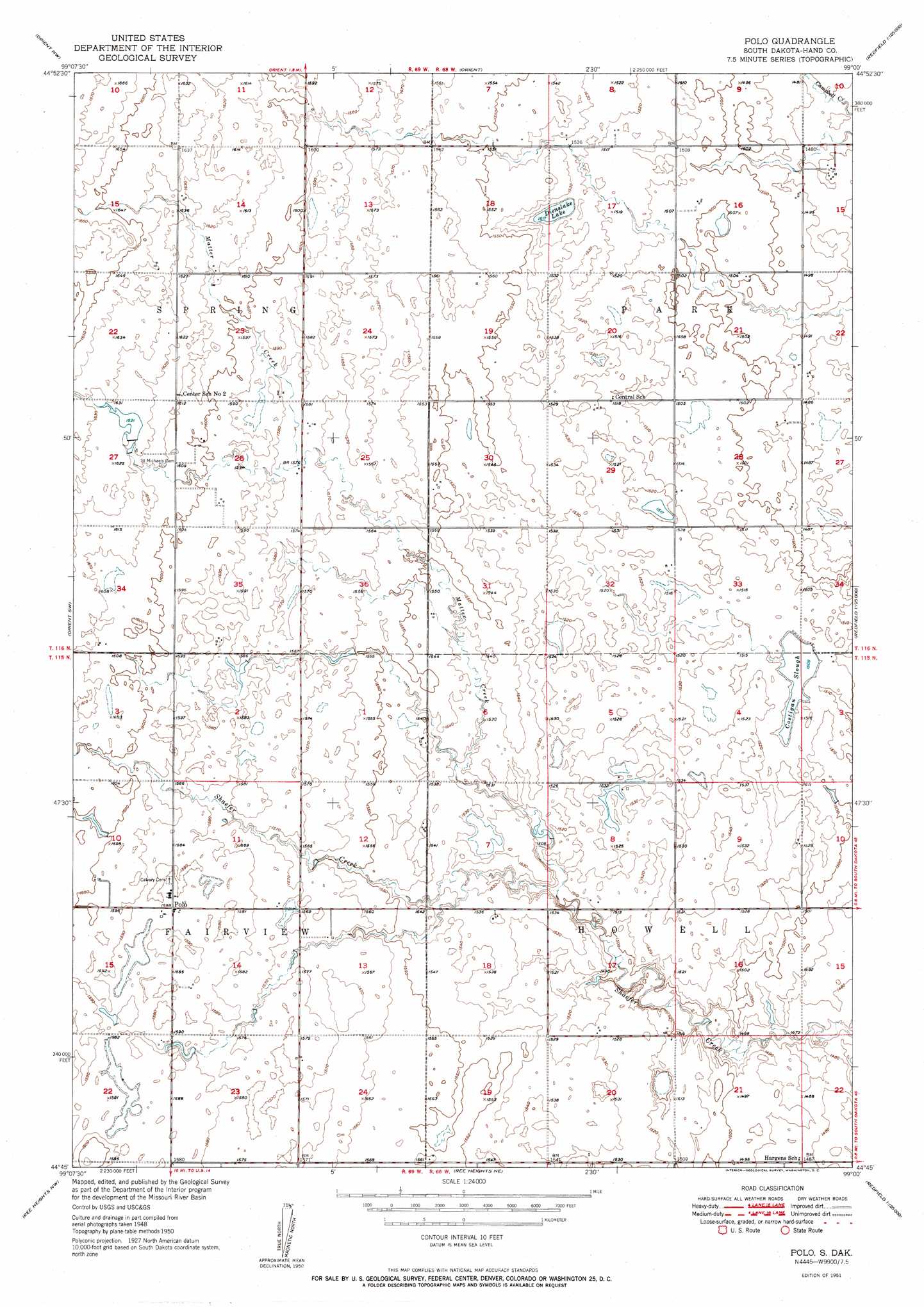
USGS Topo Quad 44099g1 - 1:24,000 scale
| Topo Map Name: | Polo |
| USGS Topo Quad ID: | 44099g1 |
| Print Size: | ca. 21 1/4" wide x 27" high |
| Southeast Coordinates: | 44.75° N latitude / 99° W longitude |
| Map Center Coordinates: | 44.8125° N latitude / 99.0625° W longitude |
| U.S. State: | SD |
| Filename: | o44099g1.jpg |
| Download Map JPG Image: | Polo topo map 1:24,000 scale |
| Map Type: | Topographic |
| Topo Series: | 7.5´ |
| Map Scale: | 1:24,000 |
| Source of Map Images: | United States Geological Survey (USGS) |
| Alternate Map Versions: |
Polo SD 1951 Download PDF Buy paper map Polo SD 2012 Download PDF Buy paper map Polo SD 2015 Download PDF Buy paper map |
1:24,000 Topo Quads surrounding Polo
Burkmere |
Faulkton West |
Faulkton East |
Cresbard Sw |
Cresbard Se |
Rezac Lake Ne |
Orient Nw |
Orient |
Miranda |
Rockham |
Rezac Lake |
Orient Sw |
Polo |
Rockham Sw |
Rockham Se |
Highmore Ne |
Ree Heights Nw |
Ree Hieghts Ne |
Miller Nw |
Burdette |
Highmore Se |
Ree Heights |
Ree Heights Se |
Miller |
Miller Se |
> Back to 44099e1 at 1:100,000 scale
> Back to 44098a1 at 1:250,000 scale
> Back to U.S. Topo Maps home
Polo topo map: Gazetteer
Polo: Lakes
Costigan Slough elevation 460m 1509′Dienslake Lake elevation 463m 1519′
Polo: Populated Places
Polo elevation 483m 1584′Polo: Streams
Matter Creek elevation 479m 1571′Matter Creek elevation 458m 1502′
Polo digital topo map on disk
Buy this Polo topo map showing relief, roads, GPS coordinates and other geographical features, as a high-resolution digital map file on DVD:
Eastern North Dakota & Eastern South Dakota
Buy digital topo maps: Eastern North Dakota & Eastern South Dakota