Gettysburg Muni Airport Se Topo Map South Dakota
To zoom in, hover over the map of Gettysburg Muni Airport Se
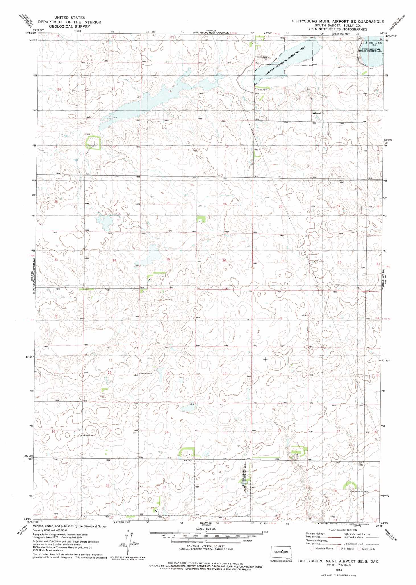
USGS Topo Quad 44099g7 - 1:24,000 scale
| Topo Map Name: | Gettysburg Muni Airport Se |
| USGS Topo Quad ID: | 44099g7 |
| Print Size: | ca. 21 1/4" wide x 27" high |
| Southeast Coordinates: | 44.75° N latitude / 99.75° W longitude |
| Map Center Coordinates: | 44.8125° N latitude / 99.8125° W longitude |
| U.S. State: | SD |
| Filename: | o44099g7.jpg |
| Download Map JPG Image: | Gettysburg Muni Airport Se topo map 1:24,000 scale |
| Map Type: | Topographic |
| Topo Series: | 7.5´ |
| Map Scale: | 1:24,000 |
| Source of Map Images: | United States Geological Survey (USGS) |
| Alternate Map Versions: |
Gettysburg Municipal Airport SE SD 2012 Download PDF Buy paper map Gettysburg Municipal Airport SE SD 2015 Download PDF Buy paper map |
1:24,000 Topo Quads surrounding Gettysburg Muni Airport Se
Lake Hurley Se |
Gettysburg |
Lebanon |
Seneca Sw |
Seneca |
Agar Ne |
Gettysburg Muni Airport |
Gettysburg Muni Airport Ne |
Thomas Lake Nw |
Bald Hills |
Agar |
Gettysburg Muni Airport Sw |
Gettysburg Muni Airport Se |
Thomas Lake Sw |
Thomas Lake |
Onida |
Blunt Nw |
Blunt Ne |
Harrold Nw |
Harrold Ne |
Onida Se |
Blunt |
Blunt Se |
Harrold |
Holabird |
> Back to 44099e1 at 1:100,000 scale
> Back to 44098a1 at 1:250,000 scale
> Back to U.S. Topo Maps home
Gettysburg Muni Airport Se topo map: Gazetteer
Gettysburg Muni Airport Se: Dams
G Lytle Dam elevation 570m 1870′Gettysburg Muni Airport Se: Parks
Hofer State Public Shooting Area elevation 570m 1870′Gettysburg Muni Airport Se: Post Offices
Kaspar Post Office (historical) elevation 573m 1879′Gettysburg Muni Airport Se digital topo map on disk
Buy this Gettysburg Muni Airport Se topo map showing relief, roads, GPS coordinates and other geographical features, as a high-resolution digital map file on DVD:
Eastern North Dakota & Eastern South Dakota
Buy digital topo maps: Eastern North Dakota & Eastern South Dakota