Capa Se Topo Map South Dakota
To zoom in, hover over the map of Capa Se
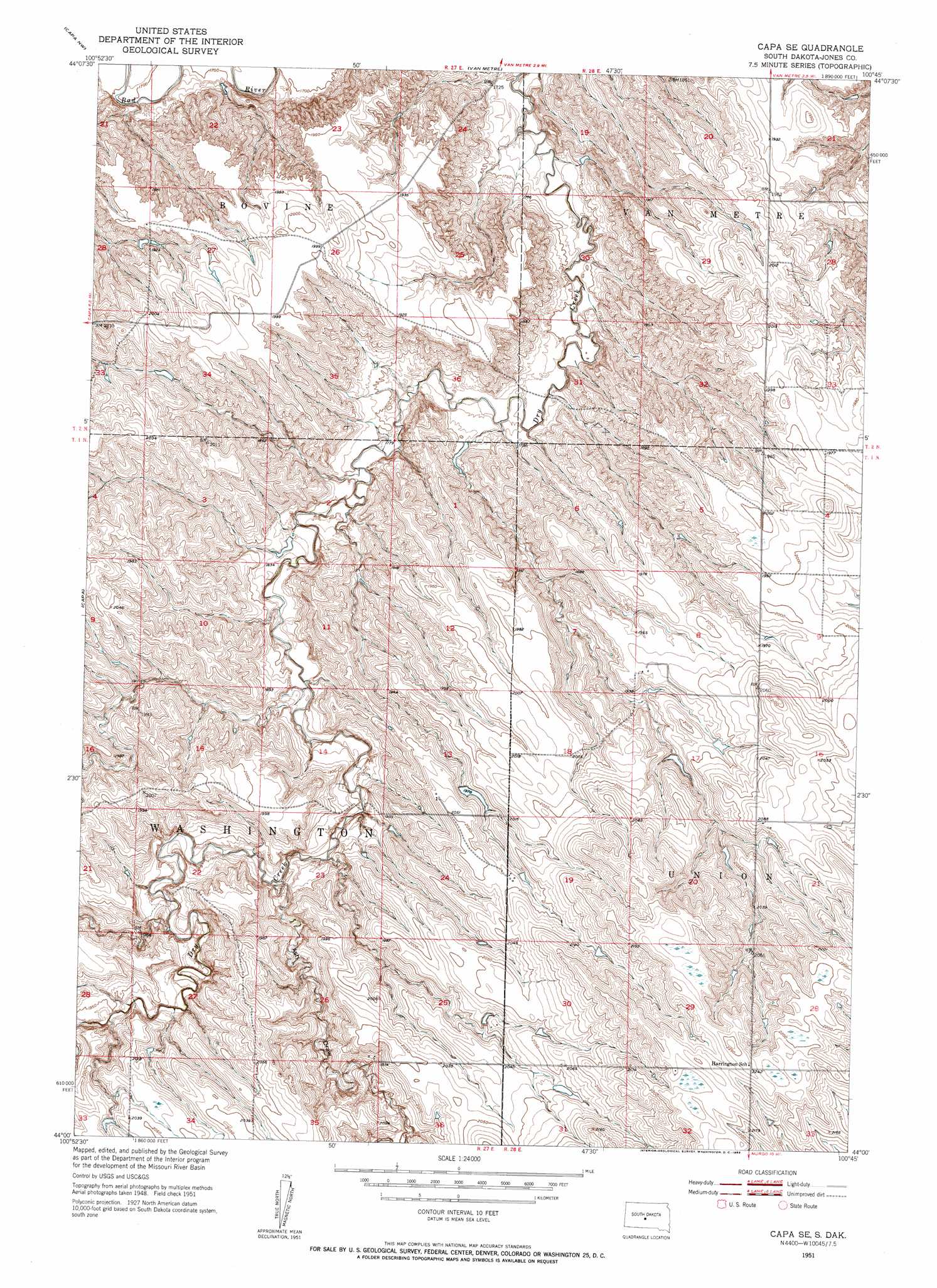
USGS Topo Quad 44100a7 - 1:24,000 scale
| Topo Map Name: | Capa Se |
| USGS Topo Quad ID: | 44100a7 |
| Print Size: | ca. 21 1/4" wide x 27" high |
| Southeast Coordinates: | 44° N latitude / 100.75° W longitude |
| Map Center Coordinates: | 44.0625° N latitude / 100.8125° W longitude |
| U.S. State: | SD |
| Filename: | o44100a7.jpg |
| Download Map JPG Image: | Capa Se topo map 1:24,000 scale |
| Map Type: | Topographic |
| Topo Series: | 7.5´ |
| Map Scale: | 1:24,000 |
| Source of Map Images: | United States Geological Survey (USGS) |
| Alternate Map Versions: |
Capa SE SD 1951, updated 1953 Download PDF Buy paper map Capa SE SD 2012 Download PDF Buy paper map Capa SE SD 2015 Download PDF Buy paper map |
1:24,000 Topo Quads surrounding Capa Se
Hayes South |
Hohrman Ranch |
Doty Ridge |
Oahe Sw |
Teton |
Midland Ne |
Capa Nw |
Van Metre |
Wendte |
Wendte Ne |
Midland Se |
Capa |
Capa Se |
Wendte Sw |
Wendte Se |
Stamford |
Okaton |
Okaton Ne |
Murdo |
Draper |
Stamford Se |
Okaton Sw |
Okaton Se |
Murdo Sw |
Murdo Se |
> Back to 44100a1 at 1:100,000 scale
> Back to 44100a1 at 1:250,000 scale
> Back to U.S. Topo Maps home
Capa Se topo map: Gazetteer
Capa Se: Dams
Golden Number 1 Dam elevation 587m 1925′Knox Number 1 Dam elevation 584m 1916′
Lyman Number 6 Dam elevation 580m 1902′
Wilson Number 1 Dam elevation 606m 1988′
Capa Se: Valleys
Ash Draw elevation 566m 1856′Capa Se digital topo map on disk
Buy this Capa Se topo map showing relief, roads, GPS coordinates and other geographical features, as a high-resolution digital map file on DVD:
Eastern North Dakota & Eastern South Dakota
Buy digital topo maps: Eastern North Dakota & Eastern South Dakota