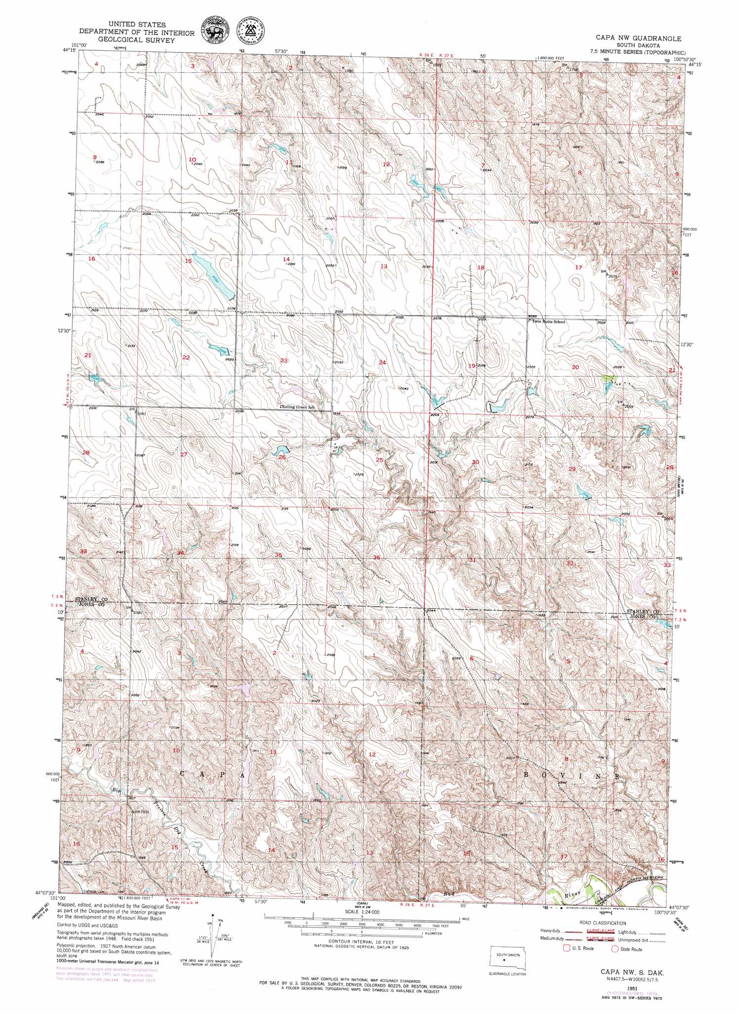
Capa Nw Topo Map South Dakota
To zoom in, hover over the map of Capa Nw
USGS Topo Quad 44100b8 - 1:24,000 scale
| Topo Map Name: | Capa Nw |
| USGS Topo Quad ID: | 44100b8 |
| Print Size: | ca. 21 1/4" wide x 27" high |
| Southeast Coordinates: | 44.125° N latitude / 100.875° W longitude |
| Map Center Coordinates: | 44.1875° N latitude / 100.9375° W longitude |
| U.S. State: | SD |
| Filename: | o44100b8.jpg |
| Download Map JPG Image: | Capa Nw topo map 1:24,000 scale |
| Map Type: | Topographic |
| Topo Series: | 7.5´ |
| Map Scale: | 1:24,000 |
| Source of Map Images: | United States Geological Survey (USGS) |
| Alternate Map Versions: |
Capa NW SD 1951, updated 1953 Download PDF Buy paper map Capa NW SD 1951, updated 1979 Download PDF Buy paper map Capa NW SD 2012 Download PDF Buy paper map Capa NW SD 2015 Download PDF Buy paper map |
1:24,000 Topo Quads surrounding Capa Nw
Bentley Ranch |
Hayes North |
Princes Ranch |
Lacy |
|
May Ranch |
Hayes South |
Hohrman Ranch |
Doty Ridge |
Oahe Sw |
Midland Nw |
Midland Ne |
Capa Nw |
Van Metre |
Wendte |
Midland |
Midland Se |
Capa |
Capa Se |
Wendte Sw |
Stamford Nw |
Stamford |
Okaton |
Okaton Ne |
Murdo |
> Back to 44100a1 at 1:100,000 scale
> Back to 44100a1 at 1:250,000 scale
> Back to U.S. Topo Maps home
Capa Nw topo map: Gazetteer
Capa Nw: Dams
Henry Wilson Dam elevation 610m 2001′Knox Number 2 Dam elevation 596m 1955′
Louis Bonhorst Number 5 Dam elevation 600m 1968′
Norbert Bonhorst Dam elevation 603m 1978′
Olson Ranches Number 7 Dam elevation 604m 1981′
Stirling Number 1 Dam elevation 579m 1899′
Capa Nw digital topo map on disk
Buy this Capa Nw topo map showing relief, roads, GPS coordinates and other geographical features, as a high-resolution digital map file on DVD:
Eastern North Dakota & Eastern South Dakota
Buy digital topo maps: Eastern North Dakota & Eastern South Dakota