Onida Sw Topo Map South Dakota
To zoom in, hover over the map of Onida Sw
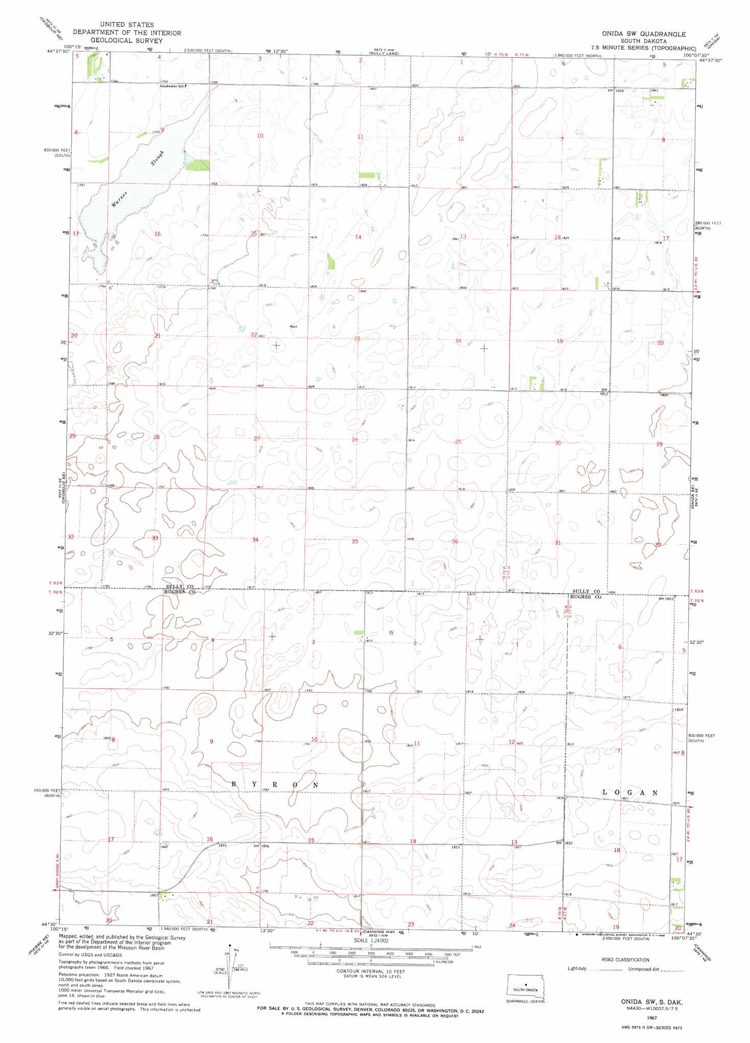
USGS Topo Quad 44100e2 - 1:24,000 scale
| Topo Map Name: | Onida Sw |
| USGS Topo Quad ID: | 44100e2 |
| Print Size: | ca. 21 1/4" wide x 27" high |
| Southeast Coordinates: | 44.5° N latitude / 100.125° W longitude |
| Map Center Coordinates: | 44.5625° N latitude / 100.1875° W longitude |
| U.S. State: | SD |
| Filename: | o44100e2.jpg |
| Download Map JPG Image: | Onida Sw topo map 1:24,000 scale |
| Map Type: | Topographic |
| Topo Series: | 7.5´ |
| Map Scale: | 1:24,000 |
| Source of Map Images: | United States Geological Survey (USGS) |
| Alternate Map Versions: |
Onida SW SD 1967, updated 1968 Download PDF Buy paper map Onida SW SD 2012 Download PDF Buy paper map Onida SW SD 2015 Download PDF Buy paper map |
1:24,000 Topo Quads surrounding Onida Sw
Artichoke Butte Sw |
Artichoke Butte |
Agar Sw |
Agar |
Gettysburg Muni Airport Sw |
Okobojo |
Okobojo Ne |
Sully Lake |
Onida |
Blunt Nw |
Okobojo Sw |
Okobojo Se |
Onida Sw |
Onida Se |
Blunt |
Oahe Dam |
Pierre Ne |
Canning Nw |
Canning |
De Grey Nw |
Pierre Sw |
Pierre |
Antelope Island |
Rousseau |
De Grey |
> Back to 44100e1 at 1:100,000 scale
> Back to 44100a1 at 1:250,000 scale
> Back to U.S. Topo Maps home
Onida Sw topo map: Gazetteer
Onida Sw: Lakes
Warnes Slough elevation 532m 1745′Onida Sw: Post Offices
Marston Post Office (historical) elevation 555m 1820′Onida Sw digital topo map on disk
Buy this Onida Sw topo map showing relief, roads, GPS coordinates and other geographical features, as a high-resolution digital map file on DVD:
Eastern North Dakota & Eastern South Dakota
Buy digital topo maps: Eastern North Dakota & Eastern South Dakota