Agar Nw Topo Map South Dakota
To zoom in, hover over the map of Agar Nw
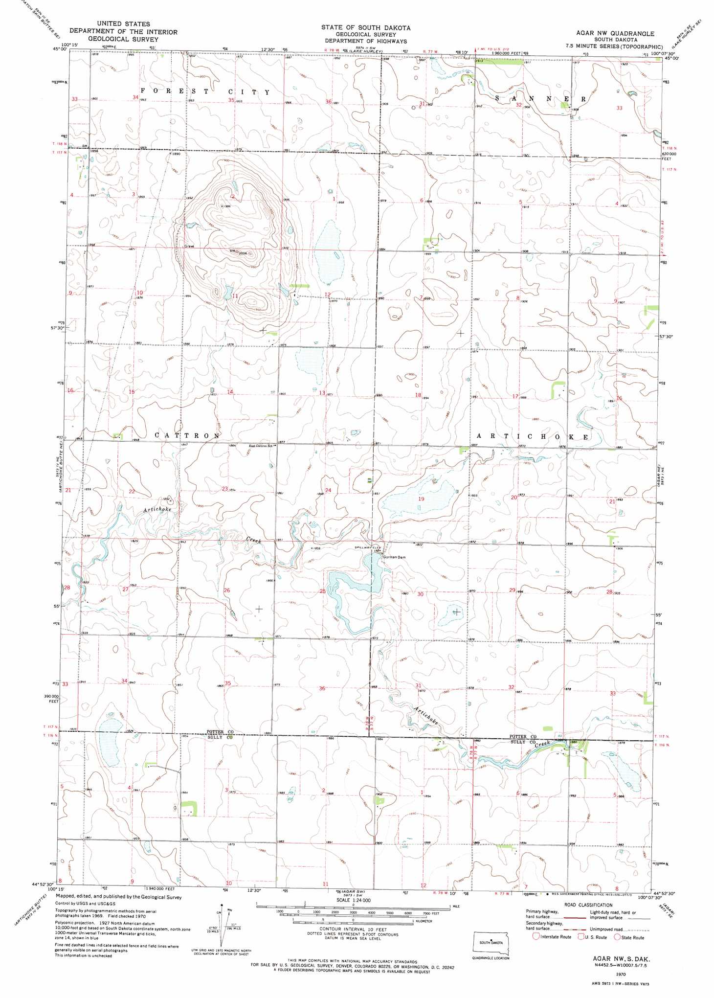
USGS Topo Quad 44100h2 - 1:24,000 scale
| Topo Map Name: | Agar Nw |
| USGS Topo Quad ID: | 44100h2 |
| Print Size: | ca. 21 1/4" wide x 27" high |
| Southeast Coordinates: | 44.875° N latitude / 100.125° W longitude |
| Map Center Coordinates: | 44.9375° N latitude / 100.1875° W longitude |
| U.S. State: | SD |
| Filename: | o44100h2.jpg |
| Download Map JPG Image: | Agar Nw topo map 1:24,000 scale |
| Map Type: | Topographic |
| Topo Series: | 7.5´ |
| Map Scale: | 1:24,000 |
| Source of Map Images: | United States Geological Survey (USGS) |
| Alternate Map Versions: |
Agar NW SD 1970, updated 1973 Download PDF Buy paper map Agar NW SD 2012 Download PDF Buy paper map Agar NW SD 2015 Download PDF Buy paper map |
1:24,000 Topo Quads surrounding Agar Nw
Patch Skin Buttes |
Four Bear Creek |
Steamboat Creek |
Lake Hurley Ne |
Flight Lake |
Patch Skin Buttes Sw |
Patch Skin Buttes Se |
Lake Hurley |
Lake Hurley Se |
Gettysburg |
Artichoke Butte Nw |
Artichoke Butte Ne |
Agar Nw |
Agar Ne |
Gettysburg Muni Airport |
Artichoke Butte Sw |
Artichoke Butte |
Agar Sw |
Agar |
Gettysburg Muni Airport Sw |
Okobojo |
Okobojo Ne |
Sully Lake |
Onida |
Blunt Nw |
> Back to 44100e1 at 1:100,000 scale
> Back to 44100a1 at 1:250,000 scale
> Back to U.S. Topo Maps home
Agar Nw topo map: Gazetteer
Agar Nw: Dams
Gorman Dam elevation 567m 1860′Agar Nw: Post Offices
Potter Post Office (historical) elevation 571m 1873′Agar Nw digital topo map on disk
Buy this Agar Nw topo map showing relief, roads, GPS coordinates and other geographical features, as a high-resolution digital map file on DVD:
Eastern North Dakota & Eastern South Dakota
Buy digital topo maps: Eastern North Dakota & Eastern South Dakota