Post Ranch Topo Map South Dakota
To zoom in, hover over the map of Post Ranch
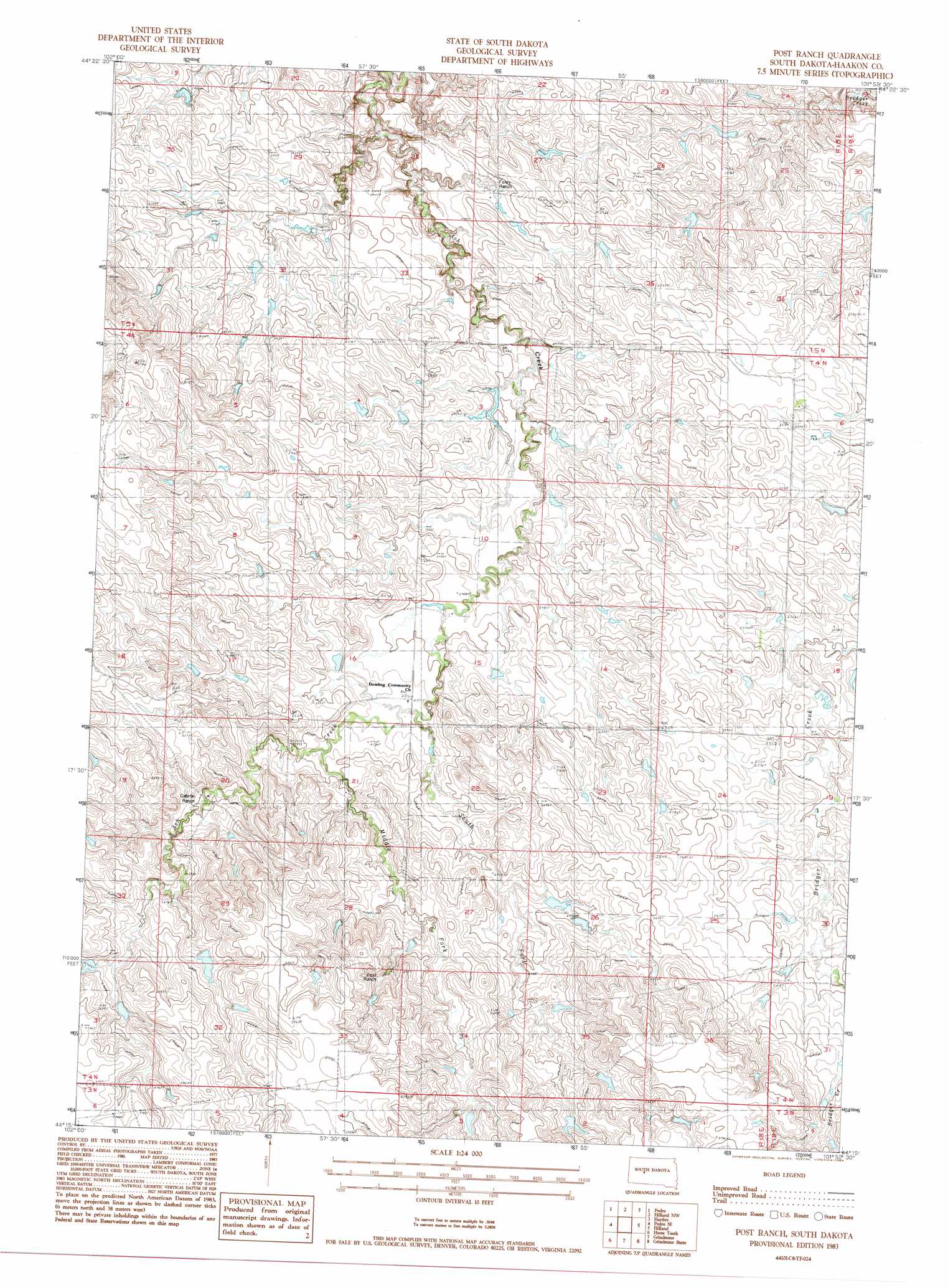
USGS Topo Quad 44101c8 - 1:24,000 scale
| Topo Map Name: | Post Ranch |
| USGS Topo Quad ID: | 44101c8 |
| Print Size: | ca. 21 1/4" wide x 27" high |
| Southeast Coordinates: | 44.25° N latitude / 101.875° W longitude |
| Map Center Coordinates: | 44.3125° N latitude / 101.9375° W longitude |
| U.S. State: | SD |
| Filename: | o44101c8.jpg |
| Download Map JPG Image: | Post Ranch topo map 1:24,000 scale |
| Map Type: | Topographic |
| Topo Series: | 7.5´ |
| Map Scale: | 1:24,000 |
| Source of Map Images: | United States Geological Survey (USGS) |
| Alternate Map Versions: |
Post Ranch SD 1983, updated 1984 Download PDF Buy paper map Post Ranch SD 2012 Download PDF Buy paper map Post Ranch SD 2015 Download PDF Buy paper map |
1:24,000 Topo Quads surrounding Post Ranch
Plainview |
Howes |
Bridger |
Bridger Se |
Rattlesnake Lake Sw |
Pedro Nw |
Pedro |
Hilland Nw |
Hartley |
Milesville |
Creighton |
Pedro Se |
Post Ranch |
Hilland |
Elbon |
Pedrow 4 Nw |
Horse Tooth |
Grindstone |
Grindstone Butte |
Elevenmile Corner |
Lake Hill |
Elm Creek Ranch |
Grindstone Sw |
Bowen Ranch |
Philip |
> Back to 44101a1 at 1:100,000 scale
> Back to 44100a1 at 1:250,000 scale
> Back to U.S. Topo Maps home
Post Ranch topo map: Gazetteer
Post Ranch: Populated Places
Dowling (historical) elevation 809m 2654′Post Ranch: Streams
Middle Fork Ash Creek elevation 772m 2532′South Fork Ash Creek elevation 766m 2513′
Post Ranch digital topo map on disk
Buy this Post Ranch topo map showing relief, roads, GPS coordinates and other geographical features, as a high-resolution digital map file on DVD:
Eastern North Dakota & Eastern South Dakota
Buy digital topo maps: Eastern North Dakota & Eastern South Dakota