Bridger Se Topo Map South Dakota
To zoom in, hover over the map of Bridger Se
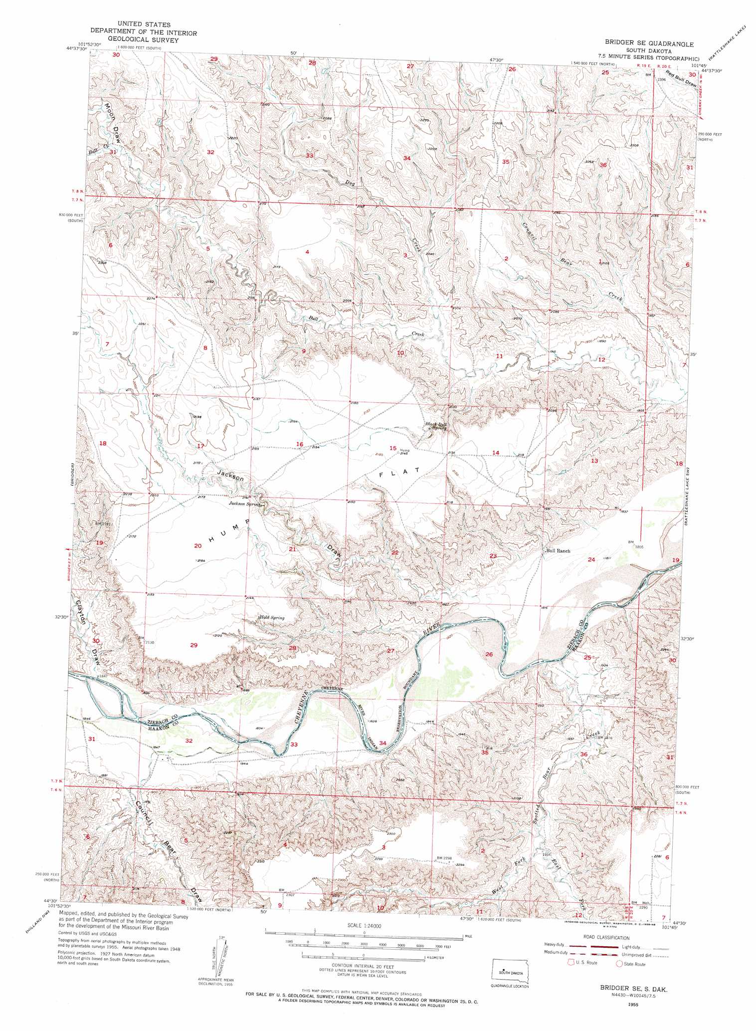
USGS Topo Quad 44101e7 - 1:24,000 scale
| Topo Map Name: | Bridger Se |
| USGS Topo Quad ID: | 44101e7 |
| Print Size: | ca. 21 1/4" wide x 27" high |
| Southeast Coordinates: | 44.5° N latitude / 101.75° W longitude |
| Map Center Coordinates: | 44.5625° N latitude / 101.8125° W longitude |
| U.S. State: | SD |
| Filename: | o44101e7.jpg |
| Download Map JPG Image: | Bridger Se topo map 1:24,000 scale |
| Map Type: | Topographic |
| Topo Series: | 7.5´ |
| Map Scale: | 1:24,000 |
| Source of Map Images: | United States Geological Survey (USGS) |
| Alternate Map Versions: |
Bridger SE SD 1955, updated 1956 Download PDF Buy paper map Bridger SW SD 1955, updated 1956 Download PDF Buy paper map Bridger SE SD 2012 Download PDF Buy paper map Bridger SE SD 2015 Download PDF Buy paper map |
1:24,000 Topo Quads surrounding Bridger Se
Avance Se |
Chasing Hawk Draw |
Red Scaffold |
Longbrake Ranch |
Sears Dam |
Lemmon Creek |
Dead Horse Draw |
Bridger Ne |
Rattlesnake Lake |
Rattlesnake Lake Ne |
Howes |
Bridger |
Bridger Se |
Rattlesnake Lake Sw |
Rattlesnake Lake Se |
Pedro |
Hilland Nw |
Hartley |
Milesville |
Murray Draw |
Pedro Se |
Post Ranch |
Hilland |
Elbon |
Tornado Ranch |
> Back to 44101e1 at 1:100,000 scale
> Back to 44100a1 at 1:250,000 scale
> Back to U.S. Topo Maps home
Bridger Se topo map: Gazetteer
Bridger Se: Flats
Hump Flat elevation 657m 2155′Bridger Se: Springs
Black Bull Spring elevation 642m 2106′Hold Spring elevation 640m 2099′
Jackson Spring elevation 644m 2112′
Bridger Se: Streams
Council Bear Creek elevation 564m 1850′Dog Creek elevation 592m 1942′
East Fork Spotted Bear Creek elevation 585m 1919′
Spotted Bear Creek elevation 556m 1824′
West Fork Spotted Bear Creek elevation 585m 1919′
Bridger Se: Valleys
Clayton Draw elevation 565m 1853′Council Bear Draw elevation 566m 1856′
Jackson Draw elevation 562m 1843′
Moon Draw elevation 632m 2073′
Bridger Se digital topo map on disk
Buy this Bridger Se topo map showing relief, roads, GPS coordinates and other geographical features, as a high-resolution digital map file on DVD:
Eastern North Dakota & Eastern South Dakota
Buy digital topo maps: Eastern North Dakota & Eastern South Dakota