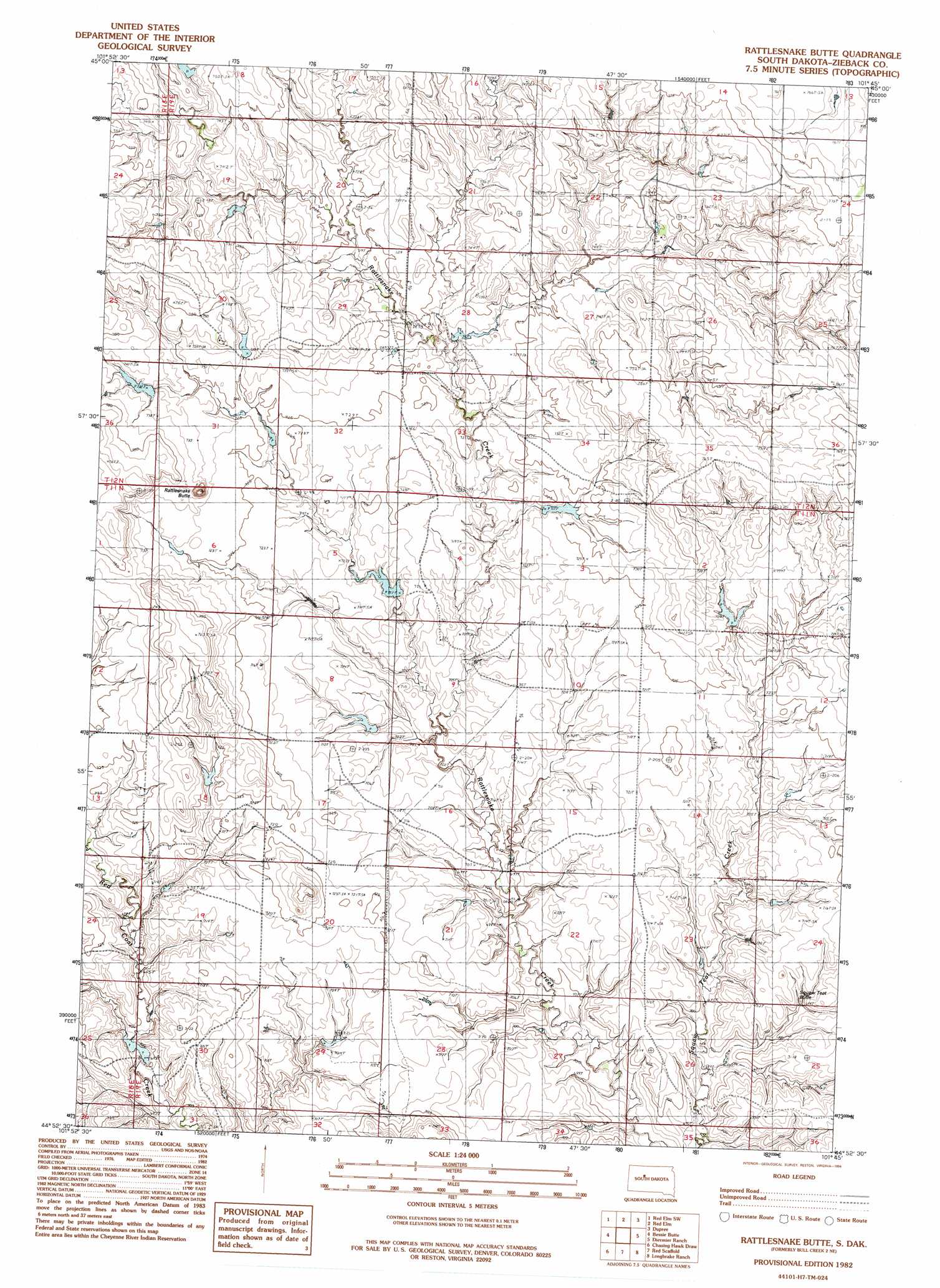
Bull Creek 2 Ne Topo Map South Dakota
To zoom in, hover over the map of Bull Creek 2 Ne
USGS Topo Quad 44101h7 - 1:24,000 scale
| Topo Map Name: | Bull Creek 2 Ne |
| USGS Topo Quad ID: | 44101h7 |
| Print Size: | ca. 21 1/4" wide x 27" high |
| Southeast Coordinates: | 44.875° N latitude / 101.75° W longitude |
| Map Center Coordinates: | 44.9375° N latitude / 101.8125° W longitude |
| U.S. State: | SD |
| Filename: | o44101h7.jpg |
| Download Map JPG Image: | Bull Creek 2 Ne topo map 1:24,000 scale |
| Map Type: | Topographic |
| Topo Series: | 7.5´ |
| Map Scale: | 1:24,000 |
| Source of Map Images: | United States Geological Survey (USGS) |
| Alternate Map Versions: |
Bull Creek 2 NE SD 1982, updated 1983 Download PDF Buy paper map Rattlesnake Butte SD 1982, updated 1994 Download PDF Buy paper map Rattlesnake Butte SD 2012 Download PDF Buy paper map Rattlesnake Butte SD 2015 Download PDF Buy paper map |
1:24,000 Topo Quads surrounding Bull Creek 2 Ne
Faith Ne |
Redelm Nw |
Redelm Ne |
Thunder Butte |
Dupree Ne |
Faith |
Red Elm Sw |
Red Elm |
Dupree |
|
Durkee Lake |
Bessie Butte |
Bull Creek 2 Ne |
Diermier Ranch |
Miller Dam |
Avance Se |
Chasing Hawk Draw |
Red Scaffold |
Longbrake Ranch |
Sears Dam |
Lemmon Creek |
Dead Horse Draw |
Bridger Ne |
Rattlesnake Lake |
Rattlesnake Lake Ne |
> Back to 44101e1 at 1:100,000 scale
> Back to 44100a1 at 1:250,000 scale
> Back to U.S. Topo Maps home
Bull Creek 2 Ne topo map: Gazetteer
Bull Creek 2 Ne: Dams
Mandernach and Carlson Number 3 Dam elevation 746m 2447′Mandernach and Carlson Number 4 Dam elevation 735m 2411′
Mandernach and Carlson Number 5 Dam elevation 725m 2378′
Mandernach and Carlson Number 6 Dam elevation 717m 2352′
Mandernach and Carlson Number 7 Dam elevation 726m 2381′
Mandernach and Carlson Number 8 Dam elevation 721m 2365′
Mandernach and Carlson Number 9 Dam elevation 739m 2424′
Mandernach and Carlson Number Two Dam elevation 719m 2358′
Bull Creek 2 Ne: Summits
Mud Butte elevation 722m 2368′Peaked Butte elevation 721m 2365′
Rattlesnake Butte elevation 736m 2414′
Bull Creek 2 Ne digital topo map on disk
Buy this Bull Creek 2 Ne topo map showing relief, roads, GPS coordinates and other geographical features, as a high-resolution digital map file on DVD:
Eastern North Dakota & Eastern South Dakota
Buy digital topo maps: Eastern North Dakota & Eastern South Dakota