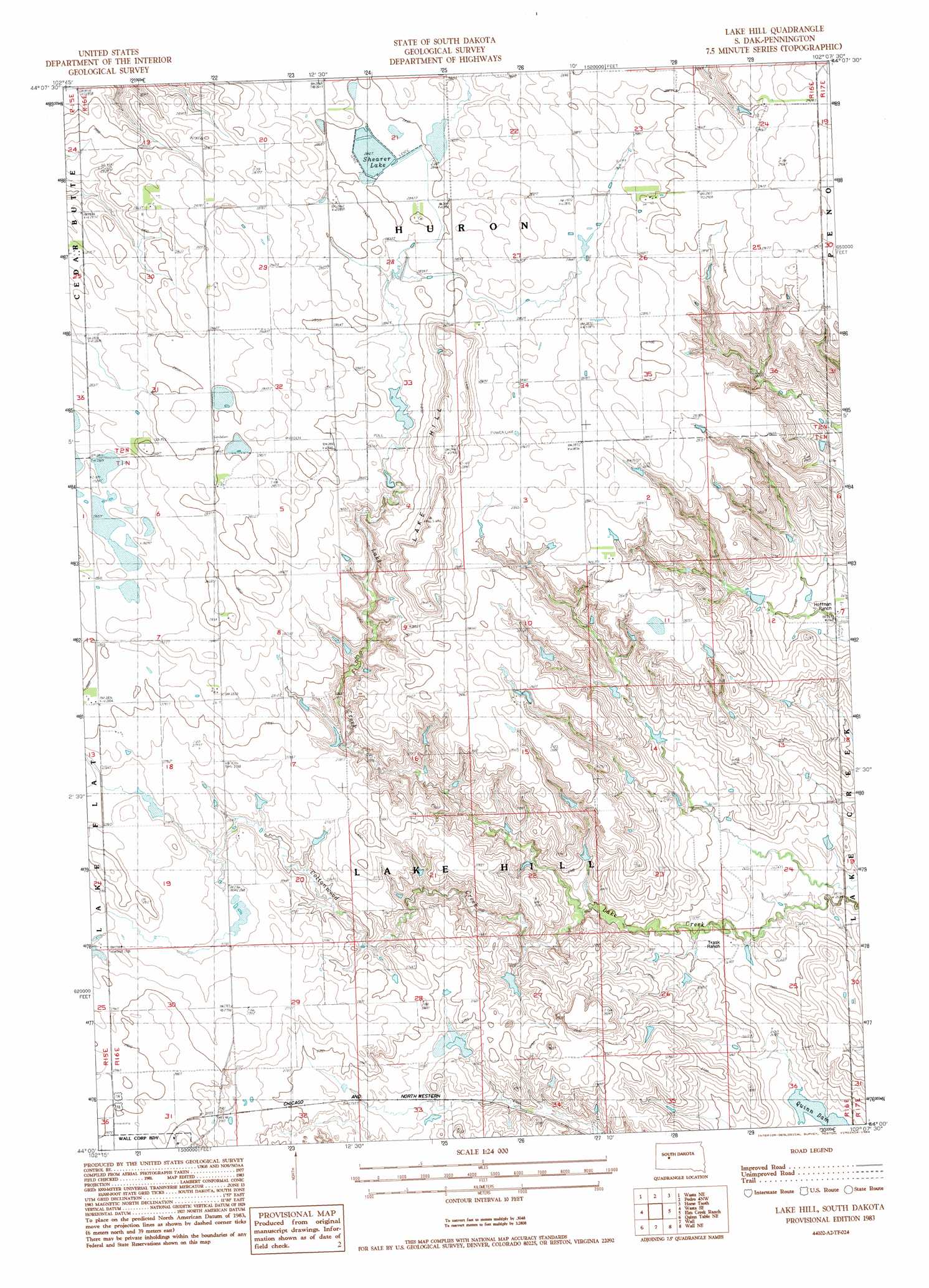
Lake Hill Topo Map South Dakota
To zoom in, hover over the map of Lake Hill
USGS Topo Quad 44102a2 - 1:24,000 scale
| Topo Map Name: | Lake Hill |
| USGS Topo Quad ID: | 44102a2 |
| Print Size: | ca. 21 1/4" wide x 27" high |
| Southeast Coordinates: | 44° N latitude / 102.125° W longitude |
| Map Center Coordinates: | 44.0625° N latitude / 102.1875° W longitude |
| U.S. State: | SD |
| Filename: | o44102a2.jpg |
| Download Map JPG Image: | Lake Hill topo map 1:24,000 scale |
| Map Type: | Topographic |
| Topo Series: | 7.5´ |
| Map Scale: | 1:24,000 |
| Source of Map Images: | United States Geological Survey (USGS) |
| Alternate Map Versions: |
Lake Hill SD 1983, updated 1984 Download PDF Buy paper map Lake Hill SD 2012 Download PDF Buy paper map Lake Hill SD 2015 Download PDF Buy paper map |
1:24,000 Topo Quads surrounding Lake Hill
Dalzell |
Dalzell Se |
Creighton |
Pedro Se |
Post Ranch |
Wasta Nw |
Wasta Ne |
Pedrow 4 Nw |
Horse Tooth |
Grindstone |
Wasta |
Wasta Se |
Lake Hill |
Elm Creek Ranch |
Grindstone Sw |
Quinn Table |
Quinn Table Ne |
Wall |
Wall Ne |
Cottonwood |
Quinn Table Sw |
Quinn Table Se |
Wall Sw |
Wall Se |
Cottonwood Sw |
> Back to 44102a1 at 1:100,000 scale
> Back to 44102a1 at 1:250,000 scale
> Back to U.S. Topo Maps home
Lake Hill topo map: Gazetteer
Lake Hill: Dams
James Kjerstad Dam elevation 828m 2716′Lavon Shearer Dam elevation 867m 2844′
Milton Trask Dam elevation 831m 2726′
Lake Hill: Reservoirs
Shearer Lake elevation 867m 2844′Lake Hill: Streams
Cottonwood Creek elevation 811m 2660′Lake Hill: Summits
Lake Hill elevation 879m 2883′Lake Hill digital topo map on disk
Buy this Lake Hill topo map showing relief, roads, GPS coordinates and other geographical features, as a high-resolution digital map file on DVD:
Eastern Wyoming & Western South Dakota
Buy digital topo maps: Eastern Wyoming & Western South Dakota