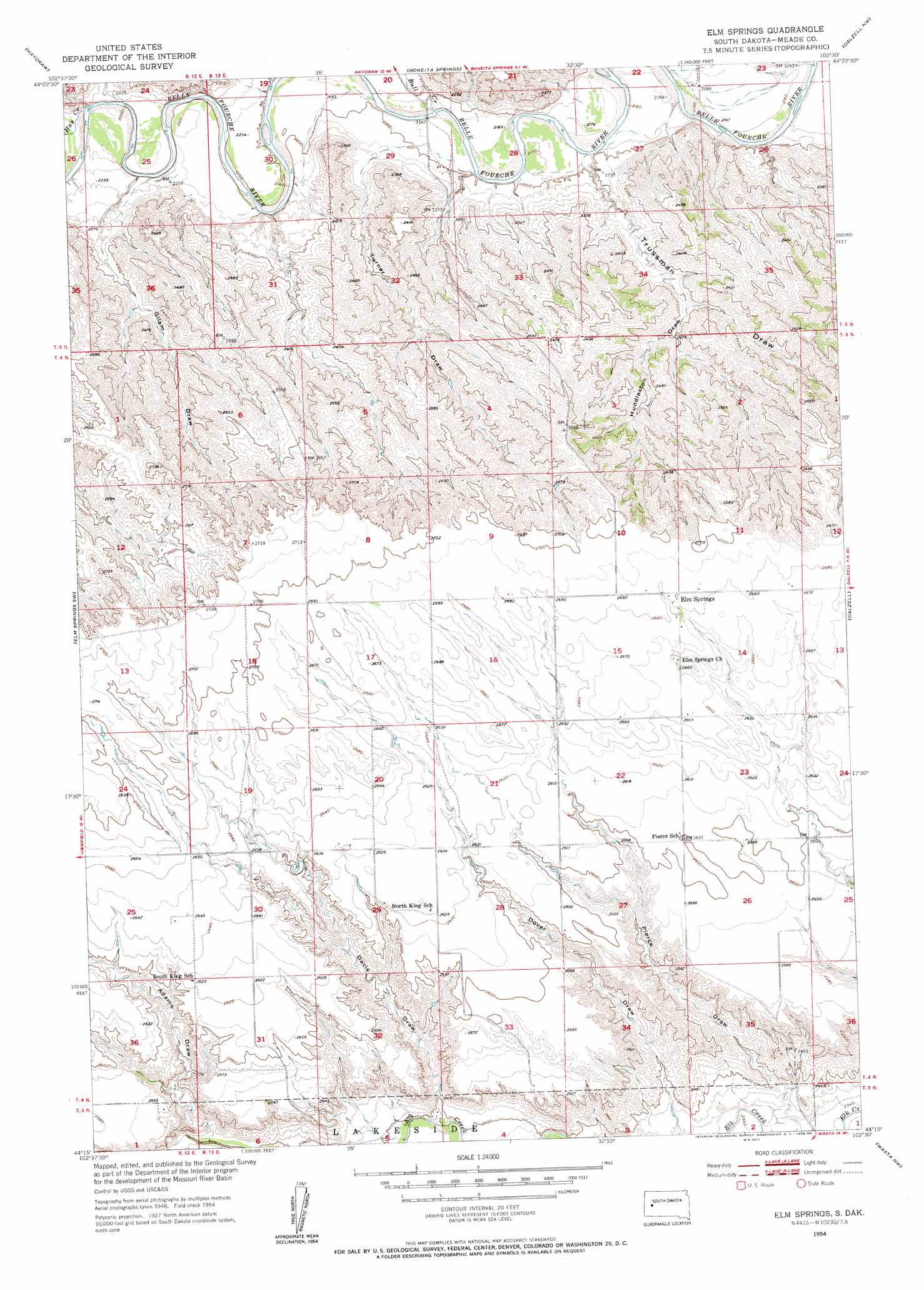
Elm Springs Topo Map South Dakota
To zoom in, hover over the map of Elm Springs
USGS Topo Quad 44102c5 - 1:24,000 scale
| Topo Map Name: | Elm Springs |
| USGS Topo Quad ID: | 44102c5 |
| Print Size: | ca. 21 1/4" wide x 27" high |
| Southeast Coordinates: | 44.25° N latitude / 102.5° W longitude |
| Map Center Coordinates: | 44.3125° N latitude / 102.5625° W longitude |
| U.S. State: | SD |
| Filename: | o44102c5.jpg |
| Download Map JPG Image: | Elm Springs topo map 1:24,000 scale |
| Map Type: | Topographic |
| Topo Series: | 7.5´ |
| Map Scale: | 1:24,000 |
| Source of Map Images: | United States Geological Survey (USGS) |
| Alternate Map Versions: |
Elm Springs SD 1954, updated 1956 Download PDF Buy paper map Elm Springs SD 2012 Download PDF Buy paper map Elm Springs SD 2015 Download PDF Buy paper map |
1:24,000 Topo Quads surrounding Elm Springs
Fairpoint Se |
Union Center |
Enning |
White Owl |
White Owl Se |
Hereford Ne |
Haydraw |
Boneita Springs |
Dalzell Nw |
Dalzell Ne |
Hereford Se |
Elm Springs Sw |
Elm Springs |
Dalzell |
Dalzell Se |
Viewfield |
Owanka Nw |
Owanka Ne |
Wasta Nw |
Wasta Ne |
New Underwood |
Owanka Sw |
Owanka |
Wasta |
Wasta Se |
> Back to 44102a1 at 1:100,000 scale
> Back to 44102a1 at 1:250,000 scale
> Back to U.S. Topo Maps home
Elm Springs topo map: Gazetteer
Elm Springs: Populated Places
Elm Springs elevation 818m 2683′Elm Springs: Streams
Bull Creek elevation 665m 2181′Hay Creek elevation 674m 2211′
Elm Springs: Valleys
Adams Draw elevation 737m 2417′Davis Draw elevation 727m 2385′
Dover Draw elevation 726m 2381′
Gilam Draw elevation 690m 2263′
Huddleston Draw elevation 696m 2283′
Maddox Draw elevation 677m 2221′
Pierce Draw elevation 720m 2362′
Trussman Draw elevation 667m 2188′
Turner Draw elevation 677m 2221′
Elm Springs digital topo map on disk
Buy this Elm Springs topo map showing relief, roads, GPS coordinates and other geographical features, as a high-resolution digital map file on DVD:
Eastern Wyoming & Western South Dakota
Buy digital topo maps: Eastern Wyoming & Western South Dakota